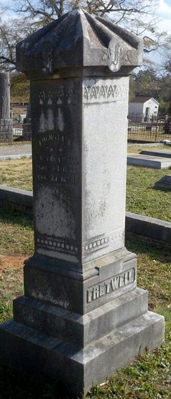
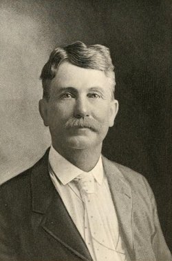
Arthur Gibbs “A.G.” Fretwell
| Birth | : | 15 Jan 1854 South Carolina, USA |
| Death | : | 31 Jan 1919 Anderson County, South Carolina, USA |
| Burial | : | Saint James Churchyard, Fitzhead, Taunton Deane Borough, England |
| Coordinate | : | 51.0481000, -3.2571000 |
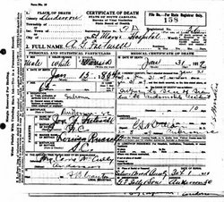
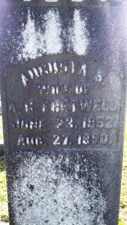
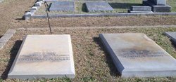
| Description | : | Arthur Gibbs Fretwell was the son of Joseph Y. Fretwell and Nancy Louisa Russell of Anderson County, South Carolina. Arthur's siblings include: Carrie M.(1846) and Joseph John (1850) Fretwell and there are probably others. A.G. Fretwell married Augusta Breazeale and they had several children: Ann Louise, Margaret A. "Margie" and "Maggie" Mrs. Peter K. McCully, Jr.), Arthur, Christine and Alice Fretwell (Mrs. Charles T. Gause). Arthur was a salesman. His death was due to an automobile accident in which he sustained injuries to the base of the brain. On February 1, 1919, Arthur Gibbs Fretwell was layed to rest in Silver Brook Cemetery,... Read More |
frequently asked questions (FAQ):
-
Where is Arthur Gibbs “A.G.” Fretwell's memorial?
Arthur Gibbs “A.G.” Fretwell's memorial is located at: Saint James Churchyard, Fitzhead, Taunton Deane Borough, England.
-
When did Arthur Gibbs “A.G.” Fretwell death?
Arthur Gibbs “A.G.” Fretwell death on 31 Jan 1919 in Anderson County, South Carolina, USA
-
Where are the coordinates of the Arthur Gibbs “A.G.” Fretwell's memorial?
Latitude: 51.0481000
Longitude: -3.2571000
Family Members:
Parent
Spouse
Siblings
Children
Flowers:
Nearby Cemetories:
1. Saint James Churchyard
Fitzhead, Taunton Deane Borough, England
Coordinate: 51.0481000, -3.2571000
2. Saint James Churchyard
Halse, Taunton Deane Borough, England
Coordinate: 51.0425680, -3.2285430
3. St Michael Churchyard
Milverton, Taunton Deane Borough, England
Coordinate: 51.0255170, -3.2537660
4. Friends' Burial Ground
Milverton, Taunton Deane Borough, England
Coordinate: 51.0267290, -3.2756778
5. Holy Trinity Churchyard
Ash Priors, Taunton Deane Borough, England
Coordinate: 51.0584700, -3.2118200
6. St. Andrew's Churchyard
Wiveliscombe, Taunton Deane Borough, England
Coordinate: 51.0410630, -3.3096850
7. Lydeard St Lawrence Churchyard
Lydeard St Lawrence, Taunton Deane Borough, England
Coordinate: 51.0818820, -3.2462470
8. St Peter and St Paul Churchyard
Combe Florey, Taunton Deane Borough, England
Coordinate: 51.0735250, -3.2139050
9. Combe Florey Extension Cemetery
Combe Florey, Taunton Deane Borough, England
Coordinate: 51.0733900, -3.2120200
10. St John The Baptist Churchyard
Tolland, Taunton Deane Borough, England
Coordinate: 51.0826570, -3.2856680
11. St. John the Baptist Churchyard
Heathfield, Taunton Deane Borough, England
Coordinate: 51.0314500, -3.1990400
12. St. Bartholomew's Churchyard
Oake, Taunton Deane Borough, England
Coordinate: 51.0196440, -3.2094170
13. Blessed Virgin Mary Churchyard
Bishops Lydeard, Taunton Deane Borough, England
Coordinate: 51.0611320, -3.1886320
14. Blessed Virgin Mary Churchyard
Brompton Ralph, West Somerset District, England
Coordinate: 51.0830230, -3.3077060
15. Saint Peter's Churchyard
Langford Budville, Taunton Deane Borough, England
Coordinate: 50.9988720, -3.2673740
16. St Bartholomew's Churchyard
Bathealton, Taunton Deane Borough, England
Coordinate: 51.0086320, -3.3130130
17. All Saints Churchyard
Nynehead, Taunton Deane Borough, England
Coordinate: 50.9973924, -3.2298043
18. Holy Cross at Hillfarrance
Wellington, Taunton Deane Borough, England
Coordinate: 51.0150260, -3.1884860
19. St. Thomas of Canterbury Churchyard
Cothelstone, Taunton Deane Borough, England
Coordinate: 51.0801700, -3.1699730
20. St. Peter's Churchyard Huish Champflower
Chipstable, Taunton Deane Borough, England
Coordinate: 51.0543700, -3.3580940
21. Saint Mary Magdalene Churchyard
Clatworthy, West Somerset District, England
Coordinate: 51.0698450, -3.3534250
22. St. Pancras Churchyard
West Bagborough, Taunton Deane Borough, England
Coordinate: 51.0966990, -3.1890352
23. St Nicholas' Church
Kittisford, Taunton Deane Borough, England
Coordinate: 50.9930799, -3.3149354
24. St. Martin de Tours Churchyard
Elworthy, West Somerset District, England
Coordinate: 51.1066110, -3.3113586

