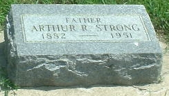
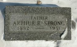
Arthur Raymond Strong
| Birth | : | 3 Aug 1882 Elgin, Cook County, Illinois, USA |
| Death | : | 28 Oct 1951 Sioux City, Woodbury County, Iowa, USA |
| Burial | : | Taupō Cemetery, Taupō, Taupō District, New Zealand |
| Coordinate | : | -38.6775870, 176.0786520 |
| Plot | : | Section 2, |
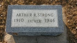
| Inscription | : | Father |
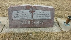
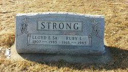
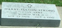
| Description | : | Arthur R. Strong, 69, of Sioux City, died October 28, 1951, from injuries suffered October 18, 1951, when he fell down an elevator shaft in the Jackson hotel in that city. In the fall Mr. Strong suffered breaks of both legs, borken pelvis and internal injuries. He was taken to St. Joseph's hospital following the accident. He was born in Elgin, IL., August 3, 1882. At the age of 12 he came to Hawarden, Iowa, with his parents and lived here until 1943 when he moved to Sioux City. He is survived by the widow; three sons, Floyd, Lloyd and Harry of Hawarden;... Read More |
frequently asked questions (FAQ):
-
Where is Arthur Raymond Strong's memorial?
Arthur Raymond Strong's memorial is located at: Taupō Cemetery, Taupō, Taupō District, New Zealand.
-
When did Arthur Raymond Strong death?
Arthur Raymond Strong death on 28 Oct 1951 in Sioux City, Woodbury County, Iowa, USA
-
Where are the coordinates of the Arthur Raymond Strong's memorial?
Latitude: -38.6775870
Longitude: 176.0786520
Family Members:
Spouse
Children
Flowers:
Nearby Cemetories:
1. Taupō Cemetery
Taupō, Taupō District, New Zealand
Coordinate: -38.6775870, 176.0786520
2. Taupō Early Settlers Cemetery
Taupō, Taupō District, New Zealand
Coordinate: -38.6763616, 176.0794441
3. Old Military and Early Settlers Cemetery
Taupō, Taupō District, New Zealand
Coordinate: -38.6839100, 176.0730100
4. Nukuhau Māori Cemetery
Nukuhau, Taupō District, New Zealand
Coordinate: -38.6796400, 176.0607400
5. Taupō Māori Cemetery
Taupō, Taupō District, New Zealand
Coordinate: -38.7013910, 176.0855890
6. Waitahanui Urupā
Waitahanui, Taupō District, New Zealand
Coordinate: -38.7906720, 176.0756252
7. Opepe Military Cemetery
Taupō District, New Zealand
Coordinate: -38.7669130, 176.2179120
8. Waiwharangi Māori Cemetery
Mokai, Taupō District, New Zealand
Coordinate: -38.5162400, 175.8759100
9. Ngakuru Cemetery
Rotorua, Rotorua District, New Zealand
Coordinate: -38.3227770, 176.1911950
10. Tūrangi Cemetery
Tūrangi, Taupō District, New Zealand
Coordinate: -38.9828700, 175.8014900
11. St. Paul's Anglican Churchyard
Tokaanu, Taupō District, New Zealand
Coordinate: -38.9649900, 175.7662100
12. Mangakino Public Cemetery
Mangakino, Taupō District, New Zealand
Coordinate: -38.3617140, 175.7631240
13. Ruamano Parekarangi Urupā
Horohoro, Rotorua District, New Zealand
Coordinate: -38.2349430, 176.1912227
14. Tokoroa Cemetery
Tokoroa, South Waikato District, New Zealand
Coordinate: -38.2311010, 175.8826160
15. Whakarewarewa Urupā
Rotorua, Rotorua District, New Zealand
Coordinate: -38.1629708, 176.2556791
16. Te Papa Marae Māori Cemetery
Murupara, Whakatāne District, New Zealand
Coordinate: -38.4499600, 176.6989500
17. Rotorua Crematorium and Cemetery
Rotorua, Rotorua District, New Zealand
Coordinate: -38.1533100, 176.2630900
18. Murupara-Galatea Cemetery
Galatea, Whakatāne District, New Zealand
Coordinate: -38.4411700, 176.7164800
19. Mamaku Cemetery
Mamaku, Rotorua District, New Zealand
Coordinate: -38.0986200, 176.0726700
20. Kauae Cemetery
Ngongotaha, Rotorua District, New Zealand
Coordinate: -38.0915298, 176.2152557
21. Taringamotu Māori Cemetery
Taringamotu, Ruapehu District, New Zealand
Coordinate: -38.8275100, 175.3158200
22. Kakahi Māori Cemetery
Kakahi, Ruapehu District, New Zealand
Coordinate: -38.9477500, 175.3700700
23. Manunui Cemetery
Manunui, Ruapehu District, New Zealand
Coordinate: -38.9014930, 175.3423740
24. Waiteti (Weriwiri Pa) Cemetery
Ngongotaha, Rotorua District, New Zealand
Coordinate: -38.0689500, 176.2132000

