
| Birth | : | 11 Jan 1886 Tate County, Mississippi, USA |
| Death | : | 27 Aug 1962 Kankakee County, Illinois, USA |
| Burial | : | Anderson District Cemetery, Anderson, Shasta County, USA |
| Coordinate | : | 40.4419518, -122.2967300 |
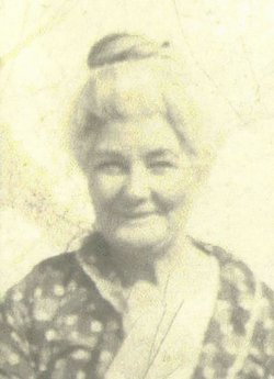
| Description | : | Arthur married Mary Edith "Mamie" Haner 10 March 1909 in Shawnee, Pottawatomie County, Oklahoma and is listed in the 1910 census of that county. Wife Mary E. is said to be 19, making her born 1891 in MO. Arthur's mother and sister were living with them as well as their daughter Clara 7 months old. Arthur is a boilermaker with Rock Island Railroad. They had another child named Floyd about 1912. On 23 May 1914 he married Ethel Ruth Brown who is listed with him on the 1920 census of same county. Arthur is 34, Ethel 24, Mildred age... Read More |
frequently asked questions (FAQ):
-
Where is Arthur S Horn's memorial?
Arthur S Horn's memorial is located at: Anderson District Cemetery, Anderson, Shasta County, USA.
-
When did Arthur S Horn death?
Arthur S Horn death on 27 Aug 1962 in Kankakee County, Illinois, USA
-
Where are the coordinates of the Arthur S Horn's memorial?
Latitude: 40.4419518
Longitude: -122.2967300
Family Members:
Parent

Spouse
Siblings
Children
Flowers:


Nearby Cemetories:
1. Anderson District Cemetery
Anderson, Shasta County, USA
Coordinate: 40.4419518, -122.2967300
2. Oddfellows Cemetery
Anderson, Shasta County, USA
Coordinate: 40.4431590, -122.2907070
3. Anderson Pioneer Cemetery
Anderson, Shasta County, USA
Coordinate: 40.4439011, -122.2904968
4. Sleepy Hollow Pet Cemetery
Anderson, Shasta County, USA
Coordinate: 40.4199430, -122.2858410
5. Cottonwood Cemetery
Cottonwood, Shasta County, USA
Coordinate: 40.3856100, -122.2936500
6. Cottonwood Creek Ranch Cemetery
Cottonwood, Shasta County, USA
Coordinate: 40.3663100, -122.2598800
7. Major Pierson B Reading Family Cemetery
Cottonwood, Shasta County, USA
Coordinate: 40.3924300, -122.2126900
8. Parkville Cemetery
Anderson, Shasta County, USA
Coordinate: 40.4640200, -122.1897500
9. Haggard Family Ranch Cemetery
Palo Cedro, Shasta County, USA
Coordinate: 40.5105600, -122.2227800
10. Bates Pioneer Cemetery
Shasta County, USA
Coordinate: 40.5348816, -122.2968674
11. Happy Valley Cemetery
Redding, Shasta County, USA
Coordinate: 40.4668999, -122.4535980
12. Shasta General Hospital Cemetery
Redding, Shasta County, USA
Coordinate: 40.5509200, -122.3841800
13. Shasta General Hospital Cemetery
Redding, Shasta County, USA
Coordinate: 40.5516000, -122.3894000
14. Lawncrest Memorial Park
Redding, Shasta County, USA
Coordinate: 40.5732994, -122.3432999
15. Texas Springs Cemetery
Redding, Shasta County, USA
Coordinate: 40.5116844, -122.4516144
16. Millville Masonic Cemetery
Millville, Shasta County, USA
Coordinate: 40.5555000, -122.1842804
17. Beck Cemetery
Shasta County, USA
Coordinate: 40.5487400, -122.1720900
18. Millville IOOF Cemetery
Millville, Shasta County, USA
Coordinate: 40.5539017, -122.1663971
19. Old Saint Joseph Cemetery
Redding, Shasta County, USA
Coordinate: 40.5781326, -122.3912811
20. Inks Creek Cemetery
Tehama County, USA
Coordinate: 40.3419800, -122.1297100
21. Redding Memorial Park
Redding, Shasta County, USA
Coordinate: 40.5894814, -122.3872833
22. Middletown Cemetery
Redding, Shasta County, USA
Coordinate: 40.5392800, -122.4748700
23. Barbara Glass Gravesite
Shasta County, USA
Coordinate: 40.5067600, -122.5049700
24. Saint Joseph Cemetery
Redding, Shasta County, USA
Coordinate: 40.5824509, -122.4310989