
Asenath Ardelia “Delia” King Gilchrest
| Birth | : | 16 Jun 1852 Cummington, Hampshire County, Massachusetts, USA |
| Death | : | 1942 Westfield, Hampden County, Massachusetts, USA |
| Burial | : | Colrain West Branch Cemetery, Colrain, Franklin County, USA |
| Coordinate | : | 42.6671982, -72.7221985 |
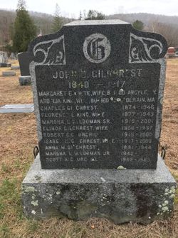
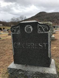
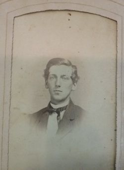
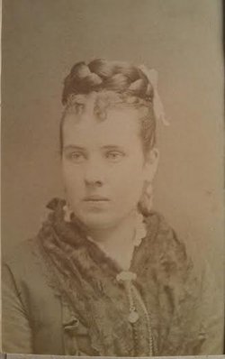
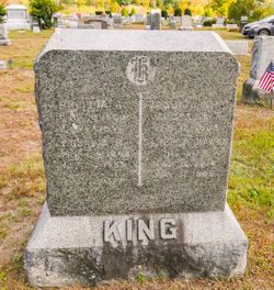
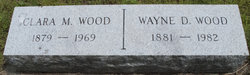
| Description | : | No dates are given on the family stone, but the stone does indicate she was buried in Colrain West Branch Cemetery. Delia was a widow of Arthur E Wood, whom she had married in 1873. Delia was born about Jun 1852, a daughter of Jason W King and Serepta Hawks King. She was living in Colrain,MA in 1920, aged 52, with sisters Mary Underwood (76) and Celia King (63). She was living with her son Wayne Wood and his wife Clara in Westfield,MA in 1940. |
frequently asked questions (FAQ):
-
Where is Asenath Ardelia “Delia” King Gilchrest's memorial?
Asenath Ardelia “Delia” King Gilchrest's memorial is located at: Colrain West Branch Cemetery, Colrain, Franklin County, USA.
-
When did Asenath Ardelia “Delia” King Gilchrest death?
Asenath Ardelia “Delia” King Gilchrest death on 1942 in Westfield, Hampden County, Massachusetts, USA
-
Where are the coordinates of the Asenath Ardelia “Delia” King Gilchrest's memorial?
Latitude: 42.6671982
Longitude: -72.7221985
Family Members:
Parent
Spouse


Siblings

Children
Flowers:


Nearby Cemetories:
1. Colrain West Branch Cemetery
Colrain, Franklin County, USA
Coordinate: 42.6671982, -72.7221985
2. Chandler Hill Cemetery
Colrain, Franklin County, USA
Coordinate: 42.6683006, -72.6832962
3. North River Cemetery
Colrain, Franklin County, USA
Coordinate: 42.6856003, -72.6917038
4. Brick School Cemetery
Colrain, Franklin County, USA
Coordinate: 42.6641998, -72.6660995
5. Arms Cemetery
Shelburne Falls, Franklin County, USA
Coordinate: 42.6166992, -72.7332993
6. Christian Hill Cemetery
Colrain, Franklin County, USA
Coordinate: 42.7158012, -72.7643967
7. West Leyden Cemetery
Leyden, Franklin County, USA
Coordinate: 42.7061005, -72.6572037
8. East Shelburne Cemetery
Shelburne, Franklin County, USA
Coordinate: 42.6105995, -72.6694031
9. South Leyden Cemetery
Leyden, Franklin County, USA
Coordinate: 42.6831400, -72.6311200
10. East Charlemont Cemetery
Charlemont, Franklin County, USA
Coordinate: 42.6197853, -72.7932739
11. Center Cemetery
Heath, Franklin County, USA
Coordinate: 42.6819000, -72.8167038
12. Henry Farm Cemetery
West Halifax, Windham County, USA
Coordinate: 42.7379712, -72.7132938
13. Brown Cemetery
West Dummerston, Windham County, USA
Coordinate: 42.7392340, -72.7135850
14. Hill Cemetery
Shelburne, Franklin County, USA
Coordinate: 42.5984344, -72.6878815
15. East Buckland Cemetery
Buckland, Franklin County, USA
Coordinate: 42.5962500, -72.7610600
16. Bell Cemetery
Halifax, Windham County, USA
Coordinate: 42.7423800, -72.6972900
17. Old East Buckland Cemetery
Buckland, Franklin County, USA
Coordinate: 42.5969400, -72.7677900
18. Stark Cemetery
Guilford, Windham County, USA
Coordinate: 42.7402992, -72.6746979
19. Clark Family Cemetery
Halifax, Windham County, USA
Coordinate: 42.7479180, -72.7103090
20. South Cemetery
Heath, Franklin County, USA
Coordinate: 42.6542015, -72.8321991
21. North Meadows Cemetery
Greenfield, Franklin County, USA
Coordinate: 42.6171989, -72.6333008
22. Country Farms Cemetery
Greenfield, Franklin County, USA
Coordinate: 42.6393900, -72.6165400
23. Pennel Hill Cemetery
Halifax, Windham County, USA
Coordinate: 42.7364006, -72.7857971
24. Shelburne Center Cemetery
Shelburne, Franklin County, USA
Coordinate: 42.5830000, -72.6969600