
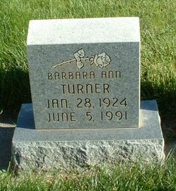
Barbara Ann Jeans Turner
| Birth | : | 28 Jan 1924 Ellensburg, Kittitas County, Washington, USA |
| Death | : | 5 Jun 1991 Ellensburg, Kittitas County, Washington, USA |
| Burial | : | Hope Lutheran Cemetery, Delmont, Douglas County, USA |
| Coordinate | : | 43.2821999, -98.1568985 |
| Description | : | OBIT: Barbara A. Turner, 67, of Thorp, died Wednesday, June 5, 1991, at Kittitas Valley community Hospital. She was born Jan. 28, 1924 in Ellensburg, one of four children of Sidney and Gladys (Sanders) Jeans. Following graduation from Thorp High School in 1942, she served in the U.S. Navy during World War II. She graduated from Yakima Beauty School and later attended Central Washington College of Education (now CWU), where she earned teaching credentials in 1953. During her long career as an educator, she taught in Toppenish, Easton and Thorp and was recognized for her abiity to teach everything... Read More |
frequently asked questions (FAQ):
-
Where is Barbara Ann Jeans Turner's memorial?
Barbara Ann Jeans Turner's memorial is located at: Hope Lutheran Cemetery, Delmont, Douglas County, USA.
-
When did Barbara Ann Jeans Turner death?
Barbara Ann Jeans Turner death on 5 Jun 1991 in Ellensburg, Kittitas County, Washington, USA
-
Where are the coordinates of the Barbara Ann Jeans Turner's memorial?
Latitude: 43.2821999
Longitude: -98.1568985
Family Members:
Spouse

Flowers:


Nearby Cemetories:
1. Hope Lutheran Cemetery
Delmont, Douglas County, USA
Coordinate: 43.2821999, -98.1568985
2. Zion Lutheran Cemetery
Delmont, Douglas County, USA
Coordinate: 43.2822000, -98.1558000
3. Delmont Cemetery
Delmont, Douglas County, USA
Coordinate: 43.2757988, -98.1481018
4. Old Missouri Cemetery
Delmont, Douglas County, USA
Coordinate: 43.2947006, -98.2043991
5. Emmanuel Lutheran Cemetery
Delmont, Douglas County, USA
Coordinate: 43.3331200, -98.1885800
6. Neusatz Cemetery
Douglas County, USA
Coordinate: 43.3410988, -98.1643982
7. Hoffnungsberg Cemetery
Hutchinson County, USA
Coordinate: 43.2972600, -98.0485700
8. Saint Marys Cemetery
Douglas County, USA
Coordinate: 43.3703000, -98.1119000
9. Oak Hollow Cemetery
Hutchinson County, USA
Coordinate: 43.1963997, -98.0599976
10. Zion Baptist Church Cemetery
Wagner, Charles Mix County, USA
Coordinate: 43.1761400, -98.2085800
11. Congregational Church Cemetery
Charles Mix County, USA
Coordinate: 43.1695600, -98.1834300
12. Haffner Family Farm Cemetery
Hutchinson County, USA
Coordinate: 43.2134840, -98.0312720
13. Eigenfeld Evangelical Lutheran Cemetery
Hutchinson County, USA
Coordinate: 43.3549995, -98.0335999
14. New Salem Reformed Cemetery
Charles Mix County, USA
Coordinate: 43.1683006, -98.1271973
15. Saint Pauls Lutheran Cemetery
Charles Mix County, USA
Coordinate: 43.1642780, -98.1687250
16. Saint Peters Cemetery
Douglas County, USA
Coordinate: 43.3847008, -98.2514038
17. Evangelic Cemetery
Douglas County, USA
Coordinate: 43.4124985, -98.1318970
18. Zion Cemetery
Parkston, Hutchinson County, USA
Coordinate: 43.3448100, -97.9939900
19. Pleasant Ridge Cemetery
Armour, Douglas County, USA
Coordinate: 43.3250008, -98.3386002
20. Roberts Chapel Cemetery
Douglas County, USA
Coordinate: 43.4127998, -98.2225037
21. Pietz Cemetery
Hutchinson County, USA
Coordinate: 43.2703018, -97.9599991
22. Zion Lutheran Cemetery
Tripp, Hutchinson County, USA
Coordinate: 43.1974400, -97.9917300
23. Friedens Reformed Cemetery
Tripp, Hutchinson County, USA
Coordinate: 43.2113991, -97.9657974
24. Grace Hill Cemetery
Tripp, Hutchinson County, USA
Coordinate: 43.2111015, -97.9638977