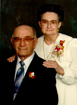
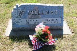
Beata Ann Steinmeyer Stillman
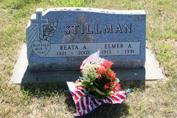
| Birth | : | 16 Jul 1921 Wisner, Cuming County, Nebraska, USA |
| Death | : | 22 Jul 2002 Sioux Falls, Minnehaha County, South Dakota, USA |
| Burial | : | Oak Grove Baptist Church Cemetery, Centertown, Warren County, USA |
| Coordinate | : | 35.7005300, -85.9630900 |
| Plot | : | Section 6, Lot 50, Space D |
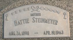
| Description | : | ~~~~~~~~~~~~~~~~~~~~~~~~~~~~~~~~ Beata Ann Stillman Freier, 81, Tripp, died Monday (July 22, 2002) at McKennan Hospital, Sioux Falls. Funeral service is at 1:30 p.m. today (Thursday) at Emmaus Lutheran Church, Tripp, with the Rev. Richard Weeman officiating. Burial is in Rosehill Cemetery, Scotland. Pallbearers are Steven Stillman, Shawn Daily, John Koons, Merald Gall, Tony Dewald and Glen Dewald. Visitation is from 9-11:30 a.m. today (Thursday) at the Goglin-Kelley Memorial Chapel, Tripp. She was born July 16, 1921, at Wisner, Neb., to Carl and Hattie (Luedke) Steinmeyer. She attended rural school and worked as a hired girl before her marriage. She married Elmer A. Stillman March 9,... Read More |
frequently asked questions (FAQ):
-
Where is Beata Ann Steinmeyer Stillman's memorial?
Beata Ann Steinmeyer Stillman's memorial is located at: Oak Grove Baptist Church Cemetery, Centertown, Warren County, USA.
-
When did Beata Ann Steinmeyer Stillman death?
Beata Ann Steinmeyer Stillman death on 22 Jul 2002 in Sioux Falls, Minnehaha County, South Dakota, USA
-
Where are the coordinates of the Beata Ann Steinmeyer Stillman's memorial?
Latitude: 35.7005300
Longitude: -85.9630900
Family Members:
Parent
Spouse
Siblings
Flowers:
Nearby Cemetories:
1. Oak Grove Baptist Church Cemetery
Centertown, Warren County, USA
Coordinate: 35.7005300, -85.9630900
2. Lance Cemetery
Warren County, USA
Coordinate: 35.7010200, -85.9521100
3. Big Spring Cemetery
Warren County, USA
Coordinate: 35.6892014, -85.9483032
4. Whitlock Cemetery
Warren County, USA
Coordinate: 35.7266998, -85.9400024
5. Rains Cemetery
Warren County, USA
Coordinate: 35.6681061, -85.9623947
6. Rains Cemetery
Cannon County, USA
Coordinate: 35.6685982, -85.9558029
7. Trousdale Cemetery
Trousdale, Warren County, USA
Coordinate: 35.6698120, -85.9488050
8. Harrington Cemetery
Centertown, Warren County, USA
Coordinate: 35.7150002, -85.9227982
9. Campbell Cemetery
Cannon County, USA
Coordinate: 35.7318993, -85.9957962
10. Ivy Bluff Cemetery
Centertown, Warren County, USA
Coordinate: 35.7415900, -85.9675900
11. Centertown Cemetery
Centertown, Warren County, USA
Coordinate: 35.7253480, -85.9216530
12. French Cemetery
Cannon County, USA
Coordinate: 35.6699982, -85.9269028
13. Fountain Springs Cemetery
Trousdale, Warren County, USA
Coordinate: 35.6582600, -85.9750600
14. Youngblood Cemetery
Centertown, Warren County, USA
Coordinate: 35.7442017, -85.9432983
15. Pleasant View Church of Christ Cemetery
Pleasant View, Cannon County, USA
Coordinate: 35.7415990, -85.9956410
16. Hulett Cemetery
Trousdale, Warren County, USA
Coordinate: 35.6512700, -85.9775700
17. Red Hill Church of Christ Cemetery
Red Hill, Cannon County, USA
Coordinate: 35.7266235, -86.0189133
18. Pleasant Hill Baptist Church Cemetery
Centertown, Warren County, USA
Coordinate: 35.6938324, -85.8964386
19. Brown Cemetery
Coffee County, USA
Coordinate: 35.6469002, -85.9978027
20. Caney Branch Cemetery
Warren County, USA
Coordinate: 35.6440811, -85.9343262
21. Brown Chapel Cemetery
Warren County, USA
Coordinate: 35.6851006, -85.8899994
22. Lorance Cemetery
Cannon County, USA
Coordinate: 35.7380981, -86.0255966
23. Ivy Bluff Cemetery
Cannon County, USA
Coordinate: 35.6606520, -86.0301490
24. Grange Hall Cemetery
Centertown, Warren County, USA
Coordinate: 35.6796989, -85.8818970

