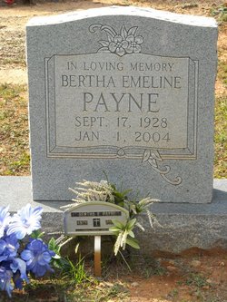
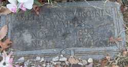
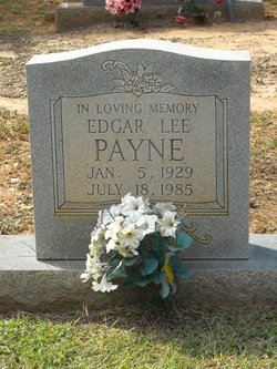
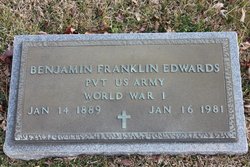
Bertha Emeline Edwards Payne
| Birth | : | 17 Sep 1928 Carroll County, Virginia, USA |
| Death | : | 1 Jan 2004 Mount Airy, Surry County, North Carolina, USA |
| Burial | : | Grandville Cemetery, Grandville, Kent County, USA |
| Coordinate | : | 42.9043999, -85.7514038 |
| Description | : | this is one of the many pics I took during my trip to NC/VA Sep 2008. not directly related to me, but has one of the family names I was researching so I took a pic. maybe it will be useful to someone researching this family. if you're related to this person and would like me to transfer the name to you, please contact me. |
frequently asked questions (FAQ):
-
Where is Bertha Emeline Edwards Payne's memorial?
Bertha Emeline Edwards Payne's memorial is located at: Grandville Cemetery, Grandville, Kent County, USA.
-
When did Bertha Emeline Edwards Payne death?
Bertha Emeline Edwards Payne death on 1 Jan 2004 in Mount Airy, Surry County, North Carolina, USA
-
Where are the coordinates of the Bertha Emeline Edwards Payne's memorial?
Latitude: 42.9043999
Longitude: -85.7514038
Family Members:
Parent
Spouse
Siblings
Children
Flowers:
Nearby Cemetories:
1. Grandville Cemetery
Grandville, Kent County, USA
Coordinate: 42.9043999, -85.7514038
2. River Bend Cemetery
Walker, Kent County, USA
Coordinate: 42.9352989, -85.7750015
3. Jenison Cemetery
Jenison, Ottawa County, USA
Coordinate: 42.8897018, -85.8019028
4. Smallpox Cemetery
Georgetown Township, Ottawa County, USA
Coordinate: 42.8994500, -85.8063100
5. Floral View Memorial Gardens
Jenison, Ottawa County, USA
Coordinate: 42.8699989, -85.8032990
6. Resurrection Cemetery
Wyoming, Kent County, USA
Coordinate: 42.8905983, -85.6819000
7. Ridgeview Memorial Gardens
Georgetown Township, Ottawa County, USA
Coordinate: 42.8632600, -85.8023900
8. Hanley Cemetery
Jenison, Ottawa County, USA
Coordinate: 42.8565090, -85.7924940
9. Sleepy Hollow Pet Cemetery and Crematory
Byron Center, Kent County, USA
Coordinate: 42.8477040, -85.7329940
10. Holy Trinity Columbarium
Wyoming, Kent County, USA
Coordinate: 42.8669010, -85.6847490
11. Shackhuddle Cemetery
Georgetown Township, Ottawa County, USA
Coordinate: 42.8634460, -85.8229030
12. Boynton Cemetery
Byron Center, Kent County, USA
Coordinate: 42.8377991, -85.7433014
13. Saint Pauls Anglican Church Columbarium
Grand Rapids, Kent County, USA
Coordinate: 42.9711200, -85.7321700
14. Haire Cemetery
Jenison, Ottawa County, USA
Coordinate: 42.9363260, -85.8374910
15. Rosedale Memorial Park
Tallmadge Township, Ottawa County, USA
Coordinate: 42.9721160, -85.7876870
16. Georgetown Township Cemetery
Hudsonville, Ottawa County, USA
Coordinate: 42.8941710, -85.8519780
17. Lowing Cemetery
Jenison, Ottawa County, USA
Coordinate: 42.9219444, -85.8525000
18. Rest Lawn Memorial Park
Grand Rapids, Kent County, USA
Coordinate: 42.9007988, -85.6438980
19. Saint Andrews Catholic Cemetery
Grand Rapids, Kent County, USA
Coordinate: 42.9463997, -85.6567001
20. Oakhill Cemetery
Grand Rapids, Kent County, USA
Coordinate: 42.9411011, -85.6517029
21. Gerald R Ford Museum
Grand Rapids, Kent County, USA
Coordinate: 42.9668140, -85.6771000
22. Kent Memorial Gardens
Byron Center, Kent County, USA
Coordinate: 42.8356018, -85.6883011
23. Westminster Presbyterian Church Columbarium
Grand Rapids, Kent County, USA
Coordinate: 42.9619070, -85.6646760
24. Mount Calvary Cemetery
Grand Rapids, Kent County, USA
Coordinate: 42.9846992, -85.7043991


