
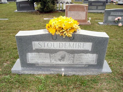

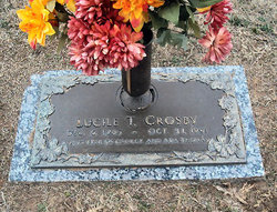
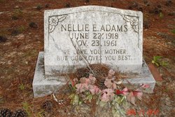
Bertha Mae Thomas Stoudemire
| Birth | : | 10 Apr 1913 USA |
| Death | : | 16 Dec 2005 Barnwell County, South Carolina, USA |
| Burial | : | Strood Cemetery, Strood, Medway Unitary Authority, England |
| Coordinate | : | 51.3900220, 0.4838640 |
frequently asked questions (FAQ):
-
Where is Bertha Mae Thomas Stoudemire's memorial?
Bertha Mae Thomas Stoudemire's memorial is located at: Strood Cemetery, Strood, Medway Unitary Authority, England.
-
When did Bertha Mae Thomas Stoudemire death?
Bertha Mae Thomas Stoudemire death on 16 Dec 2005 in Barnwell County, South Carolina, USA
-
Where are the coordinates of the Bertha Mae Thomas Stoudemire's memorial?
Latitude: 51.3900220
Longitude: 0.4838640
Family Members:
Parent

Spouse

Siblings
Children
Flowers:


Nearby Cemetories:
1. Strood Cemetery
Strood, Medway Unitary Authority, England
Coordinate: 51.3900220, 0.4838640
2. St Nicholas with St Mary Churchyard
Strood, Medway Unitary Authority, England
Coordinate: 51.3959790, 0.4931350
3. St Margaret Churchyard
Rochester, Medway Unitary Authority, England
Coordinate: 51.3849380, 0.4993630
4. Rochester Castle Moat Burial Ground
Rochester, Medway Unitary Authority, England
Coordinate: 51.3894140, 0.5024580
5. Rochester Cathedral
Rochester, Medway Unitary Authority, England
Coordinate: 51.3889750, 0.5031160
6. St Nicholas Churchyard
Rochester, Medway Unitary Authority, England
Coordinate: 51.3894170, 0.5035320
7. Rochester Baptist Church
Rochester, Medway Unitary Authority, England
Coordinate: 51.3871570, 0.5052370
8. St. Margaret's Cemetery
Rochester, Medway Unitary Authority, England
Coordinate: 51.3777000, 0.5011600
9. St Matthew Churchyard
Borstal, Medway Unitary Authority, England
Coordinate: 51.3736150, 0.4868020
10. St. Nicholas's Cemetery
Rochester, Medway Unitary Authority, England
Coordinate: 51.3780081, 0.5021076
11. All Saints Churchyard
Frindsbury, Medway Unitary Authority, England
Coordinate: 51.4004440, 0.5058970
12. Fort Pitt Military Cemetery
Rochester, Medway Unitary Authority, England
Coordinate: 51.3769790, 0.5114570
13. Chatham Unitarian Church
Chatham, Medway Unitary Authority, England
Coordinate: 51.3826090, 0.5195850
14. St Mary Churchyard
Chatham, Medway Unitary Authority, England
Coordinate: 51.3874550, 0.5244280
15. St. Michael and All Angels Churchyard
Cuxton, Medway Unitary Authority, England
Coordinate: 51.3714120, 0.4546760
16. Chatham Burial Ground
Chatham, Medway Unitary Authority, England
Coordinate: 51.3849900, 0.5272600
17. Brompton War Memorial
Chatham, Medway Unitary Authority, England
Coordinate: 51.3932140, 0.5293660
18. St John Evangelist Churchyard
Higham, Gravesham Borough, England
Coordinate: 51.4162102, 0.4616890
19. Chatham Naval Memorial
Chatham, Medway Unitary Authority, England
Coordinate: 51.3836479, 0.5321670
20. Chatham Maidstone Road Cemetery
Chatham, Medway Unitary Authority, England
Coordinate: 51.3703300, 0.5227600
21. St George Churchyard
Chatham, Medway Unitary Authority, England
Coordinate: 51.3974070, 0.5346770
22. St Philip and St James Churchyard
Upnor, Medway Unitary Authority, England
Coordinate: 51.4106250, 0.5250480
23. Chatham Palmerston Road Cemetery
Chatham, Medway Unitary Authority, England
Coordinate: 51.3678600, 0.5267300
24. All Saints Churchyard
Wouldham, Tonbridge and Malling Borough, England
Coordinate: 51.3528130, 0.4580580