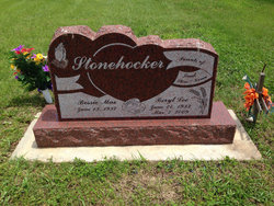
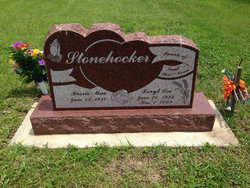
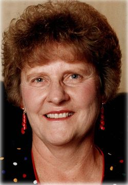
Beryl Lee Stonehocker
| Birth | : | 24 Jun 1933 Arvada, Jefferson County, Colorado, USA |
| Death | : | 7 Mar 2009 Wichita, Sedgwick County, Kansas, USA |
| Burial | : | Choteau Cemetery, Independence, Montgomery County, USA |
| Coordinate | : | 37.3194700, -95.6746700 |
| Description | : | Beryl Lee Stonehocker, age 75, of rural Clearwater, KS died on Saturday, March 7, 2009 at Via Christi St. Francis in Wichita, KS. Beryl Lee Stonehocker was born on June 24, 1933 in Arvada, CO the sixth of seven children born to Roy Sr. and Rebecca (Shaklee) Stonehocker. On May 7, 1955 he was united in marriage to Bessie Orrell at Newkirk, OK and to this union one daughter and two sons were born. Beryl and his wife moved to the farm at Clearwater, KS in 1957. He worked for Cornejo and Sons in Wichita for 10 years while farming... Read More |
frequently asked questions (FAQ):
-
Where is Beryl Lee Stonehocker's memorial?
Beryl Lee Stonehocker's memorial is located at: Choteau Cemetery, Independence, Montgomery County, USA.
-
When did Beryl Lee Stonehocker death?
Beryl Lee Stonehocker death on 7 Mar 2009 in Wichita, Sedgwick County, Kansas, USA
-
Where are the coordinates of the Beryl Lee Stonehocker's memorial?
Latitude: 37.3194700
Longitude: -95.6746700
Family Members:
Spouse
Flowers:
Nearby Cemetories:
1. Choteau Cemetery
Independence, Montgomery County, USA
Coordinate: 37.3194700, -95.6746700
2. Bethel Cemetery
Independence, Montgomery County, USA
Coordinate: 37.2761002, -95.6457977
3. Krone Cemetery
Montgomery County, USA
Coordinate: 37.3302400, -95.7494600
4. Radical Cemetery
Montgomery County, USA
Coordinate: 37.2882996, -95.7416992
5. Saint Andrews Cemetery
Independence, Montgomery County, USA
Coordinate: 37.2566986, -95.6658020
6. Pleasant Dale Cemetery
Cherryvale, Montgomery County, USA
Coordinate: 37.3139700, -95.5860700
7. Hiltz Cemetery
Montgomery County, USA
Coordinate: 37.3549995, -95.5939026
8. Calvary Cemetery
Independence, Montgomery County, USA
Coordinate: 37.2486000, -95.7043991
9. Le Hunt Cemetery
Montgomery County, USA
Coordinate: 37.2744300, -95.7586200
10. Mount Hope Cemetery
Independence, Montgomery County, USA
Coordinate: 37.2413300, -95.7060050
11. Pratt Cemetery
Montgomery County, USA
Coordinate: 37.2324982, -95.6557999
12. Spindletop Cemetery
Cherryvale, Montgomery County, USA
Coordinate: 37.2958400, -95.5570700
13. Saint Francis Xavier Cemetery
Cherryvale, Montgomery County, USA
Coordinate: 37.2633018, -95.5753021
14. Farm Ridge Cemetery
Elk City, Montgomery County, USA
Coordinate: 37.3560982, -95.8019028
15. Harmony Cemetery
Cherryvale, Montgomery County, USA
Coordinate: 37.2324982, -95.5950012
16. Simpson Cemetery
Elk City, Montgomery County, USA
Coordinate: 37.3269005, -95.8186035
17. Callahan Cemetery
Elk City, Montgomery County, USA
Coordinate: 37.3626400, -95.8113200
18. Fairview Cemetery
Cherryvale, Montgomery County, USA
Coordinate: 37.2722015, -95.5344009
19. Montgomery County Poor Farm Cemetery
Liberty, Montgomery County, USA
Coordinate: 37.1888590, -95.6493690
20. Centennial Cemetery
Cherryvale, Montgomery County, USA
Coordinate: 37.2296982, -95.5466995
21. Morehead Cemetery
Morehead, Neosho County, USA
Coordinate: 37.3849983, -95.5246964
22. Quaker Cemetery
Elk City, Montgomery County, USA
Coordinate: 37.2395900, -95.8243400
23. Thompson Homestead Cemetery
Liberty, Montgomery County, USA
Coordinate: 37.1767000, -95.6183100
24. Parker Cemetery
Montgomery County, USA
Coordinate: 37.2630997, -95.8572006


