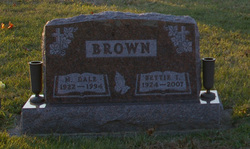
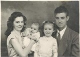
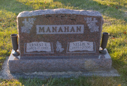
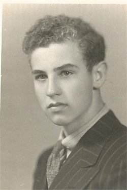
Bettie I Manahan Brown
| Birth | : | 6 Jan 1924 |
| Death | : | 17 Jan 2007 |
| Burial | : | Saint Mary Cemetery, Missoula, Missoula County, USA |
| Coordinate | : | 46.8865070, -113.9995050 |
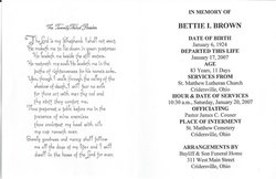
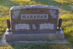
| Description | : | Bettie I. Brown, 83, died at 6:10 a.m. Jan. 17, 2007, at her residence. She was born Jan. 6, 1924, in Beaverdam to Ernest and Nellie Coon Manahan, who preceded her in death. On Aug. 15, 1942, she married M. Dale Brown, who died Feb. 2, 1994. Mrs. Brown retired as a fifth-grade teacher and media specialist from the Shawnee school system, having taught for 22 years at Maplewood and Elmwood elementary schools. She was a member of St. Matthew Lutheran Church, Cridersville, where she served as chairwoman of its Ruth Circle and had been superintendent of its Sunday school for several... Read More |
frequently asked questions (FAQ):
-
Where is Bettie I Manahan Brown's memorial?
Bettie I Manahan Brown's memorial is located at: Saint Mary Cemetery, Missoula, Missoula County, USA.
-
When did Bettie I Manahan Brown death?
Bettie I Manahan Brown death on 17 Jan 2007 in
-
Where are the coordinates of the Bettie I Manahan Brown's memorial?
Latitude: 46.8865070
Longitude: -113.9995050
Family Members:
Parent
Spouse
Flowers:
Nearby Cemetories:
1. Saint Mary Cemetery
Missoula, Missoula County, USA
Coordinate: 46.8865070, -113.9995050
2. Saint Mary Cemetery
Missoula, Missoula County, USA
Coordinate: 46.8909988, -114.0071030
3. Missoula Cemetery
Missoula, Missoula County, USA
Coordinate: 46.8910904, -114.0185471
4. Missoula County Poor Farm Cemetery
Missoula, Missoula County, USA
Coordinate: 46.8923320, -113.9682050
5. Holy Spirit Episcopal Church Columbarium
Missoula, Missoula County, USA
Coordinate: 46.8642000, -113.9963000
6. Western Montana State Veterans Cemetery
Missoula, Missoula County, USA
Coordinate: 46.8531100, -114.0563600
7. Fort Missoula Cemetery
Missoula, Missoula County, USA
Coordinate: 46.8469009, -114.0570984
8. Sunset Memorial Gardens
Missoula, Missoula County, USA
Coordinate: 46.8902779, -114.1001740
9. Saint John the Baptist Catholic Cemetery
Frenchtown, Missoula County, USA
Coordinate: 47.0155983, -114.2146988
10. Carlton Cemetery
Lolo, Missoula County, USA
Coordinate: 46.6788880, -114.0791560
11. Woodman Pioneer Cemetery
Lolo, Missoula County, USA
Coordinate: 46.7675000, -114.2676000
12. Jocko Church Cemetery
Arlee, Lake County, USA
Coordinate: 47.1395000, -114.0136000
13. Saint Josephs Cemetery
Florence, Ravalli County, USA
Coordinate: 46.6294000, -114.0861000
14. Sunnyside Cemetery
Stevensville, Ravalli County, USA
Coordinate: 46.5657997, -113.9916992
15. Saint Marys Cemetery
Stevensville, Ravalli County, USA
Coordinate: 46.5093994, -114.0986023
16. Maplewood Cemetery
Stevensville, Ravalli County, USA
Coordinate: 46.5042000, -114.0963974
17. Riverside Cemetery
Stevensville, Ravalli County, USA
Coordinate: 46.4986000, -114.0982971
18. Krantz Memorial Cemetery
Saint Ignatius, Lake County, USA
Coordinate: 47.2998000, -114.1415000
19. Sand Park Cemetery
Missoula County, USA
Coordinate: 46.8340000, -113.3830000
20. Snyelmn Sntmtmne Cemetery
Saint Ignatius, Lake County, USA
Coordinate: 47.3102000, -114.0967000
21. Saint Ignatius Catholic Cemetery
Saint Ignatius, Lake County, USA
Coordinate: 47.3107986, -114.0924988
22. Pleasant View Cemetery
Saint Ignatius, Lake County, USA
Coordinate: 47.3078995, -114.1184998
23. Saint Ignatius Historic Mission Cemetery
Saint Ignatius, Lake County, USA
Coordinate: 47.3144989, -114.1038971
24. Seeley Lake Cemetery
Missoula County, USA
Coordinate: 47.0508000, -113.3890000

