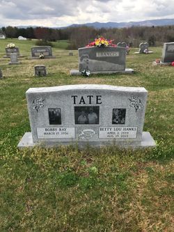
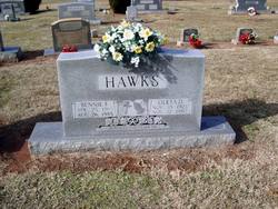
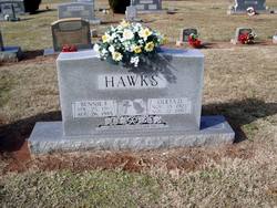
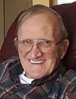
Betty Lou Hawks Tate
| Birth | : | 2 Apr 1939 Carroll County, Virginia, USA |
| Death | : | 19 Aug 2013 Dobson, Surry County, North Carolina, USA |
| Burial | : | Flat Ridge Baptist Church Cemetery, Cana, Carroll County, USA |
| Coordinate | : | 36.5867470, -80.6298910 |
| Description | : | Mrs. Betty Lou Hawks Tate age 74 of 2737 Wards Gap Road, Ararat, VA wife of Mr. Bobby Ray Tate passed away Monday, August 19, 2013 at Joan and Howard Woltz Hospice Home. She was born April 2, 1939 in Carroll County, VA to the late Benjamin "Benny" and Oleta Dickerson Hawks. She was retired f rom Brown Wooten Hosiery Company and was a member of Westview Baptist Church. Surviving are her husband of 55 years, Bobby Ray Tate of the home three daughters and two sons-in-laws, Gwen and Robert Schoenthal, Cana, VA, Michele and Leonard Goad, Cana, VA, Myra... Read More |
frequently asked questions (FAQ):
-
Where is Betty Lou Hawks Tate's memorial?
Betty Lou Hawks Tate's memorial is located at: Flat Ridge Baptist Church Cemetery, Cana, Carroll County, USA.
-
When did Betty Lou Hawks Tate death?
Betty Lou Hawks Tate death on 19 Aug 2013 in Dobson, Surry County, North Carolina, USA
-
Where are the coordinates of the Betty Lou Hawks Tate's memorial?
Latitude: 36.5867470
Longitude: -80.6298910
Family Members:
Parent
Spouse
Siblings
Flowers:
Nearby Cemetories:
1. Flat Ridge Baptist Church Cemetery
Cana, Carroll County, USA
Coordinate: 36.5867470, -80.6298910
2. Westmoreland Cemetery
Cana, Carroll County, USA
Coordinate: 36.5850100, -80.6461990
3. Speas Family Cemetery
Cana, Carroll County, USA
Coordinate: 36.5724564, -80.6447983
4. Mount Bethel Moravian Graveyard
Cana, Carroll County, USA
Coordinate: 36.6053120, -80.6272700
5. Solid Rock Baptist Church Cemetery
Cana, Carroll County, USA
Coordinate: 36.5652400, -80.6357650
6. Glass Family Memorial Cemetery
Cana, Carroll County, USA
Coordinate: 36.5652280, -80.6357090
7. Epworth United Methodist Church Cemetery
Cana, Carroll County, USA
Coordinate: 36.5736110, -80.6536110
8. A.L. Jones Family Cemetery
Cana, Carroll County, USA
Coordinate: 36.5754410, -80.6561640
9. Allen Cemetery
Cana, Carroll County, USA
Coordinate: 36.6155280, -80.6192210
10. State Line Primitive Baptist Church Cemetery
Mount Airy, Surry County, USA
Coordinate: 36.5580000, -80.6117220
11. Harrold Cemetery
Carroll County, USA
Coordinate: 36.6199300, -80.6219970
12. Cana Baptist Church Cemetery
Cana, Carroll County, USA
Coordinate: 36.5920764, -80.6717347
13. Gunnell - Bowman - Fleming Cemetery
Ararat, Patrick County, USA
Coordinate: 36.5898540, -80.5866110
14. Primitive Baptist Church Of Jesus Christ Cemetery
Cana, Carroll County, USA
Coordinate: 36.5917320, -80.6737210
15. Willis Gap Baptist Church Cemetery
Ararat, Patrick County, USA
Coordinate: 36.5925140, -80.5850250
16. Wisler Cemetery
Cana, Carroll County, USA
Coordinate: 36.5933240, -80.6756550
17. Inscore Cemetery
Ararat, Patrick County, USA
Coordinate: 36.5988000, -80.5838000
18. Gunnell Family Cemetery
Ararat, Patrick County, USA
Coordinate: 36.6034190, -80.5852510
19. Noonkester Family Cemetery
Ararat, Patrick County, USA
Coordinate: 36.6019990, -80.5830940
20. Portis Cemetery
Ararat, Patrick County, USA
Coordinate: 36.6132460, -80.5890090
21. Oak Ridge Baptist Church Cemetery
Cana, Carroll County, USA
Coordinate: 36.5718760, -80.6800790
22. Montgomery Family Cemetery
Ararat, Patrick County, USA
Coordinate: 36.6239760, -80.5977920
23. Mount Carmel Baptist Church Cemetery
Mount Airy, Surry County, USA
Coordinate: 36.5432510, -80.6457214
24. Mountain View Primitive Baptist Church Cemetery
Ararat, Patrick County, USA
Coordinate: 36.6127720, -80.5827530

