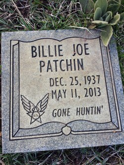
Billie Joe Patchin
| Birth | : | 25 Dec 1937 Nubieber, Lassen County, California, USA |
| Death | : | 11 May 2013 Nubieber, Lassen County, California, USA |
| Burial | : | Hillside Cemetery, Bieber, Lassen County, USA |
| Coordinate | : | 41.0811005, -121.1936035 |
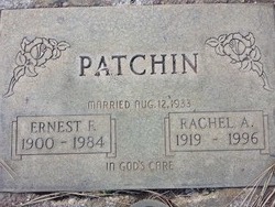
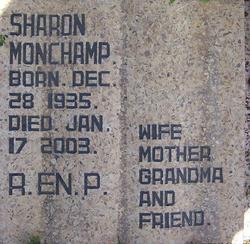
| Description | : | Billie was born in Nubieber, CA on December 25, 1937 to Ernest and Rachel Patchin and passed away on May 11, 2013 after a battle with cancer. He is preceded in death by his wife, Virginia; parents, Ernest and Rachel and his sister, Sharon Jean Monchamp. Billie is survived by his children: Shirley Ann Lopaz, Alfred Joseph Patchin, Patrick Franklin Patchin and Nicole Patchin. He is also survived by his sister, Ruth Ann McNabb and his brother, John Perry Patchin. |
frequently asked questions (FAQ):
-
Where is Billie Joe Patchin's memorial?
Billie Joe Patchin's memorial is located at: Hillside Cemetery, Bieber, Lassen County, USA.
-
When did Billie Joe Patchin death?
Billie Joe Patchin death on 11 May 2013 in Nubieber, Lassen County, California, USA
-
Where are the coordinates of the Billie Joe Patchin's memorial?
Latitude: 41.0811005
Longitude: -121.1936035
Family Members:
Parent
Siblings
Flowers:
Nearby Cemetories:
1. Hillside Cemetery
Bieber, Lassen County, USA
Coordinate: 41.0811005, -121.1936035
2. Mountain View Cemetery
Bieber, Lassen County, USA
Coordinate: 41.1328011, -121.1205978
3. Lookout Cemetery
Lookout, Modoc County, USA
Coordinate: 41.2039570, -121.1581060
4. Pine Grove Cemetery
McArthur, Shasta County, USA
Coordinate: 41.0558014, -121.3835983
5. Day Cemetery
Day, Modoc County, USA
Coordinate: 41.2093320, -121.3733430
6. Fall River Cemetery
Fall River Mills, Shasta County, USA
Coordinate: 41.0133300, -121.4333100
7. Adin Cemetery
Adin, Modoc County, USA
Coordinate: 41.1907997, -120.9567032
8. Winters Cemetery
Fall River Mills, Shasta County, USA
Coordinate: 40.9932700, -121.4460300
9. Pioneer Cemetery
Adin, Modoc County, USA
Coordinate: 41.1903150, -120.9483440
10. Eastman Lake Cemetery
Eastman Place, Shasta County, USA
Coordinate: 41.1160600, -121.4783200
11. Hayden Hill Cemetery
Hayden Hill, Lassen County, USA
Coordinate: 40.9974200, -120.8812300
12. Dana Cemetery
Glenburn, Shasta County, USA
Coordinate: 41.1234896, -121.5788626
13. Cayton Cemetery
Cayton, Shasta County, USA
Coordinate: 41.0319700, -121.6320800
14. Ash Valley Cemetery
Madeline, Lassen County, USA
Coordinate: 41.1201400, -120.7482900
15. Burney Falls Cemetery
Burney, Shasta County, USA
Coordinate: 41.0228400, -121.6456300
16. Brown Cemetery
Hat Creek, Shasta County, USA
Coordinate: 40.7532900, -121.4798200
17. Wilcox Family Cemetery
Shasta County, USA
Coordinate: 40.7447100, -121.4716700
18. Burney District Cemetery
Burney, Shasta County, USA
Coordinate: 40.8801600, -121.6526200
19. Burney Cemetery
Burney, Shasta County, USA
Coordinate: 40.8837100, -121.6566600
20. Snooks Cemetery
Burney, Shasta County, USA
Coordinate: 40.8788900, -121.6649800
21. Canby Cemetery
Modoc County, USA
Coordinate: 41.4215570, -120.8727560
22. ISOT Family Park and Cemetery
Canby, Modoc County, USA
Coordinate: 41.4469000, -120.8780000
23. Goose Valley Indian Burial Grounds
Burney, Shasta County, USA
Coordinate: 40.9503800, -121.7459000
24. Centerville Cemetery
Modoc County, USA
Coordinate: 41.4196500, -120.7411300


