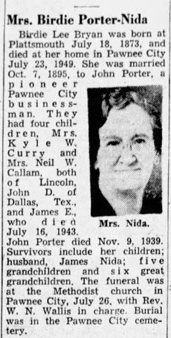
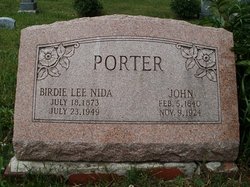
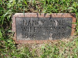
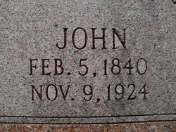
Birdie Leah Bryan Nida
| Birth | : | 18 Jul 1873 Plattsmouth, Cass County, Nebraska, USA |
| Death | : | 23 Jul 1949 Pawnee City, Pawnee County, Nebraska, USA |
| Burial | : | Parma Cemetery, Parma, Canyon County, USA |
| Coordinate | : | 43.7919006, -116.9511032 |
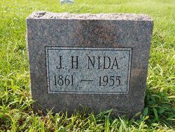
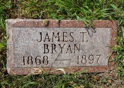
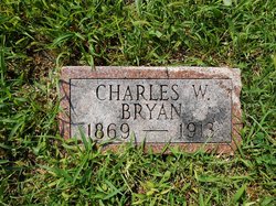
| Description | : | Married to John Porter Oct. 7, 1895. Remarried to James Harvey Nida Feb. 10, 1926. (The following information is thanks to Kelly Greer!) Verna Lee "Birdie" Bryan was listed on most records as "Birdie" yet she was recorded as the wife of John Porter on the 1920 Census of Pawnee Co., NE. as "Verna L." Porter. I have to believe therefore that her given 1st name was Verna and "Birdie" was a nickname. I submitted an EDIT here on Find A Grave to change her name to her given name of Verna Lee (Bryan) Offield-Porter-Nida. The reason I have her first married... Read More |
frequently asked questions (FAQ):
-
Where is Birdie Leah Bryan Nida's memorial?
Birdie Leah Bryan Nida's memorial is located at: Parma Cemetery, Parma, Canyon County, USA.
-
When did Birdie Leah Bryan Nida death?
Birdie Leah Bryan Nida death on 23 Jul 1949 in Pawnee City, Pawnee County, Nebraska, USA
-
Where are the coordinates of the Birdie Leah Bryan Nida's memorial?
Latitude: 43.7919006
Longitude: -116.9511032
Family Members:
Parent
Spouse
Siblings
Flowers:
Nearby Cemetories:
1. Parma Cemetery
Parma, Canyon County, USA
Coordinate: 43.7919006, -116.9511032
2. Roswell Cemetery
Roswell, Canyon County, USA
Coordinate: 43.7435989, -116.9702988
3. Lower Boise Cemetery
Parma, Canyon County, USA
Coordinate: 43.7599983, -116.8833008
4. Owyhee River Cemetery
Owyhee, Malheur County, USA
Coordinate: 43.7956800, -117.0516300
5. Owyhee Pioneer Cemetery
Owyhee, Malheur County, USA
Coordinate: 43.7762500, -117.0787700
6. Owyhee Cemetery
Nyssa, Malheur County, USA
Coordinate: 43.7957993, -117.0847015
7. Hilltop Memorial Cemetery
Nyssa, Malheur County, USA
Coordinate: 43.8834010, -117.0481340
8. Wilder Cemetery
Wilder, Canyon County, USA
Coordinate: 43.6683006, -116.9222031
9. Fargo Cemetery
Wilder, Canyon County, USA
Coordinate: 43.6500015, -116.9313965
10. Greenleaf Cemetery
Greenleaf, Canyon County, USA
Coordinate: 43.6693720, -116.8151310
11. Pleasant Ridge Cemetery
Caldwell, Canyon County, USA
Coordinate: 43.6549988, -116.7833023
12. Park View Cemetery
New Plymouth, Payette County, USA
Coordinate: 43.9761009, -116.8424988
13. Falk Cemetery
Payette County, USA
Coordinate: 43.9227982, -116.7343979
14. Applegate-Kennedy Cemetery
New Plymouth, Payette County, USA
Coordinate: 43.9749985, -116.7908020
15. Graveyard Point Cemetery
Homedale, Owyhee County, USA
Coordinate: 43.5744990, -117.0176340
16. Canyon Hill Cemetery
Caldwell, Canyon County, USA
Coordinate: 43.6893997, -116.6753006
17. Evergreen Cemetery
Ontario, Malheur County, USA
Coordinate: 44.0167007, -116.9757996
18. Corpus Christi Catholic Church Columbarium
Fruitland, Payette County, USA
Coordinate: 44.0170500, -116.9281260
19. Saint Davids Episcopal Church Memorial Garden
Caldwell, Canyon County, USA
Coordinate: 43.6538960, -116.6958430
20. Sunset Cemetery
Ontario, Malheur County, USA
Coordinate: 44.0225080, -116.9887300
21. Nielsen Farm Cemetery
Homedale, Owyhee County, USA
Coordinate: 43.5600120, -117.0042790
22. Bramwell Cemetery
Emmett, Gem County, USA
Coordinate: 43.8537000, -116.6328000
23. Middleton Cemetery
Middleton, Canyon County, USA
Coordinate: 43.7168080, -116.6325860
24. Marsing-Homedale Cemetery
Marsing, Owyhee County, USA
Coordinate: 43.5457993, -116.8910980

