

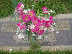
Blanche L. Lingenfelter Johnson
| Birth | : | 5 Apr 1910 Pierce County, Nebraska, USA |
| Death | : | 10 Mar 2003 Lincoln, Lancaster County, Nebraska, USA |
| Burial | : | Surteby Kyrkogård, Surteby, Marks kommun, Sweden |
| Coordinate | : | 57.4415428, 12.5166545 |
| Description | : | Daughter of J. Tom & Louise (Schreiner) Lingenfelter. She received her early education in rural Pierce county schools and graduated from Plainview High School in 1927. She attended teachers college at Chadron State and at Wayne State. She received her Bachelors Degree in Education from Wayne State. She was married to Iver C. Johnson December 1, 1934 in Madison County. She lived in Pierce County where she taught at several rural schools in Pierce County until 1957 when they moved to Columbus. While in Columbus she taught for Duncan Public Schools and the Columbus Public School System. Upon her retirement she... Read More |
frequently asked questions (FAQ):
-
Where is Blanche L. Lingenfelter Johnson's memorial?
Blanche L. Lingenfelter Johnson's memorial is located at: Surteby Kyrkogård, Surteby, Marks kommun, Sweden.
-
When did Blanche L. Lingenfelter Johnson death?
Blanche L. Lingenfelter Johnson death on 10 Mar 2003 in Lincoln, Lancaster County, Nebraska, USA
-
Where are the coordinates of the Blanche L. Lingenfelter Johnson's memorial?
Latitude: 57.4415428
Longitude: 12.5166545
Family Members:
Parent

Spouse
Siblings
Children
Flowers:


Nearby Cemetories:
1. Surteby Kyrkogård
Surteby, Marks kommun, Sweden
Coordinate: 57.4415428, 12.5166545
2. Kattunga Kyrkogård
Kattunga, Marks kommun, Sweden
Coordinate: 57.4103879, 12.5360568
3. Berghems Kyrkogård
Berghem, Marks kommun, Sweden
Coordinate: 57.4618151, 12.5881601
4. Hajoms Kyrkogård
Hajom, Marks kommun, Sweden
Coordinate: 57.5039644, 12.5509172
5. Orby Kyrkogard
Örby, Marks kommun, Sweden
Coordinate: 57.4818140, 12.7005510
6. Idala kyrkogard
Idala, Kungsbacka kommun, Sweden
Coordinate: 57.3807920, 12.3236715
7. Fritsla gamla kyrkogård
Fritsla, Marks kommun, Sweden
Coordinate: 57.5574232, 12.7928255
8. Skephult kyrkogård
Skepphult, Marks kommun, Sweden
Coordinate: 57.5361110, 12.8811110
9. Bollebygd Cemetery
Bollebygd, Bollebygds kommun, Sweden
Coordinate: 57.6666679, 12.5500002
10. Onsala Kyrkogård
Kungsbacka kommun, Sweden
Coordinate: 57.4132398, 12.0226945
11. Kållered kyrka
Kallered, Mölndals kommun, Sweden
Coordinate: 57.6060222, 12.0556331
12. Rolfstorps Kyrkogård
Himle, Varbergs kommun, Sweden
Coordinate: 57.1437882, 12.4673786
13. Mårdaklevs Gamla Kyrkogård
Mardaklev, Svenljunga kommun, Sweden
Coordinate: 57.2589286, 12.9950129
14. Billdals kyrkogård
Billdal, Göteborgs kommun, Sweden
Coordinate: 57.5805229, 11.9794241
15. Kikås Cemetery
Mölndals kommun, Sweden
Coordinate: 57.6489610, 12.0472210
16. Svenska Kyrkan
Svenljunga, Svenljunga kommun, Sweden
Coordinate: 57.4951300, 13.1159100
17. Ljushults Kyrkogård
Borås, Borås kommun, Sweden
Coordinate: 57.6174795, 13.0432013
18. Sankt Sigfrids griftegård
Borås, Borås kommun, Sweden
Coordinate: 57.7049706, 12.9184835
19. Jonsereds griftegård
Jonsered, Partille kommun, Sweden
Coordinate: 57.7420182, 12.1762995
20. Sankta Birgittas griftegård
Borås, Borås kommun, Sweden
Coordinate: 57.7142538, 12.9332699
21. Kvastekulla Griftegård
Partille, Partille kommun, Sweden
Coordinate: 57.7337760, 12.1428190
22. Askims Södra kyrkogård
Hovas, Göteborgs kommun, Sweden
Coordinate: 57.6157113, 11.9416889
23. Sankt Ansgars griftegård
Borås, Borås kommun, Sweden
Coordinate: 57.7182057, 12.9351487
24. Lerums gamla kyrkogård
Lerums kommun, Sweden
Coordinate: 57.7757400, 12.2826970