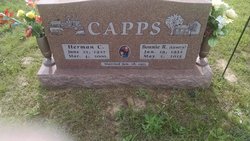
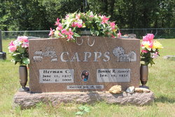
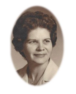
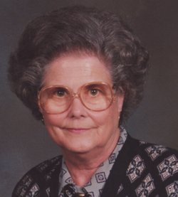
Bonnie Rose Gentry Capps
| Birth | : | 19 Jan 1932 Roscoe, St. Clair County, Missouri, USA |
| Death | : | 2 May 2015 St. Clair County, Missouri, USA |
| Burial | : | Brush Creek Cemetery, Collins, St. Clair County, USA |
| Coordinate | : | 37.8527985, -93.7148972 |
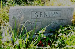
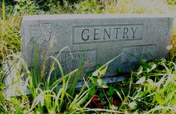
| Description | : | Bonnie Rose (Gentry) Capps was born January 19, 1932 at the family farm south of Roscoe, Mo., to Jeremiah Thomas and Beuna Lillian (Allen) Gentry. She passed away on May 2, 2015 at 83 years of age. Bonnie attended grade school in a one room school house at Riverview near her home. Her sister, Betty, was her teacher at one time. She then attended high school at El Dorado Springs, graduating in 1949. After high school she attended Draughan’s Business College in Springfield until she obtained work for the Milking Shorthorn Association in Springfield. She married Herman Clyde Capps January 18, 1953.... Read More |
frequently asked questions (FAQ):
-
Where is Bonnie Rose Gentry Capps's memorial?
Bonnie Rose Gentry Capps's memorial is located at: Brush Creek Cemetery, Collins, St. Clair County, USA.
-
When did Bonnie Rose Gentry Capps death?
Bonnie Rose Gentry Capps death on 2 May 2015 in St. Clair County, Missouri, USA
-
Where are the coordinates of the Bonnie Rose Gentry Capps's memorial?
Latitude: 37.8527985
Longitude: -93.7148972
Family Members:
Parent
Spouse
Siblings
Flowers:
Nearby Cemetories:
1. Sheek Cemetery
St. Clair County, USA
Coordinate: 37.8358002, -93.7050018
2. Moore Cemetery
St. Clair County, USA
Coordinate: 37.8381004, -93.7585983
3. Freeman-Holsapple Cemetery
Collins, St. Clair County, USA
Coordinate: 37.8816986, -93.6710968
4. Norris Cemetery
St. Clair County, USA
Coordinate: 37.8992004, -93.7600021
5. Allen Cemetery
Cedar County, USA
Coordinate: 37.8184630, -93.6463450
6. Oak Grove Cemetery
Collins, St. Clair County, USA
Coordinate: 37.9158200, -93.7316200
7. Seat Cemetery
St. Clair County, USA
Coordinate: 37.8830986, -93.7885971
8. Allen Cemetery
Collins, St. Clair County, USA
Coordinate: 37.8969002, -93.6521988
9. Simrell Cemetery
Cedar County, USA
Coordinate: 37.7855988, -93.7035980
10. Preston Cemetery
Caplinger Mills, Cedar County, USA
Coordinate: 37.8342018, -93.8035965
11. Hickory Grove Cemetery
Cedar County, USA
Coordinate: 37.7968903, -93.6473083
12. Allen Cemetery
St. Clair County, USA
Coordinate: 37.9188995, -93.7660980
13. Marshall Cemetery
Collins, St. Clair County, USA
Coordinate: 37.9113998, -93.6371994
14. Nance Cemetery
St. Clair County, USA
Coordinate: 37.9310989, -93.6675034
15. Mormon Cemetery
Arnica, Cedar County, USA
Coordinate: 37.7649002, -93.7111206
16. Horn Cemetery
Collins, St. Clair County, USA
Coordinate: 37.9376940, -93.7444440
17. Caplinger Mills Cemetery
Caplinger Mills, Cedar County, USA
Coordinate: 37.7939987, -93.8040009
18. Old Union Cemetery
Caplinger Mills, Cedar County, USA
Coordinate: 37.7626419, -93.7648621
19. Union Cemetery
St. Clair County, USA
Coordinate: 37.9547005, -93.6872025
20. Culbartson Cemetery
St. Clair County, USA
Coordinate: 37.9310989, -93.8080978
21. Burns Cemetery
Cedar County, USA
Coordinate: 37.8364630, -93.8516950
22. Robinson Cemetery
Collins, St. Clair County, USA
Coordinate: 37.8891983, -93.5783005
23. Mound Cemetery
El Dorado Springs, Cedar County, USA
Coordinate: 37.8816299, -93.8614743
24. Love Cemetery
Cedar Springs, Cedar County, USA
Coordinate: 37.8819008, -93.8613968

