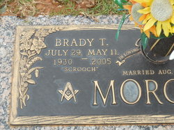
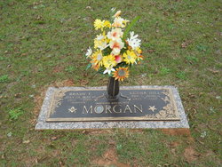
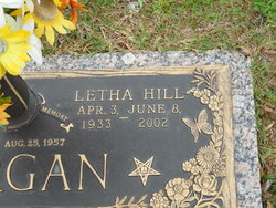
Brady T “Scrooch” Morgan
| Birth | : | 29 Jul 1930 Jonesville, Union County, South Carolina, USA |
| Death | : | 11 May 2005 Jonesville, Union County, South Carolina, USA |
| Burial | : | Bohemian Cemetery, Omaha, Douglas County, USA |
| Coordinate | : | 41.2388992, -95.9955978 |
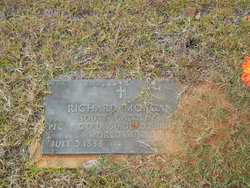
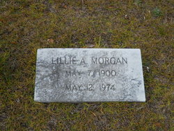
| Description | : | Brady T. "Scrooch" Morgan, 74, of Jonesville, SC, widower of Letha (Hill) Morgan, died at his residence Wednesday, May 11, 2005 after an extended illness. Mr. Morgan was born in Jonesville on July 29, 1930, a son of the late Richard Globe Morgan and Lillie (Addis) Morgan. He was a member of Jonesville Baptist Church where he worked in the nursery department for over 30 years and was a member of Prudence Masonic Lodge #139. A graduate of Jonesville High School, he retired from the U.S. Post Office in Jonesville after 30 years service and was owner/operator of Morgan's Mini Mall... Read More |
frequently asked questions (FAQ):
-
Where is Brady T “Scrooch” Morgan's memorial?
Brady T “Scrooch” Morgan's memorial is located at: Bohemian Cemetery, Omaha, Douglas County, USA.
-
When did Brady T “Scrooch” Morgan death?
Brady T “Scrooch” Morgan death on 11 May 2005 in Jonesville, Union County, South Carolina, USA
-
Where are the coordinates of the Brady T “Scrooch” Morgan's memorial?
Latitude: 41.2388992
Longitude: -95.9955978
Family Members:
Parent
Spouse
Children
Flowers:
Nearby Cemetories:
1. Bohemian Cemetery
Omaha, Douglas County, USA
Coordinate: 41.2388992, -95.9955978
2. Westlawn-Hillcrest Memorial Park
Omaha, Douglas County, USA
Coordinate: 41.2346992, -95.9966965
3. Ak-Sar-Ben Racetrack Grounds
Omaha, Douglas County, USA
Coordinate: 41.2414703, -96.0159607
4. Holy Sepulchre Cemetery
Omaha, Douglas County, USA
Coordinate: 41.2543983, -95.9875031
5. Douglas County Poor Farm Cemetery
Omaha, Douglas County, USA
Coordinate: 41.2437240, -95.9723480
6. Calvary Cemetery
Omaha, Douglas County, USA
Coordinate: 41.2364006, -96.0294037
7. First Central Congregational Columbarium
Omaha, Douglas County, USA
Coordinate: 41.2563456, -95.9658365
8. Evergreen Memorial Park Cemetery
Omaha, Douglas County, USA
Coordinate: 41.2393990, -96.0355988
9. Graceland Park Cemetery
Omaha, Douglas County, USA
Coordinate: 41.2113991, -95.9785995
10. Resurrection Cemetery
Omaha, Douglas County, USA
Coordinate: 41.2344208, -96.0365448
11. Nash Chapel Crypt
Omaha, Douglas County, USA
Coordinate: 41.2665090, -95.9721790
12. Saint Mary Magdalene Cemetery
Omaha, Douglas County, USA
Coordinate: 41.2039420, -95.9850610
13. Saint Andrews Episcopal Church Columbarium
Omaha, Douglas County, USA
Coordinate: 41.2492500, -96.0427500
14. Saint Mary's Cemetery
Omaha, Douglas County, USA
Coordinate: 41.2042007, -95.9646988
15. Countryside Community Church Columbarium
Omaha, Douglas County, USA
Coordinate: 41.2483660, -96.0500270
16. Beth El Cemetery
Ralston, Douglas County, USA
Coordinate: 41.2117004, -96.0428009
17. Trinity Cathedral Columbarium
Omaha, Douglas County, USA
Coordinate: 41.2603900, -95.9393660
18. Prospect Hill Cemetery
Omaha, Douglas County, USA
Coordinate: 41.2780991, -95.9593964
19. Saint Johns Cemetery
Bellevue, Sarpy County, USA
Coordinate: 41.1864014, -95.9682999
20. All Saints Episcopal Church Columbarium
Omaha, Douglas County, USA
Coordinate: 41.2785000, -96.0579000
21. Laurel Hill Cemetery
Omaha, Douglas County, USA
Coordinate: 41.1918983, -95.9417038
22. Servants of Mary Cemetery
Omaha, Douglas County, USA
Coordinate: 41.3017170, -96.0258260
23. Fisher Farm Cemetery
Bellevue, Sarpy County, USA
Coordinate: 41.1727982, -95.9760971
24. Hrabik Cemetery
Bellevue, Sarpy County, USA
Coordinate: 41.1726540, -95.9768200

