
| Birth | : | 24 Dec 1913 Queensland, Australia |
| Death | : | 10 Dec 1969 Stanthorpe, Southern Downs Region, Queensland, Australia |
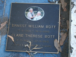
| Burial | : | Stanthorpe Cemetery, Stanthorpe, Southern Downs Region, Australia |
| Coordinate | : | -28.6452210, 151.9332990 |
| Plot | : | Section 8, Row C, Grave 6 |
| Description | : | Parents - Adam Conrad Bott & Jane Martha Spiller |
frequently asked questions (FAQ):
-
Where is Brenda Bott Thompson's memorial?
Brenda Bott Thompson's memorial is located at: Stanthorpe Cemetery, Stanthorpe, Southern Downs Region, Australia.
-
When did Brenda Bott Thompson death?
Brenda Bott Thompson death on 10 Dec 1969 in Stanthorpe, Southern Downs Region, Queensland, Australia
-
Where are the coordinates of the Brenda Bott Thompson's memorial?
Latitude: -28.6452210
Longitude: 151.9332990
Family Members:
Parent

Spouse
Siblings
Flowers:


Nearby Cemetories:
1. Stanthorpe Cemetery
Stanthorpe, Southern Downs Region, Australia
Coordinate: -28.6452210, 151.9332990
2. John Doro
Stanthorpe, Southern Downs Region, Australia
Coordinate: -28.6508250, 151.9208340
3. Strath Elbess Cemetery
Dalveen, Southern Downs Region, Australia
Coordinate: -28.4883070, 151.9692850
4. Dalveen-Mitchell Family Homestead Cemetery
Dalveen, Southern Downs Region, Australia
Coordinate: -28.4423200, 151.9604000
5. Ballandean Station Cemetery
Ballandean, Southern Downs Region, Australia
Coordinate: -28.8196000, 151.7880000
6. Wallangarra Cemetery
Wallangarra, Southern Downs Region, Australia
Coordinate: -28.9189280, 151.9230310
7. Lone Grave Warwick
Warwick, Southern Downs Region, Australia
Coordinate: -28.2316590, 151.9833180
8. Killarney Lawn Cemetery
Killarney, Southern Downs Region, Australia
Coordinate: -28.3475760, 152.2742790
9. Eden Gardens Memorial Park
Warwick, Southern Downs Region, Australia
Coordinate: -28.2229690, 152.0031130
10. St Marks Anglican Church Columbarium Wall
Warwick, Southern Downs Region, Australia
Coordinate: -28.2161000, 152.0347600
11. Warwick General Lawn Cemetery
Warwick, Southern Downs Region, Australia
Coordinate: -28.2106310, 152.0039087
12. Warwick General Cemetery
Warwick, Southern Downs Region, Australia
Coordinate: -28.2100890, 152.0044080
13. Warwick War Cemetery
Warwick, Southern Downs Region, Australia
Coordinate: -28.2089620, 152.0033530
14. Lone Graves
Coolmunda, Goondiwindi Region, Australia
Coordinate: -28.6256043, 151.4111058
15. Swan Creek Anglican Cemetery
Swan Creek, Southern Downs Region, Australia
Coordinate: -28.1974400, 152.1364830
16. Yangan General and Anglican Cemetery
Emu Vale, Southern Downs Region, Australia
Coordinate: -28.2059990, 152.2207110
17. Yangan Presbyterian Church Cemetery
Yangan, Southern Downs Region, Australia
Coordinate: -28.1972310, 152.2142130
18. Warwick-Conway Family Homestead Cemetery
Warwick, Southern Downs Region, Australia
Coordinate: -28.1258400, 152.0395700
19. Arlington Cemetery
Graysholm, Goondiwindi Region, Australia
Coordinate: -28.3259160, 151.4372210
20. Glengallan Station
Warwick, Southern Downs Region, Australia
Coordinate: -28.1027016, 152.0585067
21. Pratten Cemetery
Pratten, Southern Downs Region, Australia
Coordinate: -28.0858450, 151.7790540
22. Old Bonalbo Cemetery
Old Bonalbo, Kyogle Council, Australia
Coordinate: -28.6499996, 152.6000061
23. Bonalbo Cemetery
Bonalbo, Kyogle Council, Australia
Coordinate: -28.7180970, 152.6050560
24. Tabulam Cemetery
Tabulam, Kyogle Council, Australia
Coordinate: -28.9078060, 152.5581050