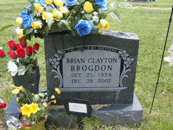
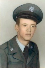
Brian Clayton Brogdon
| Birth | : | 25 Oct 1958 Springdale, Washington County, Arkansas, USA |
| Death | : | 29 Dec 2002 Springdale, Washington County, Arkansas, USA |
| Burial | : | Saints Peter and Paul Cemetery, Butte, Boyd County, USA |
| Coordinate | : | 42.9221992, -98.8593979 |
| Description | : | The Morning News Springdale, AR 31 Dec 2002 Brian Clayton Brogdon, 44, of Springdale died Dec. 29, 2002, at Northwest Medical Center in Springdale. He was born Oct. 25, 1958, in Springdale to Max and Johnette Baldwin Brogdon. He was a graduate of Springdale High School and was active in the Cub and Boy Scouts as a youth. He was former president of Northwest Arkansas Sheet Metal and owned and operated Big 8 Tire and Brakes in Fayetteville at the time of his death. He was a member of the First Presbyterian Church in Springdale and the Northwest Arkansas... Read More |
frequently asked questions (FAQ):
-
Where is Brian Clayton Brogdon's memorial?
Brian Clayton Brogdon's memorial is located at: Saints Peter and Paul Cemetery, Butte, Boyd County, USA.
-
When did Brian Clayton Brogdon death?
Brian Clayton Brogdon death on 29 Dec 2002 in Springdale, Washington County, Arkansas, USA
-
Where are the coordinates of the Brian Clayton Brogdon's memorial?
Latitude: 42.9221992
Longitude: -98.8593979
Family Members:
Parent
Flowers:
Nearby Cemetories:
1. Saints Peter and Paul Cemetery
Butte, Boyd County, USA
Coordinate: 42.9221992, -98.8593979
2. Butte Cemetery
Butte, Boyd County, USA
Coordinate: 42.9235992, -98.8585968
3. Immanuel Lutheran Cemetery
Butte, Boyd County, USA
Coordinate: 42.9006004, -98.8497009
4. Anoka Lutheran Cemetery
Anoka, Boyd County, USA
Coordinate: 42.9522018, -98.8349991
5. Old Settlers Cemetery
Anoka, Boyd County, USA
Coordinate: 42.9730988, -98.8005981
6. Trinity Lutheran Cemetery
Fairfax, Gregory County, USA
Coordinate: 43.0102997, -98.8842010
7. Adams Cemetery
Holt County, USA
Coordinate: 42.8706000, -98.9694500
8. Bethlehem Cemetery
Gregory County, USA
Coordinate: 43.0102997, -98.8041992
9. Highland Cemetery
Fairfax, Gregory County, USA
Coordinate: 43.0236015, -98.8930969
10. Southside Cemetery
Holt County, USA
Coordinate: 42.8842139, -98.9931842
11. West Hill Cemetery
Fairfax, Gregory County, USA
Coordinate: 43.0132440, -98.7839660
12. Baker Messiah Lutheran Cemetery
Boyd County, USA
Coordinate: 42.9909780, -98.7423920
13. Saint Joseph Catholic Cemetery
Boyd County, USA
Coordinate: 42.9878620, -98.7328110
14. Bohemian National Cemetery
Spencer, Boyd County, USA
Coordinate: 42.8713989, -98.7127991
15. Mount Zion Cemetery
Naper, Boyd County, USA
Coordinate: 42.9701200, -99.0183400
16. Saint Marys Cemetery
Spencer, Boyd County, USA
Coordinate: 42.8669014, -98.6980972
17. Union Cemetery
Spencer, Boyd County, USA
Coordinate: 42.8602982, -98.7018967
18. Immanuel Lutheran Cemetery
Spencer, Boyd County, USA
Coordinate: 42.9455986, -98.6830978
19. Saint Anthonys Cemetery
Fairfax, Gregory County, USA
Coordinate: 43.0532990, -98.8835983
20. Pleasant Valley Cemetery
Bonesteel, Gregory County, USA
Coordinate: 43.0327988, -98.9796982
21. Devil's Gulch Ranch Cemetery
Spencer, Boyd County, USA
Coordinate: 42.8565316, -98.6871239
22. Old Immanuel Cemetery
Spencer, Boyd County, USA
Coordinate: 42.9006004, -98.6528015
23. Saint Marys Cemetery
Bonesteel, Gregory County, USA
Coordinate: 43.0816994, -98.9413986
24. Knoll Crest Cemetery
Naper, Boyd County, USA
Coordinate: 42.9589005, -99.0875015


