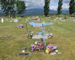
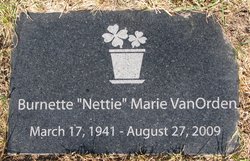
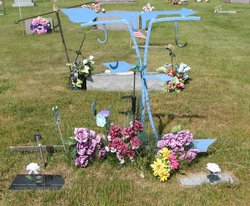
Burnette B “Nettie” Burlingham Vanorden
| Birth | : | 17 Mar 1941 Libby, Lincoln County, Montana, USA |
| Death | : | 27 Aug 2009 Eureka, Lincoln County, Montana, USA |
| Burial | : | New Bethel Cemetery, Cornettsville, Daviess County, USA |
| Coordinate | : | 38.7645830, -87.0882370 |
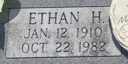
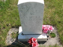
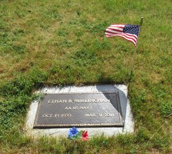
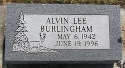
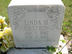
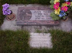
| Description | : | EUREKA - Burnette B. Vanorden, 68, of Eureka, died Thursday, Aug. 27, 2009, at her home in Eureka from natural causes. She was born March 17, 1941, in Libby to Ethan and Mary Rhodes Burlingham. Two husbands, David Armstrong and Jerry Stacy; brother Alvin; sister Beatrice; daughter Linda and father Ethan preceded her in death. Survivors include her children Delbert Armstrong, David Armstrong, Leona Armstrong, Donald Armstrong; mother Mary Burlingham; brother Ethan Burlingham; sisters Mary Vanleishout, Marjory Johnson, Martha Houchin, Florence Pound; and 11 grandchildren. Visitation will be 1-8 p.m. Monday, Aug. 31, at Schnackenberg & Nelson Funeral Home, Eureka. Graveside services will... Read More |
frequently asked questions (FAQ):
-
Where is Burnette B “Nettie” Burlingham Vanorden's memorial?
Burnette B “Nettie” Burlingham Vanorden's memorial is located at: New Bethel Cemetery, Cornettsville, Daviess County, USA.
-
When did Burnette B “Nettie” Burlingham Vanorden death?
Burnette B “Nettie” Burlingham Vanorden death on 27 Aug 2009 in Eureka, Lincoln County, Montana, USA
-
Where are the coordinates of the Burnette B “Nettie” Burlingham Vanorden's memorial?
Latitude: 38.7645830
Longitude: -87.0882370
Family Members:
Parent
Spouse
Siblings
Children
Flowers:
Nearby Cemetories:
1. New Bethel Cemetery
Cornettsville, Daviess County, USA
Coordinate: 38.7645830, -87.0882370
2. Cornettsville Cemetery
Cornettsville, Daviess County, USA
Coordinate: 38.7602790, -87.1182940
3. Canaan Fellowship Church Cemetery
Epsom, Daviess County, USA
Coordinate: 38.7819100, -87.0651450
4. Talbotts Chapel Cemetery
Epsom, Daviess County, USA
Coordinate: 38.7710991, -87.0556030
5. Wells Cemetery
Daviess County, USA
Coordinate: 38.7869970, -87.1088580
6. Saint Michael Cemetery
Montgomery, Daviess County, USA
Coordinate: 38.7421837, -87.0462036
7. Humphries Cemetery
Daviess County, USA
Coordinate: 38.7682991, -87.0310974
8. Concord Cemetery
Daviess County, USA
Coordinate: 38.7921982, -87.0393982
9. Allen Cemetery
Epsom, Daviess County, USA
Coordinate: 38.8060640, -87.0369090
10. Antioch Cemetery
Montgomery, Daviess County, USA
Coordinate: 38.7058910, -87.0872280
11. Plainville Cemetery
Plainville, Daviess County, USA
Coordinate: 38.7977982, -87.1532974
12. Osmon Cemetery
Montgomery, Daviess County, USA
Coordinate: 38.7375000, -87.0183000
13. First Mennonite Church Cemetery
Montgomery, Daviess County, USA
Coordinate: 38.7352800, -87.0174900
14. South West Cemetery
Montgomery, Daviess County, USA
Coordinate: 38.7135650, -87.0370040
15. Stoll Cemetery
Montgomery, Daviess County, USA
Coordinate: 38.7428017, -87.0068970
16. Taylor Graveyard
Odon, Daviess County, USA
Coordinate: 38.8289870, -87.1159350
17. Zion Amish Mennonite Cemetery
Montgomery, Daviess County, USA
Coordinate: 38.7468620, -86.9990270
18. Liberty Cemetery
Daviess County, USA
Coordinate: 38.7580986, -86.9933014
19. Bethel Mennonite Church Cemetery
Odon, Daviess County, USA
Coordinate: 38.7927120, -86.9982430
20. Franklin Cemetery
Daviess County, USA
Coordinate: 38.8083880, -87.0085050
21. Sugarland Memory Gardens
Washington, Daviess County, USA
Coordinate: 38.7184400, -87.1662600
22. Daviess County Farm Cemetery
Washington, Daviess County, USA
Coordinate: 38.6960100, -87.1377700
23. Cincinnati Cemetery
Plainville, Daviess County, USA
Coordinate: 38.8347000, -87.1375000
24. Graber Amish Cemetery
Daviess County, USA
Coordinate: 38.7842100, -86.9846800

