
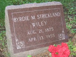
Byrdie May Strickland Wiley
| Birth | : | 21 Aug 1875 Davis County, Iowa, USA |
| Death | : | 13 Apr 1955 Davis County, Iowa, USA |
| Burial | : | Busby Cemetery, Robards, Henderson County, USA |
| Coordinate | : | 37.6964280, -87.5508640 |
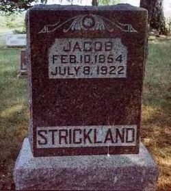
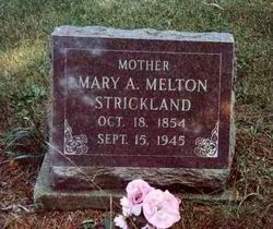
| Description | : | Byrdie Strickland married Elmer H. Wallace. Mrs. Everett WILEY, 79, died at 6:20 a.m. today at the Waller nursing home in Eldon. She had been ill for several years. She was Byrdie May STRICKLAND, daughter of Jacob and Mary Ann MELTON Strickland, and was born near Floris August 21, 1875. She was a member of the Assembly of God church in Eldon. She was married to Everett W. Wiley of Eldon November 9, 1918 He survives. Besides her husband she is survived by two children of former marriages, E.W. WALLACE of Des Moines and Mrs. Irma CRAWFORD KEPHART of Waterloo; two... Read More |
frequently asked questions (FAQ):
-
Where is Byrdie May Strickland Wiley's memorial?
Byrdie May Strickland Wiley's memorial is located at: Busby Cemetery, Robards, Henderson County, USA.
-
When did Byrdie May Strickland Wiley death?
Byrdie May Strickland Wiley death on 13 Apr 1955 in Davis County, Iowa, USA
-
Where are the coordinates of the Byrdie May Strickland Wiley's memorial?
Latitude: 37.6964280
Longitude: -87.5508640
Family Members:
Parent
Spouse
Siblings
Flowers:


Nearby Cemetories:
1. Busby Cemetery
Robards, Henderson County, USA
Coordinate: 37.6964280, -87.5508640
2. Smith Cemetery
Robards, Henderson County, USA
Coordinate: 37.7028320, -87.5458980
3. Royster Cemetery
Robards, Henderson County, USA
Coordinate: 37.6796900, -87.5458900
4. Spencer Cemetery
Henderson, Henderson County, USA
Coordinate: 37.6913986, -87.5772018
5. Book Cemetery
Robards, Henderson County, USA
Coordinate: 37.7067720, -87.5785500
6. McMullin Cemetery
Henderson County, USA
Coordinate: 37.6794014, -87.5753021
7. Eakins Cemetery
Henderson County, USA
Coordinate: 37.6660050, -87.5523660
8. Gish Cemetery #1
Henderson County, USA
Coordinate: 37.6664009, -87.5417023
9. Denton Cemetery
Robards, Henderson County, USA
Coordinate: 37.7159910, -87.5860790
10. Royster Cemetery #1
Robards, Henderson County, USA
Coordinate: 37.6699100, -87.5849800
11. Sandefur Cemetery
Robards, Henderson County, USA
Coordinate: 37.6670920, -87.5164890
12. Eakins Cemetery
Henderson County, USA
Coordinate: 37.6624985, -87.5132980
13. Normen Cemetery
Henderson County, USA
Coordinate: 37.7400017, -87.5353012
14. Pleasant Valley Cemetery
Henderson County, USA
Coordinate: 37.6933440, -87.4892580
15. Gish Family Cemetery #1
Niagara, Henderson County, USA
Coordinate: 37.7237420, -87.4954520
16. New Sights Cemetery
Robards, Henderson County, USA
Coordinate: 37.7134440, -87.6147710
17. Meahl Cemetery
Robards, Henderson County, USA
Coordinate: 37.7137860, -87.6146690
18. Gish Family Cemetery #2
Niagara, Henderson County, USA
Coordinate: 37.7419599, -87.5138651
19. McCormick Cemetery
Anthoston, Henderson County, USA
Coordinate: 37.7508340, -87.5266920
20. Cedar Log Faith Christian Church Cemetery
Anthoston, Henderson County, USA
Coordinate: 37.7516800, -87.5269600
21. Gish Cemetery
Anthoston, Henderson County, USA
Coordinate: 37.7564040, -87.5363400
22. Denton Cemetery
Henderson, Henderson County, USA
Coordinate: 37.7327995, -87.6168976
23. Busby-Denton Cemetery
Henderson County, USA
Coordinate: 37.7328000, -87.6169000
24. Agnew Cemetery
Cairo, Henderson County, USA
Coordinate: 37.7289009, -87.6219025