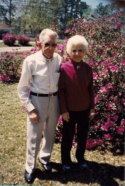
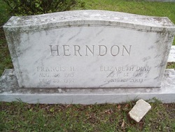
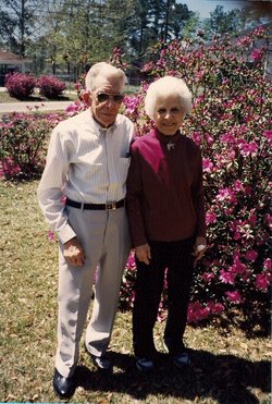
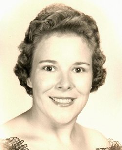
Callie Elizabeth Dial Herndon
| Birth | : | 14 Sep 1916 Marlboro County, South Carolina, USA |
| Death | : | 12 Jun 2003 Georgetown County, South Carolina, USA |
| Burial | : | Kingsley Lake Cemetery, Clay County, USA |
| Coordinate | : | 29.9686070, -82.0158140 |
| Description | : | Georgetown SC United States GEORGETOWN | Elizabeth Dial Herndon, 86, died Thursday, June 12, 2003, at Agape Senior Community in West Columbia. She was born Sept. 14, 1916, in Dillon, a daughter of the late William Dial and Martha Locklear Dial. She grew up in Blenheim and graduated from Blenheim High School. She moved to Georgetown during World War II and owned and operated Herndon's Tourist Home for a number of years. She was a member of Duncan Memorial United Methodist Church and the Susanna Wesley Bible Class. She was predeceased by her husband, Francis H. Herndon. Survivors include a daughter,... Read More |
frequently asked questions (FAQ):
-
Where is Callie Elizabeth Dial Herndon's memorial?
Callie Elizabeth Dial Herndon's memorial is located at: Kingsley Lake Cemetery, Clay County, USA.
-
When did Callie Elizabeth Dial Herndon death?
Callie Elizabeth Dial Herndon death on 12 Jun 2003 in Georgetown County, South Carolina, USA
-
Where are the coordinates of the Callie Elizabeth Dial Herndon's memorial?
Latitude: 29.9686070
Longitude: -82.0158140
Family Members:
Parent
Spouse
Siblings
Children
Flowers:
Nearby Cemetories:
1. Kingsley Lake Cemetery
Clay County, USA
Coordinate: 29.9686070, -82.0158140
2. Old Conway Cemetery
Middleburg, Clay County, USA
Coordinate: 29.9827995, -81.9499969
3. John James Conway Cemetery
Kingsley, Clay County, USA
Coordinate: 29.9847083, -81.9499893
4. German POW Camp Cemetery
Clay County, USA
Coordinate: 29.9410900, -81.9472530
5. Oak Grove Cemetery
Clay County, USA
Coordinate: 30.0121994, -81.9555969
6. Griffis Family Cemetery
Starke, Bradford County, USA
Coordinate: 29.9107826, -82.0797910
7. Peetsville Cemetery
Lawtey, Bradford County, USA
Coordinate: 30.0257030, -82.0816250
8. Saint Marks Episcopal Church Cemetery
Starke, Bradford County, USA
Coordinate: 29.9445190, -82.1065280
9. Oak Grove Baptist Church Cemetery
Middleburg, Clay County, USA
Coordinate: 30.0117702, -81.9307556
10. Beulah Cemetery
Kingsley, Clay County, USA
Coordinate: 29.9421997, -81.9186020
11. Pleasant Grove Cemetery
Starke, Bradford County, USA
Coordinate: 29.9751580, -82.1360560
12. Lawtey Cemetery
Lawtey, Bradford County, USA
Coordinate: 30.0526300, -82.0909700
13. Beulah Missionary Baptist Church Cemetery
Green Cove Springs, Clay County, USA
Coordinate: 29.9427376, -81.8963776
14. Lee Cemetery
Clay County, USA
Coordinate: 29.8568993, -82.0175018
15. Blue Pond Cemetery
Clay County, USA
Coordinate: 29.8558006, -82.0327988
16. Crosby Lake Cemetery
Starke, Bradford County, USA
Coordinate: 29.9493999, -82.1472015
17. DeSue Cemetery
Starke, Bradford County, USA
Coordinate: 29.9748840, -82.1499700
18. Fowler Cemetery
Middleburg, Clay County, USA
Coordinate: 30.0286007, -81.9005966
19. Bob Lov Cemetery
Starke, Bradford County, USA
Coordinate: 29.9754200, -82.1500092
20. Odd Fellows Cemetery
Starke, Bradford County, USA
Coordinate: 29.9006700, -82.1273090
21. Brymer Cemetery
Starke, Bradford County, USA
Coordinate: 29.9006700, -82.1273100
22. Prevatt Cemetery
Bradford County, USA
Coordinate: 29.9041996, -82.1378021
23. Evergreen Cemetery
Belmore, Clay County, USA
Coordinate: 29.8994045, -81.8950958
24. Hope Baptist Cemetery
Starke, Bradford County, USA
Coordinate: 29.8381004, -82.0682983


