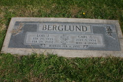
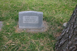
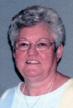
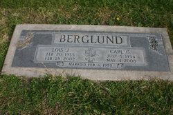
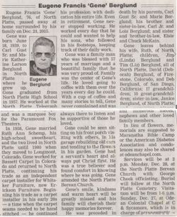
Carl “Gust” Berglund Jr.
| Birth | : | 5 Jul 1934 North Platte, Lincoln County, Nebraska, USA |
| Death | : | 4 May 2008 North Platte, Lincoln County, Nebraska, USA |
| Burial | : | Cowpen Cemetery and Crematorium, Blyth, Northumberland Unitary Authority, England |
| Coordinate | : | 55.1311260, -1.5294460 |
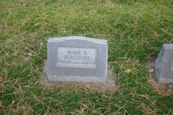
| Description | : | Carl Gust Berglund Jr. July 5, 1934-May 4, 2008 Carl Gust Berglund Jr., 73, of North Platte died May 4, 2008, at Great Plains Regional Medical Center in North Platte. Carl was born July 5, 1934, to Carl Gust Sr. and Marie Katherine Larson Berglund at North Platte where he grew up. He graduated from North Platte High School in 1952. During high school, Carl worked for the Telegraph in the circulation department. After graduating he worked his way up to composing-room supervisor and later was the pressroom operator. Carl worked for the Telegraph for a total of 30 years. He also... Read More |
frequently asked questions (FAQ):
-
Where is Carl “Gust” Berglund Jr.'s memorial?
Carl “Gust” Berglund Jr.'s memorial is located at: Cowpen Cemetery and Crematorium, Blyth, Northumberland Unitary Authority, England.
-
When did Carl “Gust” Berglund Jr. death?
Carl “Gust” Berglund Jr. death on 4 May 2008 in North Platte, Lincoln County, Nebraska, USA
-
Where are the coordinates of the Carl “Gust” Berglund Jr.'s memorial?
Latitude: 55.1311260
Longitude: -1.5294460
Family Members:
Parent
Spouse
Siblings
Flowers:
Nearby Cemetories:
1. Cowpen Cemetery and Crematorium
Blyth, Northumberland Unitary Authority, England
Coordinate: 55.1311260, -1.5294460
2. Cowpen Roman Catholic Burial Ground
Blyth, Northumberland Unitary Authority, England
Coordinate: 55.1305300, -1.5386300
3. Saint Cuthbert's Churchyard
Blyth, Northumberland Unitary Authority, England
Coordinate: 55.1265800, -1.5031400
4. Blyth Links Cemetery
Blyth, Northumberland Unitary Authority, England
Coordinate: 55.1053800, -1.4997200
5. St. Mary's Churchyard
Horton, Northumberland Unitary Authority, England
Coordinate: 55.1106200, -1.5706200
6. St Peter Churchyard
Cambois, Northumberland Unitary Authority, England
Coordinate: 55.1615300, -1.5604100
7. St. Cuthbert Churchyard
Bedlington, Northumberland Unitary Authority, England
Coordinate: 55.1303910, -1.5928880
8. North Seaton Cemetery
Ashington, Northumberland Unitary Authority, England
Coordinate: 55.1669770, -1.5575500
9. St. Paul's Churchyard
Choppington, Northumberland Unitary Authority, England
Coordinate: 55.1494290, -1.6009780
10. Netherton Lane Cemetery
Bedlington, Northumberland Unitary Authority, England
Coordinate: 55.1318960, -1.6106800
11. Mayfield Cemetery
Cramlington, Northumberland Unitary Authority, England
Coordinate: 55.0837139, -1.5730931
12. St. Nicholas' Churchyard
Cramlington, Northumberland Unitary Authority, England
Coordinate: 55.0856460, -1.5834930
13. Saint Aidens Churchyard
Ashington, Northumberland Unitary Authority, England
Coordinate: 55.1826900, -1.5781400
14. St Andrew's Churchyard
Bothal, Northumberland Unitary Authority, England
Coordinate: 55.1731340, -1.6205890
15. St. John's Churchyard
Annitsford, Metropolitan Borough of North Tyneside, England
Coordinate: 55.0676900, -1.5785500
16. St. John the Baptist Catholic Churchyard
Cramlington, Northumberland Unitary Authority, England
Coordinate: 55.0675480, -1.5783300
17. Lynemouth Cemetery
Lynemouth, Northumberland Unitary Authority, England
Coordinate: 55.2031759, -1.5361996
18. Whitley Bay Cemetery and Crematorium
Whitley Bay, Metropolitan Borough of North Tyneside, England
Coordinate: 55.0636970, -1.4588430
19. Earsdon Cemetery
Earsdon, Metropolitan Borough of North Tyneside, England
Coordinate: 55.0474600, -1.5007200
20. St. Alban’s Churchyard
Earsdon, Metropolitan Borough of North Tyneside, England
Coordinate: 55.0461000, -1.5004000
21. Dudley Cemetery
Dudley, Metropolitan Borough of North Tyneside, England
Coordinate: 55.0566100, -1.6143420
22. Saint John's Churchyard
Longhirst, Northumberland Unitary Authority, England
Coordinate: 55.1936200, -1.6474840
23. St. Mary the Virgin Church
Morpeth, Northumberland Unitary Authority, England
Coordinate: 55.1598990, -1.6917760
24. St. Mary the Virgin Churchyard
Morpeth, Northumberland Unitary Authority, England
Coordinate: 55.1597110, -1.6921530

