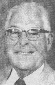
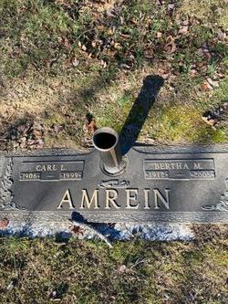
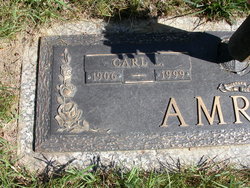
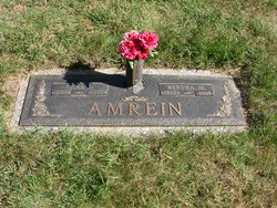
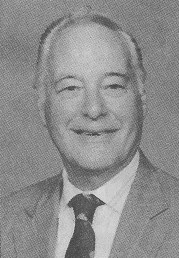
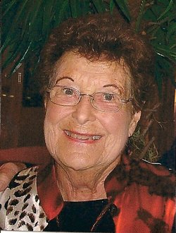
Carl Lewis Amrein
| Birth | : | 10 Jul 1906 Baltimore County, Maryland, USA |
| Death | : | 19 Jul 1999 Towson, Baltimore County, Maryland, USA |
| Burial | : | Brown Cemetery, Donegal Township, Westmoreland County, USA |
| Coordinate | : | 40.1016998, -79.4064026 |
| Description | : | Baltimore Sun, 23 Jul 1999: Carl Lewis Amrein, who began his Maryland and Pennsylvania Railroad career as a telegrapher and retired as the line's president, died Monday of a heart ailment at St. Joseph Medical Center. He was 93 and lived in Satyr Hill. He started working in 1923 as an office boy in a Bel Air canning company and taught himself Morse code, a communication system that employed copper wires, batteries, clicks and pauses. Morse code was used by the railroads. On Oct. 6, 1924, Mr. Amrein was hired as station agent in the Harford County village of Fallston, where... Read More |
frequently asked questions (FAQ):
-
Where is Carl Lewis Amrein's memorial?
Carl Lewis Amrein's memorial is located at: Brown Cemetery, Donegal Township, Westmoreland County, USA.
-
When did Carl Lewis Amrein death?
Carl Lewis Amrein death on 19 Jul 1999 in Towson, Baltimore County, Maryland, USA
-
Where are the coordinates of the Carl Lewis Amrein's memorial?
Latitude: 40.1016998
Longitude: -79.4064026
Family Members:
Parent
Spouse
Siblings
Flowers:
Nearby Cemetories:
1. Brown Cemetery
Donegal Township, Westmoreland County, USA
Coordinate: 40.1016998, -79.4064026
2. Keslar Cemetery
Fayette County, USA
Coordinate: 40.0995100, -79.4145100
3. Donegal Cemetery
Donegal, Westmoreland County, USA
Coordinate: 40.1112000, -79.3785000
4. Hays Cemetery
Mount Pleasant, Westmoreland County, USA
Coordinate: 40.1259000, -79.4021000
5. Walnut Hill Cemetery
Donegal, Westmoreland County, USA
Coordinate: 40.1040000, -79.3659000
6. Eutsey Cemetery Old
Fayette County, USA
Coordinate: 40.0781400, -79.4427900
7. Porch Cemetery
Donegal, Westmoreland County, USA
Coordinate: 40.1306000, -79.3711014
8. Byerly Freeman Cemetery
Mount Pleasant, Westmoreland County, USA
Coordinate: 40.1432500, -79.4100900
9. Eutsey Cemetery
Fayette County, USA
Coordinate: 40.0742400, -79.4474900
10. Melcroft Cemetery
Fayette County, USA
Coordinate: 40.0561000, -79.3829000
11. Knopsnider Cemetery New
Bullskin Township, Fayette County, USA
Coordinate: 40.0685400, -79.4686800
12. Knopsnider Cemetery (Old)
Bullskin Township, Fayette County, USA
Coordinate: 40.0691400, -79.4704800
13. Stouffer Cemetery
Bullskin Township, Fayette County, USA
Coordinate: 40.0848990, -79.4816900
14. Saint Raymonds Cemetery
Melcroft, Fayette County, USA
Coordinate: 40.0572014, -79.3531036
15. Mount Nebo Cemetery
Indian Head, Fayette County, USA
Coordinate: 40.0531000, -79.3556000
16. Dan Snyder Cemetery
Fayette County, USA
Coordinate: 40.0408000, -79.4317000
17. Mellinger Cemetery
Mellingertown, Westmoreland County, USA
Coordinate: 40.1432050, -79.4784730
18. Nicholson Cemetery
Clinton, Fayette County, USA
Coordinate: 40.0506100, -79.4745600
19. Good Hope Lutheran Cemetery
Fayette County, USA
Coordinate: 40.0282000, -79.3893900
20. Lobingier Cemetery
Mount Pleasant Township, Westmoreland County, USA
Coordinate: 40.1439030, -79.4887870
21. Franklin Lutheran Cemetery
Kregar, Westmoreland County, USA
Coordinate: 40.1215000, -79.3085000
22. Sparks Cemetery
Indian Head, Fayette County, USA
Coordinate: 40.0239200, -79.3892500
23. Brothers Cemetery
Fayette County, USA
Coordinate: 40.1360700, -79.5004300
24. Fairview Cemetery
Kecksburg, Westmoreland County, USA
Coordinate: 40.1696000, -79.4634000

