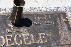
Carol Jean McGinley Voegele
| Birth | : | 8 Jan 1941 Bozeman, Gallatin County, Montana, USA |
| Death | : | 2 Mar 2008 Billings, Yellowstone County, Montana, USA |
| Burial | : | Upper Bambury Cemetery, Trappe, Talbot County, USA |
| Coordinate | : | 38.6500015, -76.0113983 |
| Plot | : | Block 10, Lot D, Space 2 |
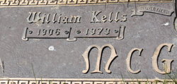
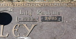
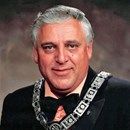
| Description | : | Carol Jean Voegele, 67, of Bozeman passed away suddenly Sunday, March 2, 2008, in Billings. Carol was born in Bozeman on Jan. 8, 1941, to William and Lily (Klute) McGinley. She graduated from Bozeman High School, then enrolled at Montana State University where she studied nursing for three years. She married Vern Voegele on Dec. 17, 1965, at Hope Lutheran Church in Bozeman, and served as a loving wife and mother for the majority of her life. Carol's pride and joy were her grandchildren, to whom she was affectionately known as "Nana." She was preceded in death by her parents,... Read More |
frequently asked questions (FAQ):
-
Where is Carol Jean McGinley Voegele's memorial?
Carol Jean McGinley Voegele's memorial is located at: Upper Bambury Cemetery, Trappe, Talbot County, USA.
-
When did Carol Jean McGinley Voegele death?
Carol Jean McGinley Voegele death on 2 Mar 2008 in Billings, Yellowstone County, Montana, USA
-
Where are the coordinates of the Carol Jean McGinley Voegele's memorial?
Latitude: 38.6500015
Longitude: -76.0113983
Family Members:
Parent
Spouse
Flowers:
Nearby Cemetories:
1. Upper Bambury Cemetery
Trappe, Talbot County, USA
Coordinate: 38.6500015, -76.0113983
2. Merrick Cemetery
Talbot County, USA
Coordinate: 38.6446991, -76.0258026
3. Paradise Cemetery
Trappe, Talbot County, USA
Coordinate: 38.6481018, -76.0355988
4. Wrights Cemetery
Trappe, Talbot County, USA
Coordinate: 38.6716995, -76.0274963
5. Piney Hill Cemetery
Trappe, Talbot County, USA
Coordinate: 38.6617012, -76.0488968
6. Kemp Cemetery
Trappe, Talbot County, USA
Coordinate: 38.6547012, -76.0560989
7. Old Paradise Cemetery
Trappe, Talbot County, USA
Coordinate: 38.6518390, -76.0565420
8. Windy Hill Cemetery
Trappe, Talbot County, USA
Coordinate: 38.6828003, -75.9792023
9. Readly Cemetery
Trappe, Talbot County, USA
Coordinate: 38.6363983, -76.0643997
10. Landing Neck Cemetery
Trappe Landing, Talbot County, USA
Coordinate: 38.7000008, -76.0402985
11. White Marsh Cemetery
Trappe, Talbot County, USA
Coordinate: 38.6970329, -76.0600662
12. Our Lady of Good Counsel Catholic Church Cemetery
Secretary, Dorchester County, USA
Coordinate: 38.6109085, -75.9498672
13. Belmont Cemetery
Choptank, Caroline County, USA
Coordinate: 38.6828003, -75.9439011
14. Locust Grove Cemetery
Locust Grove, Talbot County, USA
Coordinate: 38.6657500, -76.0906200
15. Dickinson Cemetery
Trappe, Talbot County, USA
Coordinate: 38.6263500, -76.0922100
16. Queen Esther Cemetery
Talbot County, USA
Coordinate: 38.7132988, -76.0456009
17. Roberts Cemetery
Talbot County, USA
Coordinate: 38.7192001, -76.0488968
18. East New Market Cemetery
East New Market, Dorchester County, USA
Coordinate: 38.5914001, -75.9441986
19. Rattlesnake Point Cemetery
Talbot County, USA
Coordinate: 38.6678009, -76.1168976
20. Friendship Hall Cemetery
East New Market, Dorchester County, USA
Coordinate: 38.5955600, -75.9248500
21. Maryland Veterans Cemetery
Hurlock, Dorchester County, USA
Coordinate: 38.6755981, -75.8983002
22. Cheezum Family Cemetery
Preston, Caroline County, USA
Coordinate: 38.7220103, -75.9368109
23. Christ Episcopal Church Cemetery
Cambridge, Dorchester County, USA
Coordinate: 38.5727997, -76.0768967
24. Eastern Shore State Hospital Cemetery
Cambridge, Dorchester County, USA
Coordinate: 38.5635460, -76.0554860


