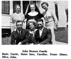
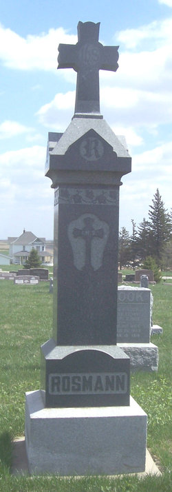
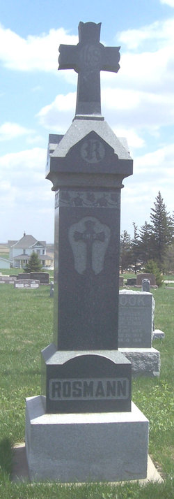
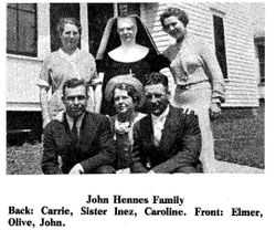
Caroline “Carrie” Rosmann Hennes
| Birth | : | 30 Jan 1886 Harlan, Shelby County, Iowa, USA |
| Death | : | 25 Jan 1956 Omaha, Douglas County, Nebraska, USA |
| Burial | : | Mayflower Hill Cemetery, Taunton, Bristol County, USA |
| Coordinate | : | 41.9199982, -71.0875015 |
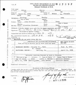
| Description | : | John Hennes and Carrie Rosman were married April 9, 1907. John died January 16, 1916 of typhoid fever at age 31, leaving Carrie a widow at 30 years of age. Carrie died January 25, 1956. To this union six children were born -- the youngest born four months after her fathers death. Olive Monahan (Francis), born April 14, 1908, graduated from Defiance Public School, 1926. She is a registered nurse, practiced 43 years, and retired in 1973. Francis, her husband, was born September 8, 1908, and they live in Omaha. Sr. Inez (Viola), born September 14, 1909, graduated from Defiance... Read More |
frequently asked questions (FAQ):
-
Where is Caroline “Carrie” Rosmann Hennes's memorial?
Caroline “Carrie” Rosmann Hennes's memorial is located at: Mayflower Hill Cemetery, Taunton, Bristol County, USA.
-
When did Caroline “Carrie” Rosmann Hennes death?
Caroline “Carrie” Rosmann Hennes death on 25 Jan 1956 in Omaha, Douglas County, Nebraska, USA
-
Where are the coordinates of the Caroline “Carrie” Rosmann Hennes's memorial?
Latitude: 41.9199982
Longitude: -71.0875015
Family Members:
Parent
Spouse
Siblings
Children
Flowers:
Nearby Cemetories:
1. Mayflower Hill Cemetery
Taunton, Bristol County, USA
Coordinate: 41.9199982, -71.0875015
2. Saint Mary Cemetery
Taunton, Bristol County, USA
Coordinate: 41.9219900, -71.0878900
3. Saint Joseph Cemetery
Taunton, Bristol County, USA
Coordinate: 41.9199982, -71.0792007
4. Plain Cemetery
Taunton, Bristol County, USA
Coordinate: 41.9124985, -71.0916977
5. Father Wilson Cemetery
Taunton, Bristol County, USA
Coordinate: 41.9087600, -71.0921900
6. Ox Bow Farm Cemetery
Taunton, Bristol County, USA
Coordinate: 41.9027020, -71.0714260
7. Neck O Land Cemetery
Taunton, Bristol County, USA
Coordinate: 41.8978500, -71.0850000
8. Dean Cemetery
Raynham, Bristol County, USA
Coordinate: 41.9053970, -71.0616490
9. Wetherell Cemetery
Taunton, Bristol County, USA
Coordinate: 41.9449200, -71.0886700
10. Seth Staples Gravesite
Taunton, Bristol County, USA
Coordinate: 41.8954700, -71.0730000
11. Shaw Cemetery
Raynham, Bristol County, USA
Coordinate: 41.9081400, -71.0550000
12. Mount Pleasant Cemetery
Taunton, Bristol County, USA
Coordinate: 41.8941500, -71.1009100
13. Brittun Cemetery
Raynham, Bristol County, USA
Coordinate: 41.9446800, -71.0698100
14. Bassett Street Cemetery
Taunton, Bristol County, USA
Coordinate: 41.9395100, -71.1156200
15. Pleasant Street Cemetery
Raynham, Bristol County, USA
Coordinate: 41.9277992, -71.0477982
16. Saint Thomas Episcopal Burying Ground
Taunton, Bristol County, USA
Coordinate: 41.9105900, -71.1270100
17. Bezer Lincoln Cemetery
Taunton, Bristol County, USA
Coordinate: 41.9429800, -71.1153300
18. Asa Lincoln Family Gravesite
Taunton, Bristol County, USA
Coordinate: 41.9043950, -71.1240160
19. Britton Cemetery
Raynham, Bristol County, USA
Coordinate: 41.9440800, -71.0579800
20. Harvey Family Burying Ground
Taunton, Bristol County, USA
Coordinate: 41.9408500, -71.1231300
21. Crane Avenue South Thayer Family Burial Ground
Taunton, Bristol County, USA
Coordinate: 41.9288300, -71.1336900
22. Mount Nebo Cemetery
Taunton, Bristol County, USA
Coordinate: 41.9091988, -71.1339035
23. Oakland Cemetery
Taunton, Bristol County, USA
Coordinate: 41.9078700, -71.1337600
24. King Cemetery
Raynham, Bristol County, USA
Coordinate: 41.9019020, -71.0439020

