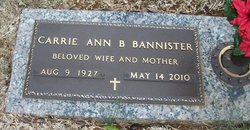
Carrie Anne Bowen Bannister
| Birth | : | 9 Aug 1927 Abbeville County, South Carolina, USA |
| Death | : | 14 May 2010 Anderson, Anderson County, South Carolina, USA |
| Burial | : | Eastview Baptist Church Cemetery, Eastview, Hardin County, USA |
| Coordinate | : | 37.5877880, -86.0613540 |
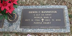
| Description | : | Anne B. Bannister (August 9, 1927 - May 14, 2010) ANDERSON – Carrie Anne Bowen Bannister, 82, of Anderson, widow of Erwin Cecil Bannister, died Friday, May 14, 2010 at the Rainey Hospice House. Born August 9, 1927 in Abbeville County, she was the daughter of the late William Edgar and Ruby Fisher Bowen. She was a homemaker and taught in the Pre-School Program at Trinity United Methodist Church for 15 years. She was a member of Trinity United Methodist Church. Survivors include her daughter, Cecilia Whitfield and husband, Dan, son, Brent Bannister and wife, Sulynn, and daughter, Kim Bannister, all of Anderson; four... Read More |
frequently asked questions (FAQ):
-
Where is Carrie Anne Bowen Bannister's memorial?
Carrie Anne Bowen Bannister's memorial is located at: Eastview Baptist Church Cemetery, Eastview, Hardin County, USA.
-
When did Carrie Anne Bowen Bannister death?
Carrie Anne Bowen Bannister death on 14 May 2010 in Anderson, Anderson County, South Carolina, USA
-
Where are the coordinates of the Carrie Anne Bowen Bannister's memorial?
Latitude: 37.5877880
Longitude: -86.0613540
Family Members:
Flowers:
Nearby Cemetories:
1. Eastview Baptist Church Cemetery
Eastview, Hardin County, USA
Coordinate: 37.5877880, -86.0613540
2. Old Brick Cemetery
Eastview, Hardin County, USA
Coordinate: 37.5780000, -86.0725000
3. Summit Methodist Church Cemetery
Eastview, Hardin County, USA
Coordinate: 37.5691770, -86.0770010
4. Richardson-Woolridge Cemetery
Summit, Hardin County, USA
Coordinate: 37.5695220, -86.0790150
5. Fairfield Baptist Church Cemetery
Eastview, Hardin County, USA
Coordinate: 37.6131140, -86.0883410
6. Parr-Hoover Family Cemetery
Eastview, Hardin County, USA
Coordinate: 37.5829160, -86.0138650
7. Dellview Cemetery
Hardin County, USA
Coordinate: 37.5793991, -86.1141968
8. Stephensburg Cemetery
Stephensburg, Hardin County, USA
Coordinate: 37.6201150, -86.0225270
9. Akers Family Cemetery
Summit, Hardin County, USA
Coordinate: 37.5673190, -86.1124840
10. Meeting Creek Baptist Church Cemetery
Eastview, Hardin County, USA
Coordinate: 37.6081740, -86.1138750
11. Duncan Cemetery
Stephensburg, Hardin County, USA
Coordinate: 37.6218460, -86.0069850
12. Sutzer Creek Cemetery
Hardin County, USA
Coordinate: 37.6278000, -86.1093979
13. Jeffries Family Cemetery
Star Mills, Hardin County, USA
Coordinate: 37.5914001, -85.9882965
14. Jacobs Graveyard
Hardin County, USA
Coordinate: 37.6047270, -86.1348970
15. Saint Ignatius Cemetery
Hardin County, USA
Coordinate: 37.5512840, -85.9988090
16. Old Saint Ignatius Cemetery
Hardin County, USA
Coordinate: 37.5513992, -85.9982986
17. Hardin-Marriott Cemetery
Star Mills, Hardin County, USA
Coordinate: 37.6002640, -85.9814720
18. Stone Church Cemetery
Hardin County, USA
Coordinate: 37.6002300, -85.9741100
19. Old Stone Church Cemetery
Star Mills, Hardin County, USA
Coordinate: 37.6002998, -85.9738998
20. Antioch Christian Church Cemetery
Big Clifty, Grayson County, USA
Coordinate: 37.5240780, -86.1109310
21. New Hope Church Of Christ Cemetery
Big Clifty, Grayson County, USA
Coordinate: 37.5222300, -86.1076070
22. Petty Cemetery
Grayson County, USA
Coordinate: 37.5505981, -86.1444016
23. Richardson Home Cemetery
Hardin County, USA
Coordinate: 37.6618230, -86.0859510
24. Cedar Hill Cemetery
Big Clifty, Grayson County, USA
Coordinate: 37.5497017, -86.1453018


