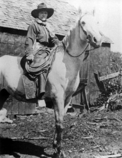
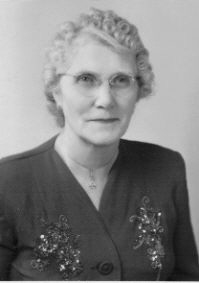
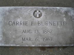
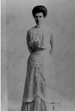
Carrie Evelyn Hammons Burnette
| Birth | : | 13 Aug 1882 Mill Grove, Mercer County, Missouri, USA |
| Death | : | 6 Mar 1967 Chico, Butte County, California, USA |
| Burial | : | Riverview Cemetery, Chamberlain, Brule County, USA |
| Coordinate | : | 43.7874985, -99.3317032 |
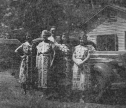
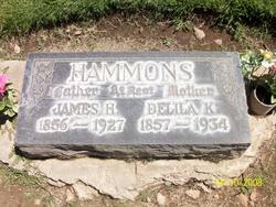
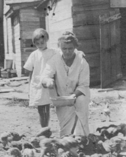
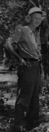
| Description | : | Carrie was born to James Henry and Delilah Katherine Vanderpool Hammons, the 2nd of 9 children. She married Lemuel Robert Noel on Nov. 3, 1898 in Ruskin, Nuckolls Co., NE. They were the parents of 4 children, Winnie, Ferne, Ruth and Harold. They divorced and she later married John (Jack) Burnette. They had 2 children, Mary Helen and Esther. For many years, Uncle Jack was the Park Commissioner of Bidwell Park in Chico, CA. They lived in one of the houses in the park that has since burned. Carrie was unable to walk for the last 20 years of... Read More |
frequently asked questions (FAQ):
-
Where is Carrie Evelyn Hammons Burnette's memorial?
Carrie Evelyn Hammons Burnette's memorial is located at: Riverview Cemetery, Chamberlain, Brule County, USA.
-
When did Carrie Evelyn Hammons Burnette death?
Carrie Evelyn Hammons Burnette death on 6 Mar 1967 in Chico, Butte County, California, USA
-
Where are the coordinates of the Carrie Evelyn Hammons Burnette's memorial?
Latitude: 43.7874985
Longitude: -99.3317032
Family Members:
Parent
Spouse
Siblings
Children
Flowers:
Nearby Cemetories:
1. Riverview Cemetery
Chamberlain, Brule County, USA
Coordinate: 43.7874985, -99.3317032
2. Graceland Cemetery
Oacoma, Lyman County, USA
Coordinate: 43.8040000, -99.3940000
3. Moeller Cemetery
Oacoma, Lyman County, USA
Coordinate: 43.8169800, -99.3979500
4. Community Cemetery
Pukwana, Brule County, USA
Coordinate: 43.7742004, -99.1919022
5. Saint Anthony Cemetery
Pukwana, Brule County, USA
Coordinate: 43.7742004, -99.1911011
6. Norwegian Cemetery
Pukwana, Brule County, USA
Coordinate: 43.8158300, -99.1942850
7. Red Lake Lutheran Cemetery
Pukwana, Brule County, USA
Coordinate: 43.7015130, -99.1698930
8. Grandview Cemetery
Chamberlain, Brule County, USA
Coordinate: 43.6431007, -99.2897034
9. Saint Albans Episcopal Cemetery
Lower Brule, Lyman County, USA
Coordinate: 43.9501800, -99.3837100
10. Amunid Emmanual Lutheran Cemetery
Ola, Brule County, USA
Coordinate: 43.6163100, -99.2317600
11. Saint John The Baptist Cemetery
Buffalo County, USA
Coordinate: 43.9688114, -99.2695074
12. Fort Hale Post Cemetery
Lyman County, USA
Coordinate: 43.9758250, -99.3642700
13. Crow Creek Cemetery
Crow Creek, Buffalo County, USA
Coordinate: 43.9583015, -99.2118988
14. German Lutheran Cemetery
Brule County, USA
Coordinate: 43.6157990, -99.2144012
15. Saint Procopius Cemetery
Pukwana, Brule County, USA
Coordinate: 43.6435200, -99.1550700
16. Bairey Cemetery
Ola, Brule County, USA
Coordinate: 43.6091900, -99.2070100
17. Swedish Lutheran Cemetery
Brule County, USA
Coordinate: 43.5861015, -99.2099991
18. Reliance Cemetery
Reliance, Lyman County, USA
Coordinate: 43.8918991, -99.6042023
19. Saint Marys Catholic Cemetery
Reliance, Lyman County, USA
Coordinate: 43.8931007, -99.6046982
20. Vega Cemetery
Kimball, Brule County, USA
Coordinate: 43.9207993, -99.0783005
21. Bohemian Protestant Cemetery
Brule County, USA
Coordinate: 43.6437150, -99.0809730
22. Iona Cemetery
Lyman County, USA
Coordinate: 43.5614014, -99.4049988
23. National Cemetery
Brule County, USA
Coordinate: 43.6150017, -99.0785980
24. Saint Columba Catholic Cemetery
Iona, Lyman County, USA
Coordinate: 43.5433900, -99.4230800

