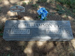
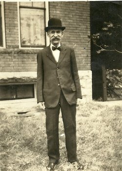
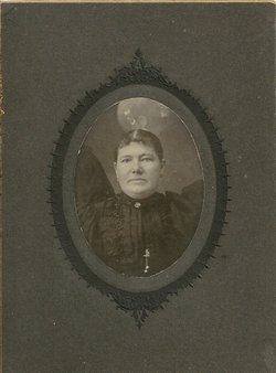
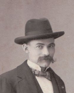
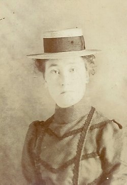
Catherine Davidson Jack Williamson
| Birth | : | 20 Apr 1882 Haddington, East Lothian, Scotland |
| Death | : | 1 Nov 1964 Lake Lotawana, Jackson County, Missouri, USA |
| Burial | : | Duke Street Cemetery, Southport, Metropolitan Borough of Sefton, England |
| Coordinate | : | 53.6343536, -2.9993131 |
| Description | : | Catherine married first, Charles Henry Williamson. She married second, Matthias Johnson and third, Young C. Roady. Topeka Capital, Topeka Kansas, Nov, 1964 Catherine Roady Burlingame-Services for Mrs. Catherine Johnson Roady, 82, Lake Lotawana, Mo., will be at 2 pm Wednesday at Carey Funeral Home here with burial in Burlingame Cemetery. She died Sunday at Lake Lotawana. She was born April 20, 1882 near Edinburg, Scotland, and lived in Missouri the past five years. She was a member of Free Methodist church. Survivors include three daughters, Mrs. Vivian Brooks, Route 4, Topeka; Mrs.... Read More |
frequently asked questions (FAQ):
-
Where is Catherine Davidson Jack Williamson's memorial?
Catherine Davidson Jack Williamson's memorial is located at: Duke Street Cemetery, Southport, Metropolitan Borough of Sefton, England.
-
When did Catherine Davidson Jack Williamson death?
Catherine Davidson Jack Williamson death on 1 Nov 1964 in Lake Lotawana, Jackson County, Missouri, USA
-
Where are the coordinates of the Catherine Davidson Jack Williamson's memorial?
Latitude: 53.6343536
Longitude: -2.9993131
Family Members:
Parent
Spouse
Siblings
Children
Flowers:
Nearby Cemetories:
1. Duke Street Cemetery
Southport, Metropolitan Borough of Sefton, England
Coordinate: 53.6343536, -2.9993131
2. Christ Church Churchyard
Southport, Metropolitan Borough of Sefton, England
Coordinate: 53.6327778, -2.9953770
3. Ardwick Cemetery
Ardwick, Metropolitan Borough of Manchester, England
Coordinate: 53.6302778, -2.9900000
4. Holy Trinity Church
Southport, Metropolitan Borough of Sefton, England
Coordinate: 53.6503800, -2.9969150
5. St. Marie on the Sands
Southport, Metropolitan Borough of Sefton, England
Coordinate: 53.6524320, -3.0023440
6. Southport Crematorium
Scarisbrick, West Lancashire District, England
Coordinate: 53.6235810, -2.9600210
7. Emmanuel Parish Church
Southport, Metropolitan Borough of Sefton, England
Coordinate: 53.6604534, -2.9748117
8. Emmanuel Church Garden of Remembrance
North Meols, West Lancashire District, England
Coordinate: 53.6607130, -2.9753420
9. Liverpool Road Cemetery
Birkdale, Metropolitan Borough of Sefton, England
Coordinate: 53.6083620, -3.0257140
10. Sacred Heart RC Cemetery
Birkdale, Metropolitan Borough of Sefton, England
Coordinate: 53.6066100, -3.0270100
11. St Cuthberts Churchyard
Southport, Metropolitan Borough of Sefton, England
Coordinate: 53.6603230, -2.9620310
12. St. Mark Churchyard
Scarisbrick, West Lancashire District, England
Coordinate: 53.6134600, -2.9403800
13. Saint John Crossens Churchyard
Crossens, Metropolitan Borough of Sefton, England
Coordinate: 53.6733410, -2.9478740
14. St. Elizabeth's Churchyard
Scarisbrick, West Lancashire District, England
Coordinate: 53.6124460, -2.9206340
15. St. Cuthbert's Churchyard
Halsall, West Lancashire District, England
Coordinate: 53.5852140, -2.9529650
16. St. Stephen's Churchyard
North Meols, West Lancashire District, England
Coordinate: 53.6813720, -2.9248140
17. St. Peter's Churchyard
Formby, Metropolitan Borough of Sefton, England
Coordinate: 53.5663834, -3.0594721
18. West Lancashire Cemetery and Crematorium
Burscough, West Lancashire District, England
Coordinate: 53.5875500, -2.8820300
19. Our Lady Of Compassion RC Churchyard
Formby, Metropolitan Borough of Sefton, England
Coordinate: 53.5574060, -3.0575020
20. St. Michael and All Angels Churchyard
Great Altcar, Metropolitan Borough of Sefton, England
Coordinate: 53.5507770, -3.0279540
21. St Thomas Churchyard
Lydiate, Metropolitan Borough of Sefton, England
Coordinate: 53.5443480, -2.9621640
22. St Peter and St Paul Churchyard
Ormskirk, West Lancashire District, England
Coordinate: 53.5692640, -2.8877690
23. Christ Churchyard
Aughton, West Lancashire District, England
Coordinate: 53.5583510, -2.9046990
24. Saint Anne's Roman Catholic Church Cemetery
Ormskirk, West Lancashire District, England
Coordinate: 53.5626520, -2.8935560

