
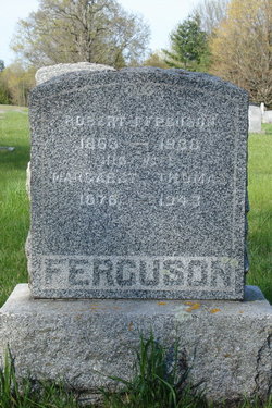
Catherine “Kate” Ferguson Duncan
| Birth | : | 1862 |
| Death | : | 25 Nov 1899 |
| Burial | : | Saint Mark's Churchyard, Widcombe, Bath and North East Somerset Unitary Authority, England |
| Coordinate | : | 51.3766660, -2.3588010 |
| Plot | : | 87 |
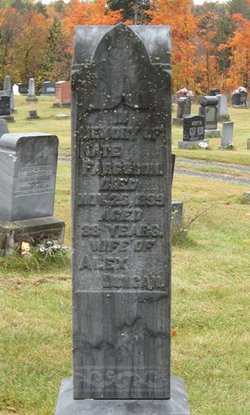
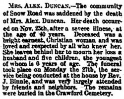
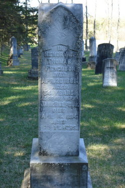
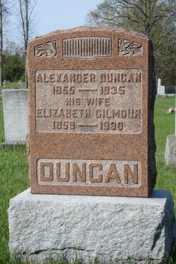
| Description | : | Kate was born in Lanark County, the daughter of Thomas Ferguson and Jane Balfour. On July 4,1882 she was married to Alex Duncan. She was Alex's 2nd wife, his first dying during childbirth. Kate and Alex had 5 children. Kate died Nov.25,1899 at McLaren's Depot, Lanark County, from Bright's disease. --------------------------------- Plot 87 : - Louise Craig, died June 13,1879, aged 23 yrs, wife of Alex Duncan. - Kate Ferguson, died Nov.25,1899, aged 38 yrs, wife of Alex Duncan. --------------------------------- Death - Lanark Era - Nov.29,1899 - At McLaren's Depot, November 25th, Mrs. Alex Duncan, the former Catherine Ferguson, aged 39 years. An aunt, of Mrs. R.A.... Read More |
frequently asked questions (FAQ):
-
Where is Catherine “Kate” Ferguson Duncan's memorial?
Catherine “Kate” Ferguson Duncan's memorial is located at: Saint Mark's Churchyard, Widcombe, Bath and North East Somerset Unitary Authority, England.
-
When did Catherine “Kate” Ferguson Duncan death?
Catherine “Kate” Ferguson Duncan death on 25 Nov 1899 in
-
Where are the coordinates of the Catherine “Kate” Ferguson Duncan's memorial?
Latitude: 51.3766660
Longitude: -2.3588010
Family Members:
Parent

Spouse
Siblings
Children

Flowers:


Nearby Cemetories:
1. Saint Mark's Churchyard
Widcombe, Bath and North East Somerset Unitary Authority, England
Coordinate: 51.3766660, -2.3588010
2. Baptist Burial Ground
Widcombe, Bath and North East Somerset Unitary Authority, England
Coordinate: 51.3764216, -2.3556947
3. Abbey & St James' Graveyard for the Poor
Widcombe, Bath and North East Somerset Unitary Authority, England
Coordinate: 51.3753550, -2.3545640
4. Old Baptist Burial Ground
Walcot, Bath and North East Somerset Unitary Authority, England
Coordinate: 51.3755070, -2.3544360
5. Old Orchard Street Catholic Burial Vault
Bath, Bath and North East Somerset Unitary Authority, England
Coordinate: 51.3800370, -2.3579910
6. St James Old Burial Ground
Bath, Bath and North East Somerset Unitary Authority, England
Coordinate: 51.3798600, -2.3610100
7. St Mary Magdalen Chapel
Widcombe, Bath and North East Somerset Unitary Authority, England
Coordinate: 51.3760486, -2.3643405
8. St. Mary de Stall Churchyard (Defunct)
Bath, Bath and North East Somerset Unitary Authority, England
Coordinate: 51.3813350, -2.3600353
9. Bath Abbey
Bath, Bath and North East Somerset Unitary Authority, England
Coordinate: 51.3815310, -2.3586640
10. Quaker Meeting House
Bath, Bath and North East Somerset Unitary Authority, England
Coordinate: 51.3823280, -2.3604380
11. Quaker Burial Ground
Widcombe, Bath and North East Somerset Unitary Authority, England
Coordinate: 51.3744350, -2.3498460
12. Bath General Hospital Burial Ground
Bath and North East Somerset Unitary Authority, England
Coordinate: 51.3824715, -2.3614742
13. Ss Michael & Paul Churchyard
Bath, Bath and North East Somerset Unitary Authority, England
Coordinate: 51.3834970, -2.3596980
14. Unitarian Chapel Burial Ground
Widcombe, Bath and North East Somerset Unitary Authority, England
Coordinate: 51.3704650, -2.3539270
15. St. Michael's Burial Ground
Bath, Bath and North East Somerset Unitary Authority, England
Coordinate: 51.3838810, -2.3594090
16. St Mary's Chapel, Queens Square
Bath, Bath and North East Somerset Unitary Authority, England
Coordinate: 51.3827790, -2.3649790
17. St Thomas à Becket's Church
Widcombe, Bath and North East Somerset Unitary Authority, England
Coordinate: 51.3734250, -2.3465560
18. Bath Abbey Cemetery
Widcombe, Bath and North East Somerset Unitary Authority, England
Coordinate: 51.3712850, -2.3483060
19. St. James' Cemetery
Bath, Bath and North East Somerset Unitary Authority, England
Coordinate: 51.3802000, -2.3722200
20. St John the Evangelist Cemetery
Bath, Bath and North East Somerset Unitary Authority, England
Coordinate: 51.3696700, -2.3487400
21. Smallcombe Vale Cemetery
Bathwick, Bath and North East Somerset Unitary Authority, England
Coordinate: 51.3757400, -2.3429400
22. St. Mary The Virgin Churchyard
Bathwick, Bath and North East Somerset Unitary Authority, England
Coordinate: 51.3759930, -2.3411930
23. St. Mary's Churchyard
Bathwick, Bath and North East Somerset Unitary Authority, England
Coordinate: 51.3876120, -2.3543540
24. St. Swithin Churchyard
Bath, Bath and North East Somerset Unitary Authority, England
Coordinate: 51.3885480, -2.3594500