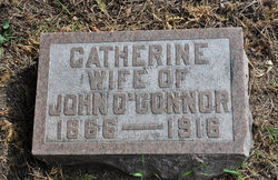
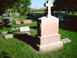
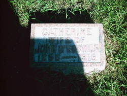
Catherine Maria Murphy O'Connor
| Birth | : | 9 Apr 1866 Dubuque, Dubuque County, Iowa, USA |
| Death | : | 27 Dec 1916 Mason City, Cerro Gordo County, Iowa, USA |
| Burial | : | Waltham Cemetery, Waltham, North East Lincolnshire Unitary Authority, England |
| Coordinate | : | 53.5155500, -0.0934700 |
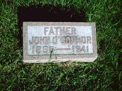
| Plot | : | Buried next to John & Thomas O'Connor |
| Description | : | Daughter of Joseph Murphy Catherine and her sister Anna were living with their father Joseph in Taylor, Dubuque Co., Iowa in 1870, not long after their mother's death. By the 1880 census, the sisters were living with their Uncle Michael Murphy and his wife Jane in Dubuque County. Joseph was not living in Dubuque at that time and it is not known for sure what happened him. He either relocated or he possibly died and is buried with his wife Rose. |
frequently asked questions (FAQ):
-
Where is Catherine Maria Murphy O'Connor's memorial?
Catherine Maria Murphy O'Connor's memorial is located at: Waltham Cemetery, Waltham, North East Lincolnshire Unitary Authority, England.
-
When did Catherine Maria Murphy O'Connor death?
Catherine Maria Murphy O'Connor death on 27 Dec 1916 in Mason City, Cerro Gordo County, Iowa, USA
-
Where are the coordinates of the Catherine Maria Murphy O'Connor's memorial?
Latitude: 53.5155500
Longitude: -0.0934700
Family Members:
Parent
Spouse
Children
Flowers:
Nearby Cemetories:
1. Waltham Cemetery
Waltham, North East Lincolnshire Unitary Authority, England
Coordinate: 53.5155500, -0.0934700
2. All Saints Churchyard
Waltham, North East Lincolnshire Unitary Authority, England
Coordinate: 53.5167000, -0.0986700
3. St Helen's Churchyard
Brigsley, North East Lincolnshire Unitary Authority, England
Coordinate: 53.4982361, -0.1099315
4. St Peters Churchyard
Holton le Clay, East Lindsey District, England
Coordinate: 53.5060368, -0.0616628
5. Holton le Clay Cemetery
Holton le Clay, East Lindsey District, England
Coordinate: 53.5074170, -0.0592630
6. St. Giles Churchyard
Scartho, North East Lincolnshire Unitary Authority, England
Coordinate: 53.5384200, -0.0888130
7. St Peter's Churchyard
Ashby cum Fenby, North East Lincolnshire Unitary Authority, England
Coordinate: 53.4903100, -0.1105200
8. Scartho Road Cemetery
Grimsby, North East Lincolnshire Unitary Authority, England
Coordinate: 53.5464940, -0.0885840
9. Grimsby Crematorium
Grimsby, North East Lincolnshire Unitary Authority, England
Coordinate: 53.5466260, -0.0776350
10. St Georges Churchyard
Bradley, North East Lincolnshire Unitary Authority, England
Coordinate: 53.5429000, -0.1275800
11. St Nicholas Church
Grainsby, East Lindsey District, England
Coordinate: 53.4765150, -0.0755630
12. St Peters Churchyard
Humberston, North East Lincolnshire Unitary Authority, England
Coordinate: 53.5278300, -0.0238300
13. St. Martin Churchyard
East Ravendale, North East Lincolnshire Unitary Authority, England
Coordinate: 53.4793000, -0.1370044
14. Holy Trinity & St Mary the Virgin Churchyard
Grimsby, North East Lincolnshire Unitary Authority, England
Coordinate: 53.5569000, -0.0541000
15. St. James Minster and Parish Church
Grimsby, North East Lincolnshire Unitary Authority, England
Coordinate: 53.5639670, -0.0893070
16. Cleethorpes Cemetery
Cleethorpes, North East Lincolnshire Unitary Authority, England
Coordinate: 53.5553760, -0.0399990
17. St Michael's Churchyard
Little Coates, North East Lincolnshire Unitary Authority, England
Coordinate: 53.5631770, -0.1274160
18. St Andrew
Beelsby, North East Lincolnshire Unitary Authority, England
Coordinate: 53.5015700, -0.1810580
19. St Marys Churchyard
Hatcliffe, North East Lincolnshire Unitary Authority, England
Coordinate: 53.4890900, -0.1729800
20. Laceby Cemetery
Laceby, North East Lincolnshire Unitary Authority, England
Coordinate: 53.5411890, -0.1740470
21. St Peter's Church
Cleethorpes, North East Lincolnshire Unitary Authority, England
Coordinate: 53.5579756, -0.0307081
22. St Nicolas Churchyard
Great Coates, North East Lincolnshire Unitary Authority, England
Coordinate: 53.5701890, -0.1391100
23. St Lawrence Churchyard
Aylesby, North East Lincolnshire Unitary Authority, England
Coordinate: 53.5511600, -0.1858320
24. St Peter & St Paul
Healing, North East Lincolnshire Unitary Authority, England
Coordinate: 53.5734480, -0.1682390

