
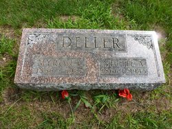
| Birth | : | 9 Oct 1843 Columbiana County, Ohio, USA |
| Death | : | 1920 Steuben County, Indiana, USA |
| Burial | : | Fort Snelling National Cemetery, Minneapolis, Hennepin County, USA |
| Coordinate | : | 44.8645935, -93.2227631 |
| Description | : | Mrs. George H. Deller was the seventh of a family of fourteen sturdy sons and daughters. She was born in Columbiana county, Ohio, October 9, 1843. She came to Steuben county, Indiana, in young womanhood. On March 23, 1865, she was married to George H. Deller, and shortly thereafter, they moved to their farm, four miles west of Pleasant Lake, on which they lived for nearly sixty years of strenuous farm life. To them were born five children, this family circle remaining unbroken until about seven years ago when Nettie passed on. In May, 1923, Mr. Deller passed to... Read More |
frequently asked questions (FAQ):
-
Where is Catherine Wolf Deller's memorial?
Catherine Wolf Deller's memorial is located at: Fort Snelling National Cemetery, Minneapolis, Hennepin County, USA.
-
When did Catherine Wolf Deller death?
Catherine Wolf Deller death on 1920 in Steuben County, Indiana, USA
-
Where are the coordinates of the Catherine Wolf Deller's memorial?
Latitude: 44.8645935
Longitude: -93.2227631
Family Members:
Parent

Spouse
Siblings
Children
Flowers:


Nearby Cemetories:
1. Church of The Assumption Catholic Cemetery
Richfield, Hennepin County, USA
Coordinate: 44.8635406, -93.2725677
2. Fort Snelling Memorial Chapel Cemetery
Fort Snelling, Hennepin County, USA
Coordinate: 44.8920708, -93.1846619
3. Acacia Park Cemetery
Mendota Heights, Dakota County, USA
Coordinate: 44.8788986, -93.1710968
4. Pilot Knob Indian Burial Ground
Mendota Heights, Dakota County, USA
Coordinate: 44.8810790, -93.1672870
5. Church of Saint Peter Historic Cemetery
Mendota, Dakota County, USA
Coordinate: 44.8839417, -93.1671906
6. Resurrection Cemetery
Mendota Heights, Dakota County, USA
Coordinate: 44.8767014, -93.1513977
7. Oak Hill Cemetery
Minneapolis, Hennepin County, USA
Coordinate: 44.8950005, -93.2861023
8. Mayflower United Church of Christ Memorial Garden
Minneapolis, Hennepin County, USA
Coordinate: 44.9038990, -93.2760520
9. B'Nai Emet Cemetery
Richfield, Hennepin County, USA
Coordinate: 44.8740510, -93.3085120
10. Gemelus Chesed Cemetery
Richfield, Hennepin County, USA
Coordinate: 44.8752750, -93.3087220
11. Christ Lutheran Church Cemetery
Eagan, Dakota County, USA
Coordinate: 44.8038712, -93.2025681
12. Saint John's Cemetery
Eagan, Dakota County, USA
Coordinate: 44.8050003, -93.1958008
13. Minneapolis Jewish Cemetery
Richfield, Hennepin County, USA
Coordinate: 44.8753014, -93.3099976
14. Saint Mary's Cemetery
Minneapolis, Hennepin County, USA
Coordinate: 44.9229205, -93.2625275
15. United Hebrew Brotherhood Cemetery
Richfield, Hennepin County, USA
Coordinate: 44.8750000, -93.3131027
16. Saint Joan of Arc Memorial Garden
Minneapolis, Hennepin County, USA
Coordinate: 44.9213700, -93.2719500
17. Bloomington Cemetery
Bloomington, Hennepin County, USA
Coordinate: 44.8153000, -93.2893982
18. Trinity Lone Oak Cemetery
Eagan, Dakota County, USA
Coordinate: 44.8503600, -93.1270750
19. Temple Israel Memorial Park
Minneapolis, Hennepin County, USA
Coordinate: 44.9272003, -93.2711029
20. Saint Lukes Episcopal Church Memorial Garden
Minneapolis, Hennepin County, USA
Coordinate: 44.9198300, -93.2917000
21. Oak Grove Presbyterian Church Columbarium
Bloomington, Hennepin County, USA
Coordinate: 44.8194490, -93.3084200
22. Saint Stephen Lutheran Columbarium
Bloomington, Hennepin County, USA
Coordinate: 44.8509380, -93.3297870
23. Adath Yeshurun Cemetery
Edina, Hennepin County, USA
Coordinate: 44.9015007, -93.3283310
24. Saint Marys Episcopal Church Memorial Garden
Saint Paul, Ramsey County, USA
Coordinate: 44.9451999, -93.1805399