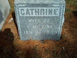
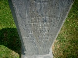
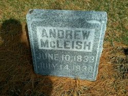
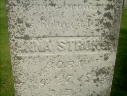
Cathrine Strawn McLeish
| Birth | : | 26 Jan 1852 Durand, Winnebago County, Illinois, USA |
| Death | : | 2 Sep 1910 Maynard, Fayette County, Iowa, USA |
| Burial | : | Cowpen Cemetery and Crematorium, Blyth, Northumberland Unitary Authority, England |
| Coordinate | : | 55.1311260, -1.5294460 |
| Plot | : | Lot 69 |
frequently asked questions (FAQ):
-
Where is Cathrine Strawn McLeish's memorial?
Cathrine Strawn McLeish's memorial is located at: Cowpen Cemetery and Crematorium, Blyth, Northumberland Unitary Authority, England.
-
When did Cathrine Strawn McLeish death?
Cathrine Strawn McLeish death on 2 Sep 1910 in Maynard, Fayette County, Iowa, USA
-
Where are the coordinates of the Cathrine Strawn McLeish's memorial?
Latitude: 55.1311260
Longitude: -1.5294460
Family Members:
Parent
Spouse
Siblings
Children
Flowers:
Nearby Cemetories:
1. Cowpen Cemetery and Crematorium
Blyth, Northumberland Unitary Authority, England
Coordinate: 55.1311260, -1.5294460
2. Cowpen Roman Catholic Burial Ground
Blyth, Northumberland Unitary Authority, England
Coordinate: 55.1305300, -1.5386300
3. Saint Cuthbert's Churchyard
Blyth, Northumberland Unitary Authority, England
Coordinate: 55.1265800, -1.5031400
4. Blyth Links Cemetery
Blyth, Northumberland Unitary Authority, England
Coordinate: 55.1053800, -1.4997200
5. St. Mary's Churchyard
Horton, Northumberland Unitary Authority, England
Coordinate: 55.1106200, -1.5706200
6. St Peter Churchyard
Cambois, Northumberland Unitary Authority, England
Coordinate: 55.1615300, -1.5604100
7. St. Cuthbert Churchyard
Bedlington, Northumberland Unitary Authority, England
Coordinate: 55.1303910, -1.5928880
8. North Seaton Cemetery
Ashington, Northumberland Unitary Authority, England
Coordinate: 55.1669770, -1.5575500
9. St. Paul's Churchyard
Choppington, Northumberland Unitary Authority, England
Coordinate: 55.1494290, -1.6009780
10. Netherton Lane Cemetery
Bedlington, Northumberland Unitary Authority, England
Coordinate: 55.1318960, -1.6106800
11. Mayfield Cemetery
Cramlington, Northumberland Unitary Authority, England
Coordinate: 55.0837139, -1.5730931
12. St. Nicholas' Churchyard
Cramlington, Northumberland Unitary Authority, England
Coordinate: 55.0856460, -1.5834930
13. Saint Aidens Churchyard
Ashington, Northumberland Unitary Authority, England
Coordinate: 55.1826900, -1.5781400
14. St Andrew's Churchyard
Bothal, Northumberland Unitary Authority, England
Coordinate: 55.1731340, -1.6205890
15. St. John's Churchyard
Annitsford, Metropolitan Borough of North Tyneside, England
Coordinate: 55.0676900, -1.5785500
16. St. John the Baptist Catholic Churchyard
Cramlington, Northumberland Unitary Authority, England
Coordinate: 55.0675480, -1.5783300
17. Lynemouth Cemetery
Lynemouth, Northumberland Unitary Authority, England
Coordinate: 55.2031759, -1.5361996
18. Whitley Bay Cemetery and Crematorium
Whitley Bay, Metropolitan Borough of North Tyneside, England
Coordinate: 55.0636970, -1.4588430
19. Earsdon Cemetery
Earsdon, Metropolitan Borough of North Tyneside, England
Coordinate: 55.0474600, -1.5007200
20. St. Alban’s Churchyard
Earsdon, Metropolitan Borough of North Tyneside, England
Coordinate: 55.0461000, -1.5004000
21. Dudley Cemetery
Dudley, Metropolitan Borough of North Tyneside, England
Coordinate: 55.0566100, -1.6143420
22. Saint John's Churchyard
Longhirst, Northumberland Unitary Authority, England
Coordinate: 55.1936200, -1.6474840
23. St. Mary the Virgin Church
Morpeth, Northumberland Unitary Authority, England
Coordinate: 55.1598990, -1.6917760
24. St. Mary the Virgin Churchyard
Morpeth, Northumberland Unitary Authority, England
Coordinate: 55.1597110, -1.6921530

