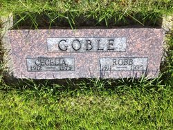
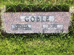
Cecelia Frances Moynagh-Handley Goble
| Birth | : | 24 Aug 1912 Butte, Silver Bow County, Montana, USA |
| Death | : | 5 Jun 1979 Saint Ignatius, Lake County, Montana, USA |
| Burial | : | Simpson Cemetery, Cannon County, USA |
| Coordinate | : | 35.7792015, -86.1350021 |
| Description | : | Cecelia Frances Goble, 66, died Tuesday in the Mission Valley Hospital here after a long illness. She was born Aug. 24, 1912, at Butte, where she attended school. She later worked as a bookkeeper in Great Falls. On July 6, 1936, she married Robert Goble in Butte. In 1951, they moved to Sacramento, Calif. They lived there until 1974, when they moved to St. Ignatius. Mrs. Goble is survived by her husband, Robert, St. Ignatius; one daughter, Nancy Murray, Bel Mar, Calif.; two grandchildren, and a brother, Charles Handley, Yelm, Wash. |
frequently asked questions (FAQ):
-
Where is Cecelia Frances Moynagh-Handley Goble's memorial?
Cecelia Frances Moynagh-Handley Goble's memorial is located at: Simpson Cemetery, Cannon County, USA.
-
When did Cecelia Frances Moynagh-Handley Goble death?
Cecelia Frances Moynagh-Handley Goble death on 5 Jun 1979 in Saint Ignatius, Lake County, Montana, USA
-
Where are the coordinates of the Cecelia Frances Moynagh-Handley Goble's memorial?
Latitude: 35.7792015
Longitude: -86.1350021
Family Members:
Parent
Spouse
Flowers:
Nearby Cemetories:
1. Simpson Cemetery
Cannon County, USA
Coordinate: 35.7792015, -86.1350021
2. Davis-Thomas Cemetery
Cannon County, USA
Coordinate: 35.7691994, -86.1324997
3. Brandon Cemetery
Cannon County, USA
Coordinate: 35.7891998, -86.1453018
4. Cannon County Farm Cemetery
Cannon County, USA
Coordinate: 35.7897890, -86.1522920
5. Cateston Cemetery
Cannon County, USA
Coordinate: 35.7966995, -86.1511002
6. Curlee Cemetery
Cannon County, USA
Coordinate: 35.7799988, -86.1631012
7. Gandy Cemetery
Cannon County, USA
Coordinate: 35.8058014, -86.1382980
8. Brawleys Fork Cemetery
Readyville, Cannon County, USA
Coordinate: 35.8038902, -86.1524963
9. Lassiter Cemetery
Cannon County, USA
Coordinate: 35.7811012, -86.1755981
10. Barton Cemetery
Cannon County, USA
Coordinate: 35.8111000, -86.1500015
11. Saffel Cemetery
Cannon County, USA
Coordinate: 35.8067017, -86.1605988
12. Jameson Cemetery
Cannon County, USA
Coordinate: 35.7542000, -86.1053009
13. Patton Cemetery
Cannon County, USA
Coordinate: 35.7430992, -86.1541977
14. Bragg Cemetery
Cannon County, USA
Coordinate: 35.8191986, -86.1346970
15. Milligan Cemetery
Cannon County, USA
Coordinate: 35.7386017, -86.1231003
16. Pallette Cemetery
Cannon County, USA
Coordinate: 35.7481003, -86.1722031
17. Hoover Cemetery
Rutherford County, USA
Coordinate: 35.8025017, -86.1819000
18. Carter Cemetery
Cannon County, USA
Coordinate: 35.8314018, -86.1389008
19. Bragg Cemetery
Cannon County, USA
Coordinate: 35.8363991, -86.1386032
20. Peeler Cemetery
Cannon County, USA
Coordinate: 35.7658005, -86.0661011
21. Bragg Cemetery
Cannon County, USA
Coordinate: 35.8372002, -86.1393967
22. Jones Cemetery
Rutherford County, USA
Coordinate: 35.8231010, -86.1875000
23. Cripple Creek Cemetery
Floraton, Rutherford County, USA
Coordinate: 35.7783012, -86.2133026
24. King Cemetery
Cannon County, USA
Coordinate: 35.7442017, -86.0678024


