| Birth | : | 16 Oct 1915 Silver Creek, Merrick County, Nebraska, USA |
| Death | : | 11 Mar 2010 Columbus, Platte County, Nebraska, USA |
| Burial | : | Silver Creek Cemetery, Silver Creek, Merrick County, USA |
| Coordinate | : | 41.3222008, -97.6830978 |
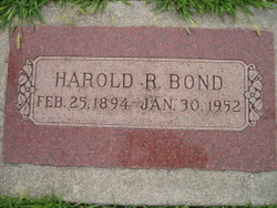
| Description | : | Son of Harold and Lorna (Powers) Bond. He graduated from Silver Creek High School in 1934. He married Bernice McDaniel and moved to Chicago, Il where he obtained a job driving trucks from Chicago to New York. Following her unexpected death, he married Inez Frederick. They were married for 29 years and had 3 children together. In 1944, Charles was drafted into the US Army. He served one year stateside and one year overseas in the European Theater and in the South Pacific. He received one Battle Star for the Battle of the Bulge. He also played in the Fort... Read More |
frequently asked questions (FAQ):
-
Where is Charles E. “Spike” Bond's memorial?
Charles E. “Spike” Bond's memorial is located at: Silver Creek Cemetery, Silver Creek, Merrick County, USA.
-
When did Charles E. “Spike” Bond death?
Charles E. “Spike” Bond death on 11 Mar 2010 in Columbus, Platte County, Nebraska, USA
-
Where are the coordinates of the Charles E. “Spike” Bond's memorial?
Latitude: 41.3222008
Longitude: -97.6830978
Family Members:
Parent
Spouse
Siblings
Flowers:
Nearby Cemetories:
1. Silver Creek Cemetery
Silver Creek, Merrick County, USA
Coordinate: 41.3222008, -97.6830978
2. Saint Lawrence Cemetery
Silver Creek, Merrick County, USA
Coordinate: 41.2942009, -97.7052994
3. Saints Peter and Paul Cemetery
Krakow, Nance County, USA
Coordinate: 41.3908157, -97.7522888
4. Fairview Cemetery
Swedehome, Polk County, USA
Coordinate: 41.2357500, -97.7052000
5. Fairview Cemetery
Silver Creek, Merrick County, USA
Coordinate: 41.2920000, -97.8006000
6. Beulah Cemetery
Swedehome, Polk County, USA
Coordinate: 41.2277985, -97.6755981
7. Valley German Methodist Cemetery
Osceola, Polk County, USA
Coordinate: 41.2540000, -97.5817500
8. Saint Johns Lutheran Church Cemetery
Polk County, USA
Coordinate: 41.3427940, -97.5421140
9. Valley View Cemetery
Genoa, Nance County, USA
Coordinate: 41.4317017, -97.7319031
10. Saint Mary Cemetery
Osceola, Polk County, USA
Coordinate: 41.3233580, -97.5124280
11. Genoa Indian Industrial School Cemetery
Genoa, Nance County, USA
Coordinate: 41.4471700, -97.7218400
12. Gruetli Cemetery
Monroe, Platte County, USA
Coordinate: 41.4290000, -97.5810000
13. Calvary Cemetery
Clarks, Merrick County, USA
Coordinate: 41.2196999, -97.8193970
14. Saint Andrews Catholic Church Cemetery #1
Osceola, Polk County, USA
Coordinate: 41.2923500, -97.4891000
15. Friends Cemetery
Oconee, Platte County, USA
Coordinate: 41.4775009, -97.6941986
16. Saint Stanislaus Catholic Cemetery
Duncan, Platte County, USA
Coordinate: 41.3926000, -97.4962000
17. Saint Andrews Catholic Cemetery #2
Osceola, Polk County, USA
Coordinate: 41.2787000, -97.4822000
18. Swede Home Cemetery
Swedehome, Polk County, USA
Coordinate: 41.1622900, -97.6657800
19. Sunnyside Cemetery
Nance County, USA
Coordinate: 41.4016991, -97.8692017
20. Jackson Cemetery
Duncan, Platte County, USA
Coordinate: 41.3946991, -97.4822006
21. Wesley Chapel Cemetery
Polk County, USA
Coordinate: 41.2350006, -97.4850006
22. Osceola Cemetery
Osceola, Polk County, USA
Coordinate: 41.1840210, -97.5413818
23. Bureau Cemetery
Clarks, Merrick County, USA
Coordinate: 41.2639008, -97.9344025
24. Swede Plain Cemetery
Stromsburg, Polk County, USA
Coordinate: 41.1199100, -97.7576800


