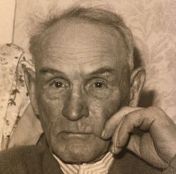
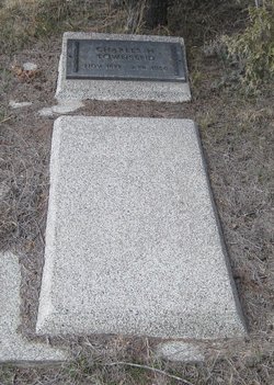
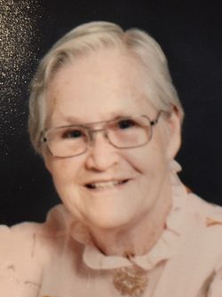
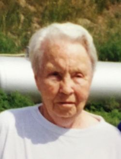
Charles Herbert Townsend
| Birth | : | 6 Nov 1871 Lawrence, Essex County, Massachusetts, USA |
| Death | : | 3 Apr 1956 Sheridan County, Nebraska, USA |
| Burial | : | White Clay Cemetery, Rushville, Sheridan County, USA |
| Coordinate | : | 42.9732820, -102.5667230 |
| Description | : | Charles Herbert Townsend was born in Lawrence, Mass., Nov. 6, 1871, the second son of Horatio and Annie Young Townsend. The young family of four left Mass. to homestead in the area of White Clay Nebraska, where Annie's brother had settled. Five born children would be born there. When he was about 15-16 years of age, Charles left his home and headed further west where he put himself up for hire. He did various jobs, until 1890 when he went to the home of Uncle Will Young, (brother of his mother, Annie) to care for his ailing grandfather Young. Charlie was... Read More |
frequently asked questions (FAQ):
-
Where is Charles Herbert Townsend's memorial?
Charles Herbert Townsend's memorial is located at: White Clay Cemetery, Rushville, Sheridan County, USA.
-
When did Charles Herbert Townsend death?
Charles Herbert Townsend death on 3 Apr 1956 in Sheridan County, Nebraska, USA
-
Where are the coordinates of the Charles Herbert Townsend's memorial?
Latitude: 42.9732820
Longitude: -102.5667230
Family Members:
Parent
Spouse
Siblings
Children
Flowers:
Nearby Cemetories:
1. White Clay Cemetery
Rushville, Sheridan County, USA
Coordinate: 42.9732820, -102.5667230
2. Holy Cross Cemetery
Pine Ridge, Oglala Lakota County, USA
Coordinate: 43.0194016, -102.5503006
3. Pine Ridge Presbyterian Cemetery
Pine Ridge, Oglala Lakota County, USA
Coordinate: 43.0235200, -102.5506200
4. Abold Family Cemetery
Rushville, Sheridan County, USA
Coordinate: 42.8863500, -102.6158000
5. Red Cloud Cemetery
Pine Ridge, Oglala Lakota County, USA
Coordinate: 43.0776839, -102.5837514
6. Holly Cemetery
Rushville, Sheridan County, USA
Coordinate: 42.8575120, -102.5370990
7. Saint Aloysius Cemetery
Sheridan County, USA
Coordinate: 42.9015500, -102.4025500
8. Wolf Creek Community Cemetery
Oglala Lakota County, USA
Coordinate: 43.0405750, -102.3966490
9. Cortier Family Cemetery
Oglala Lakota County, USA
Coordinate: 43.1160000, -102.6210000
10. Beaver Valley Cemetery
Sheridan County, USA
Coordinate: 42.8880997, -102.7517014
11. Tashnke-Ko-Ki-Pa-Pi Cemetery
Oglala Lakota County, USA
Coordinate: 43.1222000, -102.6560974
12. Saint James Cemetery
Oglala Lakota County, USA
Coordinate: 43.1356010, -102.6397018
13. Lamont Cemetery
Wounded Knee, Oglala Lakota County, USA
Coordinate: 43.1006012, -102.4107971
14. Bomar Cemetery
Hay Springs, Sheridan County, USA
Coordinate: 42.8062000, -102.6459600
15. Spotted Bear Family Cemetery
Denby, Oglala Lakota County, USA
Coordinate: 43.0608200, -102.3376600
16. Saint Matthews Episcopal Cemetery
Slim Butte, Oglala Lakota County, USA
Coordinate: 43.0780530, -102.7873140
17. Native American Cemetery
Oglala, Oglala Lakota County, USA
Coordinate: 43.0886002, -102.3550034
18. Amity Cemetery
Sheridan County, USA
Coordinate: 42.8036003, -102.4389038
19. Bethel Cemetery
Sheridan County, USA
Coordinate: 42.9011002, -102.3208008
20. Novotny Cemetery
Hay Springs, Sheridan County, USA
Coordinate: 42.7742004, -102.5963974
21. Our Lady of Lourdes Catholic Cemetery
Slim Butte, Oglala Lakota County, USA
Coordinate: 43.0619800, -102.8166200
22. Slim Buttes Cemetery
Pine Ridge, Oglala Lakota County, USA
Coordinate: 43.0621700, -102.8168100
23. Messiah Episcopal Cemetery
Wounded Knee, Oglala Lakota County, USA
Coordinate: 43.1499300, -102.3779400
24. Presbyterian Cemetery
Wounded Knee, Oglala Lakota County, USA
Coordinate: 43.1503300, -102.3781000

