
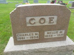
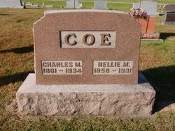
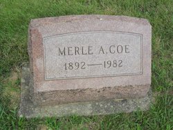
Charles Morton Coe
| Birth | : | 30 Jan 1861 Tippecanoe County, Indiana, USA |
| Death | : | 28 Aug 1934 Tippecanoe County, Indiana, USA |
| Burial | : | Los Molinos Cemetery, Los Molinos, Tehama County, USA |
| Coordinate | : | 40.0475650, -122.1011820 |
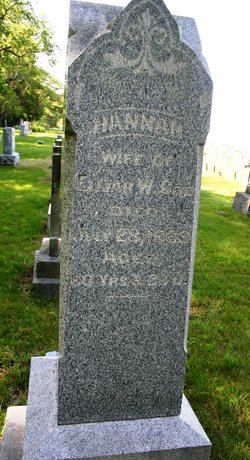
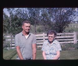
| Description | : | Husband of Nellie M Clark's Hill, Aug 24 - Special - Charles Coe, 73, native of Tippecanoe county and well known retired farmer and land owner, died at his country home, three and a half miles west of here, at 8:30 o'clock last evening, following an extended illness. Born near here, he was the son of Elijah and Hanna Coe,. His wife, Nellie Coe, died several years ago. Surviving are three sisters, Mrs Hattie Campbell, of Battle Creek, Michigan, Mrs Allie Bryant, and Mrs Addie Stuckey, of Clarks Hill, and six children, Mrs Glenn Mugg and Mrs Ruby Clark, of this... Read More |
frequently asked questions (FAQ):
-
Where is Charles Morton Coe's memorial?
Charles Morton Coe's memorial is located at: Los Molinos Cemetery, Los Molinos, Tehama County, USA.
-
When did Charles Morton Coe death?
Charles Morton Coe death on 28 Aug 1934 in Tippecanoe County, Indiana, USA
-
Where are the coordinates of the Charles Morton Coe's memorial?
Latitude: 40.0475650
Longitude: -122.1011820
Family Members:
Parent
Spouse
Siblings
Children
Flowers:


Nearby Cemetories:
1. Los Molinos Cemetery
Los Molinos, Tehama County, USA
Coordinate: 40.0475650, -122.1011820
2. Tehama Cemetery
Tehama, Tehama County, USA
Coordinate: 40.0233002, -122.1433029
3. Growney Ranch Family Cemetery
Red Bluff, Tehama County, USA
Coordinate: 40.1167300, -122.1952500
4. New Clairvaux Abbey Cemetery
Vina, Tehama County, USA
Coordinate: 39.9381450, -122.0641890
5. Vina Cemetery
Vina, Tehama County, USA
Coordinate: 39.9636440, -121.9957070
6. Sunset Hill Cemetery
Corning, Tehama County, USA
Coordinate: 39.9271600, -122.1586100
7. Oak Hill Cemetery
Red Bluff, Tehama County, USA
Coordinate: 40.1699982, -122.2433014
8. Red Bluff Memorial Chapel Mausoleum & Columbarium
Red Bluff, Tehama County, USA
Coordinate: 40.1717130, -122.2466860
9. Saint Mary's Cemetery
Red Bluff, Tehama County, USA
Coordinate: 40.1716995, -122.2521973
10. Kirkwood Cemetery
Corning, Tehama County, USA
Coordinate: 39.8624992, -122.1519012
11. Pine Creek Cemetery
Chico, Butte County, USA
Coordinate: 39.8617240, -121.9842480
12. Red Bank Cemetery
Red Bank, Tehama County, USA
Coordinate: 40.1036970, -122.4458540
13. Cameron-Davis Cemetery
Tehama County, USA
Coordinate: 40.2709800, -121.8778500
14. Orland Masonic Cemetery
Orland, Glenn County, USA
Coordinate: 39.7684760, -122.1943310
15. Elmore Cemetery
Flournoy, Tehama County, USA
Coordinate: 39.8642006, -122.4005966
16. Bragg Cemetery
Nord, Butte County, USA
Coordinate: 39.7750980, -121.9568170
17. Inks Creek Cemetery
Tehama County, USA
Coordinate: 40.3419800, -122.1297100
18. Graves Cemetery
Orland, Glenn County, USA
Coordinate: 39.7827988, -122.2930984
19. Cohasset Cemetery
Cohasset, Butte County, USA
Coordinate: 39.9124880, -121.7333220
20. Benner Family Cemetery
Tehama County, USA
Coordinate: 40.1826890, -121.7183500
21. Cottonwood Creek Ranch Cemetery
Cottonwood, Shasta County, USA
Coordinate: 40.3663100, -122.2598800
22. Paskenta Cemetery
Corning, Tehama County, USA
Coordinate: 39.9002991, -122.5089035
23. Orland Catholic Cemetery
Orland, Glenn County, USA
Coordinate: 39.7030983, -122.1393967
24. Orland IOOF Cemetery
Orland, Glenn County, USA
Coordinate: 39.7026000, -122.1401000