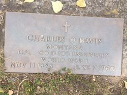
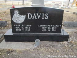
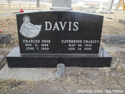
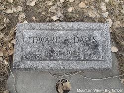
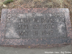
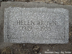
Charles Onie Davis
| Birth | : | 11 Nov 1888 Spring Valley, Fillmore County, Minnesota, USA |
| Death | : | 7 Jun 1960 Lewis and Clark County, Montana, USA |
| Burial | : | Citizens Cemetery, Clarendon, Donley County, USA |
| Coordinate | : | 34.9192009, -100.8803024 |
| Plot | : | Section 1 Block 33 Lot 3 Grave 4 |
| Description | : | : Big Timber Pioneer June 16, 1960 Charles Onie Davis Rites Held Friday Funeral services for Charles Onie Davis, 71, who died Tuesday of last week at the veteran's hospital in Fort Harrison were held Friday from the Lowry Chapel. John W. Griffen of the Seventh Day Adventist church in Bozeman officiated. Mrs. Frank King and Mrs. Carl Baucher of Bozeman sang "Old Rugged Cross" and "God's Way is the Best Way" and Mrs. and Mrs. Glen Kenison, nephew of Mrs. Davis sang "Beyond the Sunset," Mrs. Vernon Larson was accompanist. Pallbearers were Bob Brownlee, Tom Lomeland, Mike Breck, Claude... Read More |
frequently asked questions (FAQ):
-
Where is Charles Onie Davis's memorial?
Charles Onie Davis's memorial is located at: Citizens Cemetery, Clarendon, Donley County, USA.
-
When did Charles Onie Davis death?
Charles Onie Davis death on 7 Jun 1960 in Lewis and Clark County, Montana, USA
-
Where are the coordinates of the Charles Onie Davis's memorial?
Latitude: 34.9192009
Longitude: -100.8803024
Family Members:
Parent
Spouse
Siblings
Children
Flowers:
Nearby Cemetories:
1. Citizens Cemetery
Clarendon, Donley County, USA
Coordinate: 34.9192009, -100.8803024
2. Saint Marys Cemetery
Clarendon, Donley County, USA
Coordinate: 34.9188995, -100.8833008
3. Odd Fellows Cemetery
Clarendon, Donley County, USA
Coordinate: 34.9188995, -100.8863983
4. Rowe Cemetery
Hedley, Donley County, USA
Coordinate: 34.8869019, -100.6725006
5. Jericho Cemetery
Jericho, Donley County, USA
Coordinate: 35.1655998, -100.9203033
6. Boydston Cemetery
Donley County, USA
Coordinate: 35.1516991, -100.9914017
7. Goodnight Cemetery
Goodnight, Armstrong County, USA
Coordinate: 35.0463982, -101.1735992
8. Walls Family Cemetery
Hall County, USA
Coordinate: 34.6449710, -100.8643660
9. Liberty Cemetery
Lesley, Hall County, USA
Coordinate: 34.6477900, -100.8095400
10. Lakeview Cemetery
Lakeview, Hall County, USA
Coordinate: 34.6737350, -100.7160060
11. Alanreed Cemetery
Alanreed, Gray County, USA
Coordinate: 35.2114880, -100.7242870
12. Groom Cemetery
Groom, Carson County, USA
Coordinate: 35.1946983, -101.1327972
13. Fairview Cemetery North Section
Memphis, Hall County, USA
Coordinate: 34.7319630, -100.5276770
14. Fairview Cemetery South Section
Memphis, Hall County, USA
Coordinate: 34.7302830, -100.5255150
15. Saint Marys Cemetery
Groom, Carson County, USA
Coordinate: 35.2208100, -101.1169600
16. Eldridge Cemetery
Gray County, USA
Coordinate: 35.2771988, -100.7722015
17. Hillcrest Cemetery
McLean, Gray County, USA
Coordinate: 35.2400017, -100.6078033
18. Mount Pleasant Cemetery
Armstrong County, USA
Coordinate: 34.9446983, -101.3608017
19. Quail Cemetery
Quail, Collingsworth County, USA
Coordinate: 34.9211006, -100.3972015
20. Dozier Cemetery
Dozier, Collingsworth County, USA
Coordinate: 35.0518990, -100.3608017
21. Darsey Cemetery
Alanreed, Gray County, USA
Coordinate: 35.3597946, -100.7690887
22. Claude Cemetery
Claude, Armstrong County, USA
Coordinate: 35.1324997, -101.3799973
23. Newlin Cemetery
Newlin, Hall County, USA
Coordinate: 34.6055984, -100.4456024
24. Rolla Cemetery
Rolla, Collingsworth County, USA
Coordinate: 34.7939740, -100.3116540

