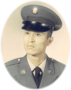
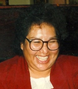
Charles “Vohke'sehemeo'o” Sooktis Jr.
| Birth | : | 2 Aug 1943 Lame Deer, Rosebud County, Montana, USA |
| Death | : | 9 Feb 2021 Hardin, Big Horn County, Montana, USA |
| Burial | : | Birney Cemetery, Rosebud County, USA |
| Coordinate | : | 45.2846985, -106.5868988 |
| Description | : | Charles Sooktis, Jr. Vohke’sehemeo’o “Cliff Road” passed away onFebruary 9, 2021 at his home in Hardin, Montana. He was born on August 2, 1943 in Lame Deer, Mt to Charles Sooktis Sr. and Margaret Seminole Sooktis in their log home. Charles had many children who took his Indian name after him: Ryan Kennedy, Aiden Spang, Riley James Dreamer and Charles Butch Bundt He spent a majority of his younger years at the home of his aunt Beatric and Tuck Small. There is a lot of stories that he mentioned regarding his uncle Tuck and Beatrice. Especially riding horses with his... Read More |
frequently asked questions (FAQ):
-
Where is Charles “Vohke'sehemeo'o” Sooktis Jr.'s memorial?
Charles “Vohke'sehemeo'o” Sooktis Jr.'s memorial is located at: Birney Cemetery, Rosebud County, USA.
-
When did Charles “Vohke'sehemeo'o” Sooktis Jr. death?
Charles “Vohke'sehemeo'o” Sooktis Jr. death on 9 Feb 2021 in Hardin, Big Horn County, Montana, USA
-
Where are the coordinates of the Charles “Vohke'sehemeo'o” Sooktis Jr.'s memorial?
Latitude: 45.2846985
Longitude: -106.5868988
Family Members:
Parent
Spouse
Siblings
Children
Flowers:
Nearby Cemetories:
1. Birney Cemetery
Rosebud County, USA
Coordinate: 45.2846985, -106.5868988
2. Dufford Cemetery
Powder River County, USA
Coordinate: 45.1091995, -106.2316971
3. Muddy Creek Cemetery
Muddy, Big Horn County, USA
Coordinate: 45.5741997, -106.7406006
4. Lame Deer Cemetery
Lame Deer, Rosebud County, USA
Coordinate: 45.6264000, -106.6619034
5. Two Moons Gravesite
Busby, Big Horn County, USA
Coordinate: 45.5308840, -106.9564430
6. Busby Cemetery
Busby, Big Horn County, USA
Coordinate: 45.5358009, -106.9505997
7. Willow Crossing Cemetery
Powder River County, USA
Coordinate: 45.5382996, -106.1931000
8. Ashland Cemetery
Ashland, Rosebud County, USA
Coordinate: 45.5867170, -106.2645560
9. Saint Labre Cemetery
Ashland, Rosebud County, USA
Coordinate: 45.6070930, -106.2836910
10. Evangelical Lutheran Cemetery of Monarch
Monarch, Sheridan County, USA
Coordinate: 44.9073000, -107.0299000
11. Monarch Cemetery
Sheridan County, USA
Coordinate: 44.8969002, -107.0128021
12. Lee Cemetery
Rosebud County, USA
Coordinate: 45.7792015, -106.5413971
13. Fort Mackenzie Post Cemetery (Defunct)
Sheridan, Sheridan County, USA
Coordinate: 44.8311270, -106.9902060
14. Forty Mile Colony Cemetery
Big Horn County, USA
Coordinate: 45.2856738, -107.3520215
15. Twin Pine Cemetery
Sonnette, Powder River County, USA
Coordinate: 45.3665600, -105.8292100
16. Powder River Battlefield Soldiers Monument
Powder River County, USA
Coordinate: 45.0977403, -105.8544210
17. Saint Peter's Episcopal Church Columbarium
Sheridan, Sheridan County, USA
Coordinate: 44.7971000, -106.9583000
18. Trinity Lutheran Church Columbarium
Sheridan, Sheridan County, USA
Coordinate: 44.7995000, -106.9739000
19. Lodge Grass Cemetery
Lodge Grass, Big Horn County, USA
Coordinate: 45.3223340, -107.3785110
20. Brown Cemetery
Colstrip, Rosebud County, USA
Coordinate: 45.8321991, -106.4180984
21. Sheridan Municipal Cemetery
Sheridan, Sheridan County, USA
Coordinate: 44.7853012, -106.9702988
22. First Presbyterian Church Columbarium
Sheridan, Sheridan County, USA
Coordinate: 44.7746000, -106.9542000
23. ER Cemetery
Weston, Campbell County, USA
Coordinate: 44.9385000, -105.9333000
24. Bean Cemetery
Rosebud County, USA
Coordinate: 45.8535995, -106.4011002


