


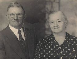
Charles Wachter “Pete” Brown
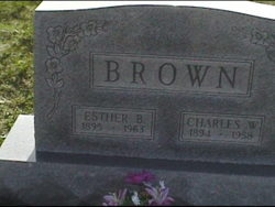
| Birth | : | 8 Sep 1894 Lantz, Frederick County, Maryland, USA |
| Death | : | 15 Mar 1958 Cascade, Washington County, Maryland, USA |
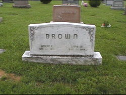
| Burial | : | Locust Hill Baptist Church Cemetery, Travelers Rest, Greenville County, USA |
| Coordinate | : | 35.0158005, -82.3796997 |
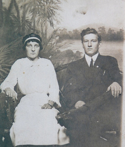
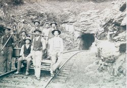
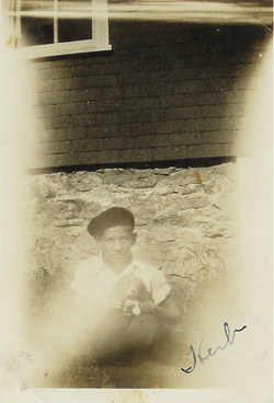
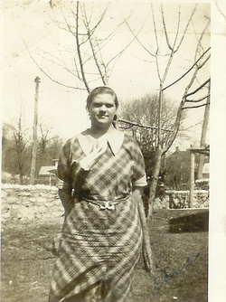
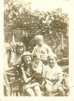
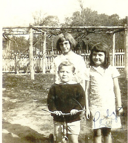
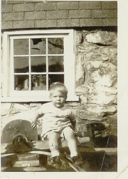
| Description | : | Charles Wachter "Pete" Brown, born at Bulltail, Raven Rock Road, near Lantz, Frederick County, Maryland. He was named after Doctor Charles L. Wachter, of Sabillasville, Frederick County, Maryland, the physican who delivered him into life. He spent his early years working on his fathers farm at Bulltail. His brother Ivan had a hackmens license from the Western Maryland Railroad, which both brothers operated from Pen Mar Park to High Rock and beyond to Mt. Quirauk. He started working for the Western Maryland Railroad in 1905, Section # 14 from Highfield to the Western Portal of Jack's Mountain. His Section Forman... Read More |
frequently asked questions (FAQ):
-
Where is Charles Wachter “Pete” Brown's memorial?
Charles Wachter “Pete” Brown's memorial is located at: Locust Hill Baptist Church Cemetery, Travelers Rest, Greenville County, USA.
-
When did Charles Wachter “Pete” Brown death?
Charles Wachter “Pete” Brown death on 15 Mar 1958 in Cascade, Washington County, Maryland, USA
-
Where are the coordinates of the Charles Wachter “Pete” Brown's memorial?
Latitude: 35.0158005
Longitude: -82.3796997
Family Members:
Parent
Spouse
Siblings


Children

Flowers:


Nearby Cemetories:
1. Locust Hill Baptist Church Cemetery
Travelers Rest, Greenville County, USA
Coordinate: 35.0158005, -82.3796997
2. Old Poole Cemetery
Greenville County, USA
Coordinate: 35.0058330, -82.3891250
3. Mountain Grove Baptist Church Cemetery
Travelers Rest, Greenville County, USA
Coordinate: 35.0244255, -82.4014969
4. Mountain View Methodist Church Cemetery
Taylors, Greenville County, USA
Coordinate: 35.0312805, -82.3572693
5. Clark Family Cemetery
Travelers Rest, Greenville County, USA
Coordinate: 34.9912000, -82.3950070
6. Monastery of Saint Clare Cemetery
Travelers Rest, Greenville County, USA
Coordinate: 34.9968430, -82.4047620
7. Saint Luke United Methodist Church Cemetery
Travelers Rest, Greenville County, USA
Coordinate: 34.9863434, -82.3833008
8. Mush Creek Baptist Church Cemetery
Travelers Rest, Greenville County, USA
Coordinate: 35.0469017, -82.3835983
9. Meadow Fork Baptist Church Cemetery
Travelers Rest, Greenville County, USA
Coordinate: 35.0486183, -82.3908386
10. Enoree Baptist Church Cemetery
Travelers Rest, Greenville County, USA
Coordinate: 34.9831009, -82.4028015
11. Faith Temple Church of God Cemetery
Taylors, Greenville County, USA
Coordinate: 34.9911003, -82.3435974
12. Benson Cemetery
Greenville County, USA
Coordinate: 34.9902980, -82.4175010
13. Gum Springs Pentecostal Holiness Church Cemetery
Taylors, Greenville County, USA
Coordinate: 35.0243988, -82.3317032
14. Young and Sally Poole Cemetery
Travelers Rest, Greenville County, USA
Coordinate: 34.9760370, -82.3875900
15. Jackson Grove United Methodist Church Cemetery
Travelers Rest, Greenville County, USA
Coordinate: 34.9749985, -82.3563995
16. New Liberty Baptist Church Cemetery
Travelers Rest, Greenville County, USA
Coordinate: 35.0391998, -82.4281006
17. Springfield-Langston Familly Cemetery
Travelers Rest, Greenville County, USA
Coordinate: 34.9771220, -82.4142990
18. Cool Springs Primitive Baptist Church Cemetery
Travelers Rest, Greenville County, USA
Coordinate: 35.0572014, -82.4131012
19. Double Springs Baptist Church Cemetery
Taylors, Greenville County, USA
Coordinate: 34.9813995, -82.3317032
20. Forester-Southern Cemetery
Travelers Rest, Greenville County, USA
Coordinate: 35.0678160, -82.3997340
21. Clearview Baptist Church Cemetery
Travelers Rest, Greenville County, USA
Coordinate: 34.9669075, -82.4093628
22. Moon Family Cemetery
Greer, Greenville County, USA
Coordinate: 35.0009840, -82.3146040
23. Camp Creek Baptist Church Cemetery
Taylors, Greenville County, USA
Coordinate: 35.0544014, -82.3293991
24. Few Family Cemetery
Greer, Greenville County, USA
Coordinate: 35.0306282, -82.3128738