
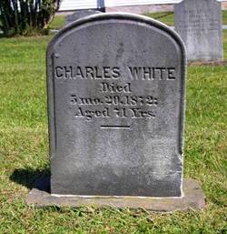
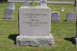
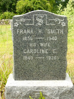
Charles White
| Birth | : | 4 Mar 1801 Westport, Bristol County, Massachusetts, USA |
| Death | : | 20 May 1872 Westport, Bristol County, Massachusetts, USA |
| Burial | : | Fort Sully Post Cemetery, Sully County, USA |
| Coordinate | : | 44.5866480, -100.6087530 |
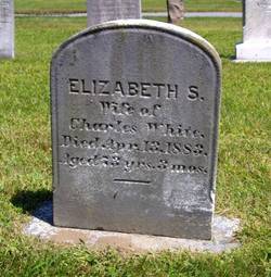
| Description | : | WIFE: Elizabeth S. White |
frequently asked questions (FAQ):
-
Where is Charles White's memorial?
Charles White's memorial is located at: Fort Sully Post Cemetery, Sully County, USA.
-
When did Charles White death?
Charles White death on 20 May 1872 in Westport, Bristol County, Massachusetts, USA
-
Where are the coordinates of the Charles White's memorial?
Latitude: 44.5866480
Longitude: -100.6087530
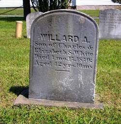
Family Members:
Parent

Spouse
Siblings

Children
Flowers:


Nearby Cemetories:
1. Fort Sully Post Cemetery
Sully County, USA
Coordinate: 44.5866480, -100.6087530
2. Fort Bennett Post Cemetery
Stanley County, USA
Coordinate: 44.6716500, -100.6404200
3. Mission Ridge Cemetery
Mission Ridge, Stanley County, USA
Coordinate: 44.6960983, -100.7716980
4. Okobojo Cemetery
Sully County, USA
Coordinate: 44.6568985, -100.3647003
5. Meers Cemetery
Stanley County, USA
Coordinate: 44.4116970, -100.7360760
6. Scotty Philip Cemetery
Fort Pierre, Stanley County, USA
Coordinate: 44.4019012, -100.4036026
7. Mount Calvary Cemetery
Pierre, Hughes County, USA
Coordinate: 44.4197006, -100.3557968
8. Fort Pierre Chouteau Cemetery
Fort Pierre, Stanley County, USA
Coordinate: 44.3908700, -100.3878300
9. Blair Cemetery
Sully County, USA
Coordinate: 44.8027992, -100.4199982
10. South Dakota State Capitol Grounds
Pierre, Hughes County, USA
Coordinate: 44.3660100, -100.3448000
11. Cedar Hill Cemetery
Fort Pierre, Stanley County, USA
Coordinate: 44.3356018, -100.3964005
12. Lindsay Cemetery
Dewey County, USA
Coordinate: 44.7188988, -101.0000000
13. Byron Township Cemetery
Blunt, Hughes County, USA
Coordinate: 44.4979200, -100.1904700
14. Sansarc Cemetery
Hayes, Stanley County, USA
Coordinate: 44.5153008, -101.0342026
15. Riverside Cemetery
Pierre, Hughes County, USA
Coordinate: 44.3608017, -100.3071976
16. Rousseau Cemetery
Dewey County, USA
Coordinate: 44.7435989, -100.9933014
17. Looking Horse Cemetery
Green Grass, Dewey County, USA
Coordinate: 44.7338982, -101.0177994
18. Walking Horse Cemetery
Parade, Dewey County, USA
Coordinate: 44.7338642, -101.0181952
19. Mathews Family Cemetery
Stanley County, USA
Coordinate: 44.1816040, -100.5581080
20. Onida Cemetery
Onida, Sully County, USA
Coordinate: 44.7147000, -100.0650000
21. Pleasant Hill Cemetery
Blunt, Hughes County, USA
Coordinate: 44.5135994, -100.0156021
22. Canning Cemetery
Hughes County, USA
Coordinate: 44.3986890, -100.0278460
23. Schreiber Cemetery
Agar, Sully County, USA
Coordinate: 44.8821983, -100.1196976
24. Holy Rosary Cemetery
Agar, Sully County, USA
Coordinate: 44.8380000, -100.0616000