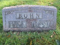
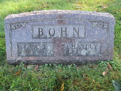
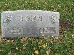
Charley Arthur Bohn
| Birth | : | 26 Jul 1887 |
| Death | : | 27 Jan 1983 Allison, Butler County, Iowa, USA |
| Burial | : | St Gregory Churchyard, Kirknewton, Northumberland Unitary Authority, England |
| Coordinate | : | 55.5658590, -2.1387780 |
| Plot | : | 94 |
| Description | : | From Contributor: Howard (48840714) Charles A. Bohn DUMONT - Services for Charles A. Bohn, 95. who died Thursday at Allison Care Center in Allison, were 1:30 p.m. Monday at Hitesville Gospel Hall: burial in Hitesville Cemetery; survivors include a son, Ernest of Bristow; and a granddaughter; Vogel Funeral Home in Dumont was in charge of arrangements. CLIPPED FROM The Courier Waterloo, Iowa 31 Jan 1983, Mon • Page 4 |
frequently asked questions (FAQ):
-
Where is Charley Arthur Bohn's memorial?
Charley Arthur Bohn's memorial is located at: St Gregory Churchyard, Kirknewton, Northumberland Unitary Authority, England.
-
When did Charley Arthur Bohn death?
Charley Arthur Bohn death on 27 Jan 1983 in Allison, Butler County, Iowa, USA
-
Where are the coordinates of the Charley Arthur Bohn's memorial?
Latitude: 55.5658590
Longitude: -2.1387780
Family Members:
Parent
Spouse
Siblings
Children
Flowers:
Nearby Cemetories:
1. St Gregory Churchyard
Kirknewton, Northumberland Unitary Authority, England
Coordinate: 55.5658590, -2.1387780
2. Flodden Field Cemetery
Branxton, Northumberland Unitary Authority, England
Coordinate: 55.6287730, -2.1765120
3. St Paul's Churchyard
Branxton, Northumberland Unitary Authority, England
Coordinate: 55.6308820, -2.1726490
4. Mindrum Churchyard
Mindrum, Northumberland Unitary Authority, England
Coordinate: 55.5937100, -2.2481000
5. St Michael and All Angels Churchyard
Ford, Northumberland Unitary Authority, England
Coordinate: 55.6301700, -2.0895430
6. St Mary & St Michael Churchyard
Doddington, Northumberland Unitary Authority, England
Coordinate: 55.5837211, -2.0083409
7. St. Mary the Virgin Chapelyard
Etal, Northumberland Unitary Authority, England
Coordinate: 55.6481100, -2.1150200
8. St Helen's Churchyard
Cornhill-on-Tweed, Northumberland Unitary Authority, England
Coordinate: 55.6464840, -2.2264990
9. St. Michael Churchyard
Ilderton, Northumberland Unitary Authority, England
Coordinate: 55.4904200, -1.9743800
10. St John the Baptist Churchyard
Lowick, Northumberland Unitary Authority, England
Coordinate: 55.6501470, -1.9826250
11. All Saints Churchyard
Duddo, Northumberland Unitary Authority, England
Coordinate: 55.6859800, -2.0862900
12. St Cuthbert Churchyard
Carham, Northumberland Unitary Authority, England
Coordinate: 55.6389230, -2.3238090
13. Holy Cross Churchyard
Chatton, Northumberland Unitary Authority, England
Coordinate: 55.5474907, -1.9105738
14. St. Peter's Parish Church
Chillingham, Northumberland Unitary Authority, England
Coordinate: 55.5273100, -1.9030830
15. Kyloe Cemetery
Kyloe, Northumberland Unitary Authority, England
Coordinate: 55.6570310, -1.9191950
16. Saint Nicholas Churchyard
Kyloe, Northumberland Unitary Authority, England
Coordinate: 55.6569000, -1.9188300
17. St. Anne's Churchyard
Ancroft, Northumberland Unitary Authority, England
Coordinate: 55.7000400, -1.9981800
18. St. Michael and All Angels Churchyard
Ingram, Northumberland Unitary Authority, England
Coordinate: 55.4405530, -1.9706240
19. Saint Mary's Churchyard
Belford, Northumberland Unitary Authority, England
Coordinate: 55.5992600, -1.8292900
20. St. Michael & All Angels Churchyard
Alnham, Northumberland Unitary Authority, England
Coordinate: 55.3926170, -2.0159210
21. St Maurice Churchyard
Eglingham, Northumberland Unitary Authority, England
Coordinate: 55.4689000, -1.8336000
22. Saint Hilda’s Churchyard
Lucker, Northumberland Unitary Authority, England
Coordinate: 55.5660400, -1.7597400
23. St. Mary the Virgin Parish Churchyard
Holy Island, Northumberland Unitary Authority, England
Coordinate: 55.6694200, -1.8016450
24. Our Lady & St. Cuthbert's
Berwick-upon-Tweed, Northumberland Unitary Authority, England
Coordinate: 55.7695760, -1.9994210

