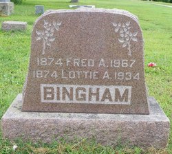
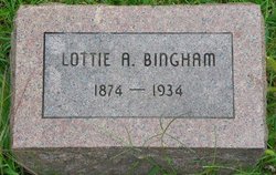
Charlotte Ann “Lottie” Rice Bingham
| Birth | : | 1874 Floyd County, Iowa, USA |
| Death | : | 1934 |
| Burial | : | Good Hope Masonic Cemetery, Goodhope, Harrison County, USA |
| Coordinate | : | 39.1772300, -80.4393600 |
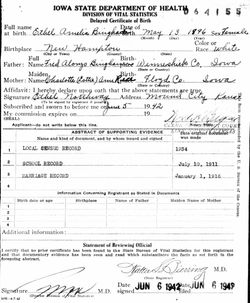
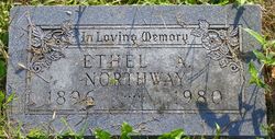
| Description | : | Name correction from daughter, Ethel's delayed birth certificate. (Image) Lottie appears on these two Censuses with her parents: 1880/ Kansas/ Mitchell h/ Andrew Rice, 65y b.NY, occ: Farmer w/ Mary J, 42y b.OH s/ Andrew J, 24y b.IL, occ: Farm work s/ Willie B, 17y b.IA, occ: Farm work d/ Lotta A, 7y b.IA d/ Bessie, 5y b.IA 1895 Iowa State Census Andrew Rice, 80y b.NY, Retired Mary, 56y b.OH, ME Lottie, 21y b.Floyd Co, Iowa Record of Marriage: groom: Fred A Bingham bride: Lottie Rice date: 20 July 1895 place: New Hampton, Chickasaw, Iowa father... Read More |
frequently asked questions (FAQ):
-
Where is Charlotte Ann “Lottie” Rice Bingham's memorial?
Charlotte Ann “Lottie” Rice Bingham's memorial is located at: Good Hope Masonic Cemetery, Goodhope, Harrison County, USA.
-
When did Charlotte Ann “Lottie” Rice Bingham death?
Charlotte Ann “Lottie” Rice Bingham death on 1934 in
-
Where are the coordinates of the Charlotte Ann “Lottie” Rice Bingham's memorial?
Latitude: 39.1772300
Longitude: -80.4393600
Family Members:
Parent
Spouse
Children
Flowers:
Nearby Cemetories:
1. Good Hope Masonic Cemetery
Goodhope, Harrison County, USA
Coordinate: 39.1772300, -80.4393600
2. New Bethel Cemetery
Harrison County, USA
Coordinate: 39.1772003, -80.4392014
3. Post Cemetery
Harrison County, USA
Coordinate: 39.1631012, -80.4413986
4. Bethel Cemetery
Goodhope, Harrison County, USA
Coordinate: 39.1903000, -80.4261017
5. Hershey Cemetery
Lost Creek, Harrison County, USA
Coordinate: 39.1731500, -80.4091900
6. Duck Creek Cemetery
Lost Creek, Harrison County, USA
Coordinate: 39.1594009, -80.3949966
7. Sheets Mill Cemetery
Harrison County, USA
Coordinate: 39.1843987, -80.3803024
8. Broad Run Baptist Church Cemetery
Lightburn, Lewis County, USA
Coordinate: 39.1276190, -80.4395590
9. Mount Carmel Cemetery
Kincheloe, Harrison County, USA
Coordinate: 39.1693993, -80.5056000
10. Pleasant Hill United Methodist Church Cemetery
Harrison County, USA
Coordinate: 39.1469990, -80.4944340
11. Green Hill Cemetery
Harrison County, USA
Coordinate: 39.1610080, -80.5112400
12. McCan's Run United Methodist Church Cemetery
Weston, Lewis County, USA
Coordinate: 39.1163550, -80.4632670
13. McWhorter Church Cemetery
McWhorter, Harrison County, USA
Coordinate: 39.1281000, -80.3815670
14. Old Frame Meeting House Graveyard
Lost Creek, Harrison County, USA
Coordinate: 39.1630550, -80.3548340
15. Frame Seventh Day Baptist Church Cemetery
Clarksburg, Harrison County, USA
Coordinate: 39.1630690, -80.3547570
16. Jarvisville Baptist Church Cemetery
Jarvisville, Harrison County, USA
Coordinate: 39.2342090, -80.4902440
17. Coburn's Creek Cemetery
Harrison County, USA
Coordinate: 39.2402000, -80.4002304
18. Bailey Cemetery
Westfield, Lewis County, USA
Coordinate: 39.1067470, -80.4560270
19. Mount Hebron Cemetery
Jane Lew, Lewis County, USA
Coordinate: 39.1060982, -80.4255981
20. Pioneer Cemetery
Jane Lew, Lewis County, USA
Coordinate: 39.1071830, -80.4098780
21. Seventh Day Baptist Church Cemetery
Lost Creek, Harrison County, USA
Coordinate: 39.1713982, -80.3419037
22. Day Cemetery
Harrison County, USA
Coordinate: 39.2172012, -80.5325012
23. Adkinson Cemetery
Harrison County, USA
Coordinate: 39.2069016, -80.3396988
24. Jesse Run Cemetery
Jane Lew, Lewis County, USA
Coordinate: 39.1038235, -80.3900664

