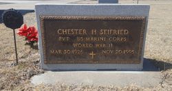
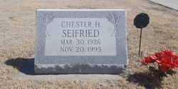
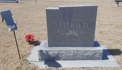
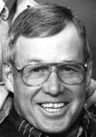
Chester Henry Seifried
| Birth | : | 30 Mar 1926 Canton, Blaine County, Oklahoma, USA |
| Death | : | 20 Nov 1995 Wichita, Sedgwick County, Kansas, USA |
| Burial | : | Dighton Cemetery, Dighton, Lane County, USA |
| Coordinate | : | 38.4832993, -100.4297028 |
| Description | : | Unidentified newspaper: CHESTER H. SEIFRIED - Canton native Chester H. Seifried, 69, died Nov. 20, 1995, in Wichita, Kan. The son of Henry and Laura Baird Seifried, he was born at Canton March 30, 1926, and was a farmer-rancher. He had lived at Sun City, Kan., for 23 years. He married Viola Weiser Oct. 19, 1946, and then married Nancy Evans Daniels at Kalvesta, Kan., on Oct. 25, 1992. He was a member of the Medicine Lodge United Methodist Church, American Legion Post #190 at Dighton, Kan., and the American Quarterhorse Association. Survivors include his wife, Nancy; his mother, Laura Seifried, Canton; two sons,... Read More |
frequently asked questions (FAQ):
-
Where is Chester Henry Seifried's memorial?
Chester Henry Seifried's memorial is located at: Dighton Cemetery, Dighton, Lane County, USA.
-
When did Chester Henry Seifried death?
Chester Henry Seifried death on 20 Nov 1995 in Wichita, Sedgwick County, Kansas, USA
-
Where are the coordinates of the Chester Henry Seifried's memorial?
Latitude: 38.4832993
Longitude: -100.4297028
Family Members:
Parent
Spouse
Siblings
Children
Flowers:
Nearby Cemetories:
1. Dighton Cemetery
Dighton, Lane County, USA
Coordinate: 38.4832993, -100.4297028
2. Shields Cemetery
Shields, Lane County, USA
Coordinate: 38.6267014, -100.4424973
3. Ward Cemetery
Shields, Lane County, USA
Coordinate: 38.3967800, -100.2826400
4. White Rock Cemetery
Lane County, USA
Coordinate: 38.6258011, -100.3311005
5. Sutton Cemetery
Lane County, USA
Coordinate: 38.3711014, -100.6113968
6. Beeler Cemetery
Ness County, USA
Coordinate: 38.4502983, -100.1967010
7. Thomas Cemetery
Lane County, USA
Coordinate: 38.3325005, -100.2718964
8. Healy Cemetery
Healy, Lane County, USA
Coordinate: 38.6131600, -100.6230900
9. Grigston Cemetery
Grigston, Scott County, USA
Coordinate: 38.4603400, -100.6996500
10. Utica Cemetery
Utica, Ness County, USA
Coordinate: 38.6464005, -100.1580963
11. Buda Cemetery
Beeler, Ness County, USA
Coordinate: 38.2900009, -100.1755981
12. Prairie Chapel Cemetery
Ness County, USA
Coordinate: 38.5946999, -100.0730972
13. Ravanna Cemetery
Ravanna, Finney County, USA
Coordinate: 38.1747970, -100.3824370
14. Alanthus Cemetery
Gove County, USA
Coordinate: 38.7731018, -100.2822037
15. Swedish Lutheran Cemetery
Gove, Gove County, USA
Coordinate: 38.7655983, -100.6089020
16. Arnold Cemetery
Arnold, Ness County, USA
Coordinate: 38.6474991, -100.0468979
17. Eminence Cemetery
Finney County, USA
Coordinate: 38.1464005, -100.5175018
18. North Star Cemetery
Ness County, USA
Coordinate: 38.5219500, -99.9916800
19. Saint Ignatius Cemetery
Laird, Ness County, USA
Coordinate: 38.2956900, -100.0587500
20. Amish Cemetery
Arnold, Ness County, USA
Coordinate: 38.6814003, -100.0556030
21. Rauch Family Cemetery
Trego County, USA
Coordinate: 38.7086090, -100.0799100
22. Mishler Cemetery
Ness County, USA
Coordinate: 38.3921300, -99.9910300
23. Kidderville Cemetery
Hodgeman County, USA
Coordinate: 38.1903000, -100.1541977
24. Morning Star Cemetery
Gove County, USA
Coordinate: 38.8431015, -100.3349991


