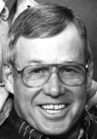
Dwayne Chester Seifried
| Birth | : | 15 Dec 1950 Quinter, Gove County, Kansas, USA |
| Death | : | 12 Nov 2009 Dighton, Lane County, Kansas, USA |
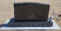
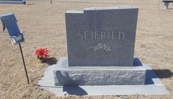
| Burial | : | Dighton Cemetery, Dighton, Lane County, USA |
| Coordinate | : | 38.4832993, -100.4297028 |
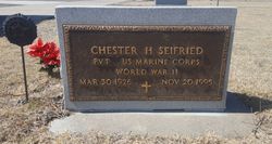
| Description | : | Dwayne C. Seifried, 58, died Thursday, Nov. 12, 2009, at Lane County Hospital in Dighton from injuries suffered at a grain elevator in Amy. He was born Dec. 15, 1950, in Quinter, to Chester Henry and Viola Marie Weiser Seifried. He attended Theoni Grade School in Finney County through the fifth grade and then attended school in Dighton, graduating from Dighton High School in 1968 and later attending Kansas State University. On Nov. 29, 1969, he married Roberta Sue Shaffer in Dighton. Mr. Seifried was the Amy Elevator branch manager for the Garden City Co-op and was chairman of the Garden City Co-op... Read More |
frequently asked questions (FAQ):
-
Where is Dwayne Chester Seifried's memorial?
Dwayne Chester Seifried's memorial is located at: Dighton Cemetery, Dighton, Lane County, USA.
-
When did Dwayne Chester Seifried death?
Dwayne Chester Seifried death on 12 Nov 2009 in Dighton, Lane County, Kansas, USA
-
Where are the coordinates of the Dwayne Chester Seifried's memorial?
Latitude: 38.4832993
Longitude: -100.4297028
Family Members:
Parent
Flowers:
Nearby Cemetories:
1. Dighton Cemetery
Dighton, Lane County, USA
Coordinate: 38.4832993, -100.4297028
2. Shields Cemetery
Shields, Lane County, USA
Coordinate: 38.6267014, -100.4424973
3. Ward Cemetery
Shields, Lane County, USA
Coordinate: 38.3967800, -100.2826400
4. White Rock Cemetery
Lane County, USA
Coordinate: 38.6258011, -100.3311005
5. Sutton Cemetery
Lane County, USA
Coordinate: 38.3711014, -100.6113968
6. Beeler Cemetery
Ness County, USA
Coordinate: 38.4502983, -100.1967010
7. Thomas Cemetery
Lane County, USA
Coordinate: 38.3325005, -100.2718964
8. Healy Cemetery
Healy, Lane County, USA
Coordinate: 38.6131600, -100.6230900
9. Grigston Cemetery
Grigston, Scott County, USA
Coordinate: 38.4603400, -100.6996500
10. Utica Cemetery
Utica, Ness County, USA
Coordinate: 38.6464005, -100.1580963
11. Buda Cemetery
Beeler, Ness County, USA
Coordinate: 38.2900009, -100.1755981
12. Prairie Chapel Cemetery
Ness County, USA
Coordinate: 38.5946999, -100.0730972
13. Ravanna Cemetery
Ravanna, Finney County, USA
Coordinate: 38.1747970, -100.3824370
14. Alanthus Cemetery
Gove County, USA
Coordinate: 38.7731018, -100.2822037
15. Swedish Lutheran Cemetery
Gove, Gove County, USA
Coordinate: 38.7655983, -100.6089020
16. Arnold Cemetery
Arnold, Ness County, USA
Coordinate: 38.6474991, -100.0468979
17. Eminence Cemetery
Finney County, USA
Coordinate: 38.1464005, -100.5175018
18. North Star Cemetery
Ness County, USA
Coordinate: 38.5219500, -99.9916800
19. Saint Ignatius Cemetery
Laird, Ness County, USA
Coordinate: 38.2956900, -100.0587500
20. Amish Cemetery
Arnold, Ness County, USA
Coordinate: 38.6814003, -100.0556030
21. Rauch Family Cemetery
Trego County, USA
Coordinate: 38.7086090, -100.0799100
22. Mishler Cemetery
Ness County, USA
Coordinate: 38.3921300, -99.9910300
23. Kidderville Cemetery
Hodgeman County, USA
Coordinate: 38.1903000, -100.1541977
24. Morning Star Cemetery
Gove County, USA
Coordinate: 38.8431015, -100.3349991


