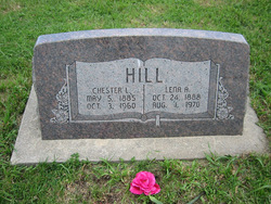
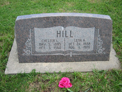
Chester Lloyd Hill
| Birth | : | 5 May 1885 Ellis, Jefferson County, Nebraska, USA |
| Death | : | 3 Oct 1960 Ellis, Jefferson County, Nebraska, USA |
| Burial | : | Saint Marys Catholic Church Cemetery, McGregor, Clayton County, USA |
| Coordinate | : | 43.0213735, -91.1834632 |
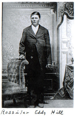
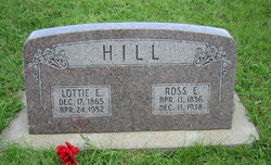
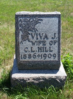
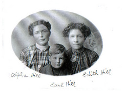
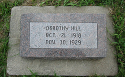
| Description | : | He was married to Viva Jane Atkins on August 29, 1905 in Beatrice, Gage County, Nebraska. Their children: Alden Allen and Earl Gilbert Hill. He was married to Anna Lena Christina Carlina Johnson on September 07, 1915 in Fairbury, Jefferson County, Nebraska. Their children: Lloyd Everett, Dorothy Lucille, Orville Ray, Darrell Dean, and Ruth Audrey Hill. His parents: Rossiter Eddy Hill and Charlotte Elnora Jane Elwood. He was a School Teacher, Farmer, and then worked into Construction. |
frequently asked questions (FAQ):
-
Where is Chester Lloyd Hill's memorial?
Chester Lloyd Hill's memorial is located at: Saint Marys Catholic Church Cemetery, McGregor, Clayton County, USA.
-
When did Chester Lloyd Hill death?
Chester Lloyd Hill death on 3 Oct 1960 in Ellis, Jefferson County, Nebraska, USA
-
Where are the coordinates of the Chester Lloyd Hill's memorial?
Latitude: 43.0213735
Longitude: -91.1834632
Family Members:
Parent
Spouse
Siblings
Children
Flowers:
Nearby Cemetories:
1. Saint Marys Catholic Church Cemetery
McGregor, Clayton County, USA
Coordinate: 43.0213735, -91.1834632
2. Walton Cemetery
McGregor, Clayton County, USA
Coordinate: 43.0216270, -91.1909350
3. Pleasant Grove Cemetery
McGregor, Clayton County, USA
Coordinate: 43.0266991, -91.1949997
4. Buell Park Cemetery
Mendon Township, Clayton County, USA
Coordinate: 43.0168226, -91.1999590
5. Moody Cemetery
McGregor, Clayton County, USA
Coordinate: 43.0030594, -91.1886063
6. Eastman Cemetery
McGregor, Clayton County, USA
Coordinate: 43.0010000, -91.2190000
7. Fort Crawford Cemetery
Prairie du Chien, Crawford County, USA
Coordinate: 43.0471000, -91.1474000
8. Evergreen Cemetery
Prairie du Chien, Crawford County, USA
Coordinate: 43.0331500, -91.1301170
9. Baylis Cemetery
McGregor, Clayton County, USA
Coordinate: 43.0633160, -91.1959630
10. Saint Gabriel Cemetery
Prairie du Chien, Crawford County, USA
Coordinate: 43.0584984, -91.1453018
11. First Evangelical Lutheran Church Cemetery
McGregor, Clayton County, USA
Coordinate: 42.9718000, -91.1760000
12. Knapp Cemetery
McGregor, Clayton County, USA
Coordinate: 43.0635000, -91.2213000
13. Frenchtown Cemetery
Prairie du Chien, Crawford County, USA
Coordinate: 43.0705500, -91.1516500
14. Calvary Cemetery
Prairie du Chien, Crawford County, USA
Coordinate: 43.0705500, -91.1506330
15. Norwegian Church Cemetery
McGregor, Clayton County, USA
Coordinate: 42.9644400, -91.1764100
16. Bridgeport Cemetery
Prairie du Chien, Crawford County, USA
Coordinate: 43.0102600, -91.0701300
17. Glenn-Glass House Cemetery
Wyalusing, Grant County, USA
Coordinate: 42.9499200, -91.1235300
18. Harford Cemetery
Wyalusing, Grant County, USA
Coordinate: 42.9401000, -91.1401800
19. Spaulding Cemetery
Waukon Junction, Allamakee County, USA
Coordinate: 43.1130090, -91.1829510
20. Giard Cemetery
Farmersburg, Clayton County, USA
Coordinate: 42.9933014, -91.3080978
21. Railroad Employee Cemetery
Giard, Clayton County, USA
Coordinate: 43.0305395, -91.3140229
22. Council Hill Cemetery
Monona, Clayton County, USA
Coordinate: 43.0718994, -91.3000031
23. Saint Wenceslaus Cemetery
McGregor, Clayton County, USA
Coordinate: 43.0593987, -91.3142014
24. Flint Cemetery
Bagley, Grant County, USA
Coordinate: 42.9528008, -91.0781021

