
| Birth | : | 7 Nov 1770 Pomfret, Windham County, Connecticut, USA |
| Death | : | 9 Jul 1777 Pomfret, Windham County, Connecticut, USA |
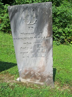
| Burial | : | Taylor Cemetery, Atwood, Douglas County, USA |
| Coordinate | : | 39.7700005, -88.4614029 |
| Description | : | son of Ebenezer & Jerusha age 6 yrs |
frequently asked questions (FAQ):
-
Where is Chester Williams's memorial?
Chester Williams's memorial is located at: Taylor Cemetery, Atwood, Douglas County, USA.
-
When did Chester Williams death?
Chester Williams death on 9 Jul 1777 in Pomfret, Windham County, Connecticut, USA
-
Where are the coordinates of the Chester Williams's memorial?
Latitude: 39.7700005
Longitude: -88.4614029
Family Members:
Parent

Siblings
Flowers:


Nearby Cemetories:
1. Taylor Cemetery
Atwood, Douglas County, USA
Coordinate: 39.7700005, -88.4614029
2. Prairie Mennonite Church Cemetery
Douglas County, USA
Coordinate: 39.7550960, -88.4391840
3. Zion Cemetery
Arthur, Douglas County, USA
Coordinate: 39.7551000, -88.4226000
4. Mackville Cemetery
Atwood, Piatt County, USA
Coordinate: 39.8072014, -88.4717026
5. Moore Cemetery
Piatt County, USA
Coordinate: 39.8217010, -88.4822006
6. Arthur Cemetery
Arthur, Douglas County, USA
Coordinate: 39.7151909, -88.4610901
7. Yoder Cemetery
Arthur, Douglas County, USA
Coordinate: 39.7105293, -88.4577026
8. Bourbon Cemetery
Bourbon, Douglas County, USA
Coordinate: 39.7510986, -88.3768997
9. Crane Bridge Cemetery
Atwood, Piatt County, USA
Coordinate: 39.8354700, -88.4884200
10. Harshbarger Cemetery
Atwood, Piatt County, USA
Coordinate: 39.8422370, -88.4657980
11. Filmore Cemetery
Chesterville, Douglas County, USA
Coordinate: 39.7177000, -88.3910000
12. Miller Cemetery
Chesterville, Douglas County, USA
Coordinate: 39.7032242, -88.4142761
13. Cartwright Cemetery
Tuscola, Douglas County, USA
Coordinate: 39.7916679, -88.3663864
14. Lower Lester Cemetery
Douglas County, USA
Coordinate: 39.7835999, -88.3632965
15. Chesterville Cemetery
Chesterville, Douglas County, USA
Coordinate: 39.7060000, -88.3865000
16. Antioch Cemetery
Piatt County, USA
Coordinate: 39.8581009, -88.4891968
17. Upper Lester Cemetery
Ficklin, Douglas County, USA
Coordinate: 39.8140411, -88.3557434
18. Sunnyside Mennonite Church Cemetery
Douglas County, USA
Coordinate: 39.7009000, -88.3811000
19. Pleasant View Church Cemetery
Chesterville, Douglas County, USA
Coordinate: 39.6732292, -88.4136581
20. Trinity Christian Fellowship Cemetery
Sullivan, Moultrie County, USA
Coordinate: 39.6666990, -88.4761040
21. Bagdad School Cemetery
Arcola, Douglas County, USA
Coordinate: 39.6796500, -88.3872800
22. Gingerich Cemetery
Sullivan, Moultrie County, USA
Coordinate: 39.6797830, -88.5381920
23. Yoder Cemetery
Arthur, Douglas County, USA
Coordinate: 39.6608009, -88.4477997
24. Bagdad Cemetery
Douglas County, USA
Coordinate: 39.6821000, -88.3724000