
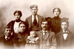
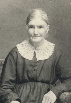
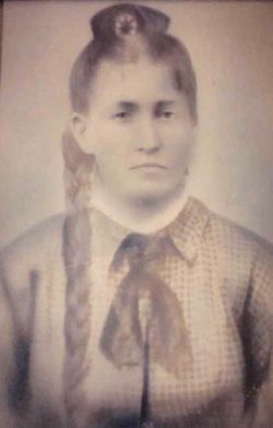
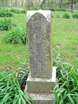
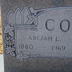
Christopher Monroe Cook
| Birth | : | 22 Aug 1852 Moniteau County, Missouri, USA |
| Death | : | 19 Feb 1936 Moniteau County, Missouri, USA |
| Burial | : | Horncastle Cemetery, Horncastle, East Lindsey District, England |
| Coordinate | : | 53.1995200, -0.1095800 |
| Description | : | Son of George Washington Cook & Elizabeth Phelan Cook. Husband of Mary M. Barnhart Cook. Note: Name on grave marker as C. Monroe Cook. |
frequently asked questions (FAQ):
-
Where is Christopher Monroe Cook's memorial?
Christopher Monroe Cook's memorial is located at: Horncastle Cemetery, Horncastle, East Lindsey District, England.
-
When did Christopher Monroe Cook death?
Christopher Monroe Cook death on 19 Feb 1936 in Moniteau County, Missouri, USA
-
Where are the coordinates of the Christopher Monroe Cook's memorial?
Latitude: 53.1995200
Longitude: -0.1095800
Family Members:
Parent

Spouse
Siblings

Children
Flowers:


Nearby Cemetories:
1. Horncastle Cemetery
Horncastle, East Lindsey District, England
Coordinate: 53.1995200, -0.1095800
2. Holy Trinity Churchyard
Horncastle, East Lindsey District, England
Coordinate: 53.2077100, -0.1103900
3. St. Mary's Churchyard
Horncastle, East Lindsey District, England
Coordinate: 53.2068380, -0.1208750
4. St Peters Churchyard
Low Toynton, East Lindsey District, England
Coordinate: 53.2166100, -0.0914000
5. St Margarets Churchyard
Langton, East Lindsey District, England
Coordinate: 53.2034275, -0.1490403
6. St. Helen's Churchyard
Edlington, East Lindsey District, England
Coordinate: 53.2260200, -0.1536400
7. All Saints Churchyard
Hameringham, East Lindsey District, England
Coordinate: 53.1865890, -0.0412020
8. All Saints Churchyard
Greetham with Somersby, East Lindsey District, England
Coordinate: 53.2185110, -0.0418221
9. St. Benedict's Churchyard
Haltham, East Lindsey District, England
Coordinate: 53.1571600, -0.1378600
10. St. Mary's Churchyard
Lusby with Winceby, East Lindsey District, England
Coordinate: 53.1962840, -0.0245500
11. St. Andrew's Churchyard
Fulletby, East Lindsey District, England
Coordinate: 53.2416800, -0.0560500
12. St. Margaret's Churchyard
Hemingby, East Lindsey District, England
Coordinate: 53.2524100, -0.1469300
13. St. Mary's Churchyard
Kirkby on Bain, East Lindsey District, England
Coordinate: 53.1442900, -0.1430300
14. St. Andrew's Churchyard
Ashby Puerorum, East Lindsey District, England
Coordinate: 53.2231670, -0.0123010
15. All Saints Churchyard
Horsington, East Lindsey District, England
Coordinate: 53.2023100, -0.2160600
16. St. Swithin's Churchyard
Baumber, East Lindsey District, England
Coordinate: 53.2530300, -0.1699400
17. St. Peter and St. Paul's Churchyard
Belchford, East Lindsey District, England
Coordinate: 53.2599830, -0.0616480
18. St. Nicholas' Churchyard
East Kirkby, East Lindsey District, England
Coordinate: 53.1476632, -0.0086767
19. All Saints Churchyard
Great Sturton, East Lindsey District, England
Coordinate: 53.2730000, -0.1789600
20. St. Margaret's Churchyard
Bucknall, East Lindsey District, England
Coordinate: 53.2039920, -0.2513250
21. All Saints Churchyard
Gautby, East Lindsey District, England
Coordinate: 53.2359800, -0.2413800
22. St. Leonard's Without Churchyard
Kirkstead, East Lindsey District, England
Coordinate: 53.1361800, -0.2224600
23. Coningsby Baptist Chapelyard
Coningsby, East Lindsey District, England
Coordinate: 53.1086300, -0.1689600
24. St. Peter's Churchyard
Asterby, East Lindsey District, England
Coordinate: 53.2975600, -0.1050000