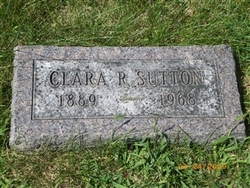
Clara Rebecca Smith Sutton
| Birth | : | 17 Aug 1889 Michigan, USA |
| Death | : | 5 Sep 1968 Plattsmouth, Cass County, Nebraska, USA |
| Burial | : | Saint Paul AME Cemetery, Oatland, Georgetown County, USA |
| Coordinate | : | 33.4882000, -79.3486800 |
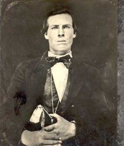
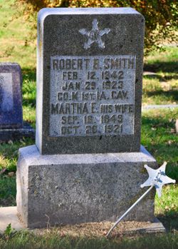
| Description | : | Daughter of Robert Bruce Smith and Martha Ellen Knapp-Smith. Wife to John Wesley Sutton. |
frequently asked questions (FAQ):
-
Where is Clara Rebecca Smith Sutton's memorial?
Clara Rebecca Smith Sutton's memorial is located at: Saint Paul AME Cemetery, Oatland, Georgetown County, USA.
-
When did Clara Rebecca Smith Sutton death?
Clara Rebecca Smith Sutton death on 5 Sep 1968 in Plattsmouth, Cass County, Nebraska, USA
-
Where are the coordinates of the Clara Rebecca Smith Sutton's memorial?
Latitude: 33.4882000
Longitude: -79.3486800
Family Members:
Parent
Siblings
Children
Flowers:
Nearby Cemetories:
1. Saint Paul AME Cemetery
Oatland, Georgetown County, USA
Coordinate: 33.4882000, -79.3486800
2. Johnson Family Cemetery
Georgetown County, USA
Coordinate: 33.4855760, -79.3630240
3. Mount Sinai Baptist Church Cemetery
Georgetown, Georgetown County, USA
Coordinate: 33.4982000, -79.3619800
4. Chester Hill Missionary Baptist Cemetery
Georgetown, Georgetown County, USA
Coordinate: 33.4881950, -79.3680360
5. Johnson Chapel Baptist Church Cemetery
Johnson Corner, Georgetown County, USA
Coordinate: 33.4613500, -79.3644500
6. Mount Olive Missionary Baptist Church Cemetery
Georgetown, Georgetown County, USA
Coordinate: 33.5275410, -79.3540620
7. Ford Burying Ground
Georgetown County, USA
Coordinate: 33.4405420, -79.3379880
8. Frost Graveyard
Marysville, Georgetown County, USA
Coordinate: 33.4405500, -79.3378500
9. Hopewell Missionary Church Cemetery
Georgetown, Georgetown County, USA
Coordinate: 33.5329160, -79.3183170
10. Eastland Cemetery
Georgetown, Georgetown County, USA
Coordinate: 33.5314400, -79.3864600
11. Nazareth AME Church
Georgetown, Georgetown County, USA
Coordinate: 33.5439480, -79.3289290
12. Old Prince Frederick Cemetery
Georgetown County, USA
Coordinate: 33.5350120, -79.3909680
13. Rocky Point Plantation Cemetery
Choppee, Georgetown County, USA
Coordinate: 33.5480120, -79.3560500
14. Arnett Memorial Gardens
Georgetown County, USA
Coordinate: 33.5532830, -79.3320450
15. Black River Church Cemetery
Georgetown County, USA
Coordinate: 33.5476900, -79.3953610
16. Baxley Family Cemetery
Choppee, Georgetown County, USA
Coordinate: 33.5619860, -79.3391890
17. First Calvary Cemetery
Georgetown, Georgetown County, USA
Coordinate: 33.4121670, -79.3627310
18. Saint Peters Episcopal Church Cemetery
Plantersville, Georgetown County, USA
Coordinate: 33.5237200, -79.2661500
19. Wilson Cemetery
Georgetown County, USA
Coordinate: 33.5513992, -79.4024963
20. New Mount Zion A.M.E. Church Cemetery
Georgetown, Georgetown County, USA
Coordinate: 33.4465430, -79.2697240
21. Friendship Saint Mary's AME Cemetery
Plantersville, Georgetown County, USA
Coordinate: 33.4734040, -79.2549740
22. Exum Family Cemetery
Choppee, Georgetown County, USA
Coordinate: 33.5660000, -79.3814370
23. Gospel Missionary Baptist Church Cemetery
Georgetown, Georgetown County, USA
Coordinate: 33.4009750, -79.3256450
24. Mount Tabor Baptist Church Cemetery
Georgetown, Georgetown County, USA
Coordinate: 33.5269241, -79.2414246

