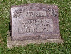
Clarence E. Stober
| Birth | : | 29 Jul 1892 Iowa, USA |
| Death | : | 15 Aug 1970 Bloomfield, Davis County, Iowa, USA |
| Burial | : | Trezevant Cemetery, Trezevant, Carroll County, USA |
| Coordinate | : | 36.0120400, -88.6195660 |
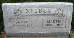
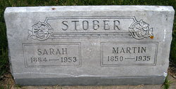
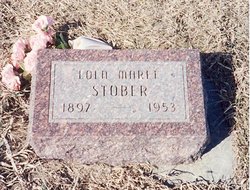
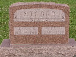
| Description | : | h/o Lola Maree BEEMS f/o Waunette, s/o Martin Stober & Sarah Henderson. The Randolph Times, (Randolph, Nebraska), 24 Sept 1970. Clarence STOBER Succumbs In Iowa Clarence E. STOBER 76, of Bloomfield, Ia., a former Randolph farmer, died August 15, (1970) after a short illness. word has been received here. Mr. STOBER was buried in the Burgher Cemetery near Monterey, Ia. Son of Martin and Sarah STOBER, he was born in Moulton, IA. July 28, 1892. He married Maree BEEMS who died in 1953. He married Jessie Johnson. She preceded him in death in 1966. Survivors include one daughter, Mrs. Wauneta MANZER of Boise, Ida; one... Read More |
frequently asked questions (FAQ):
-
Where is Clarence E. Stober's memorial?
Clarence E. Stober's memorial is located at: Trezevant Cemetery, Trezevant, Carroll County, USA.
-
When did Clarence E. Stober death?
Clarence E. Stober death on 15 Aug 1970 in Bloomfield, Davis County, Iowa, USA
-
Where are the coordinates of the Clarence E. Stober's memorial?
Latitude: 36.0120400
Longitude: -88.6195660
Family Members:
Parent
Spouse
Siblings
Children
Flowers:
Nearby Cemetories:
1. Trezevant Cemetery
Trezevant, Carroll County, USA
Coordinate: 36.0120400, -88.6195660
2. Mount Ararat Cemetery
Trezevant, Carroll County, USA
Coordinate: 36.0140960, -88.6293450
3. Blanks Family Cemetery
Trezevant, Carroll County, USA
Coordinate: 36.0193000, -88.5999000
4. Walker Family Cemetery
Trezevant, Carroll County, USA
Coordinate: 36.0358510, -88.6130660
5. Oak Grove Cemetery
Trezevant, Carroll County, USA
Coordinate: 36.0350060, -88.6398990
6. Wingo Family Cemetery
Trezevant, Carroll County, USA
Coordinate: 36.0329430, -88.5955100
7. Hillsman Cemetery
Trezevant, Carroll County, USA
Coordinate: 36.0106870, -88.5826890
8. Republican Grove Cemetery
Trezevant, Carroll County, USA
Coordinate: 36.0235150, -88.6545770
9. Harris Cemetery
Trezevant, Carroll County, USA
Coordinate: 36.0174950, -88.5809410
10. Jones Cemetery
McLemoresville, Carroll County, USA
Coordinate: 35.9791500, -88.6106400
11. Hurt Family Cemetery
Trezevant, Carroll County, USA
Coordinate: 35.9790900, -88.6105700
12. Shaw Cemetery
Atwood, Carroll County, USA
Coordinate: 35.9786000, -88.6322200
13. Fuqua Cemetery #2
Trezevant, Carroll County, USA
Coordinate: 36.0494520, -88.6123430
14. Reedy Creek Church Cemetery
McLemoresville, Carroll County, USA
Coordinate: 35.9888440, -88.5807860
15. McLemoresville Cemetery
McLemoresville, Carroll County, USA
Coordinate: 35.9882400, -88.5788000
16. Wingo Chapel Cemetery
Wingo, Carroll County, USA
Coordinate: 36.0485500, -88.5834000
17. Pisgah Cemetery
Atwood, Carroll County, USA
Coordinate: 35.9766998, -88.6622009
18. Fuqua Cemetery #1
Trezevant, Carroll County, USA
Coordinate: 36.0207940, -88.5584210
19. Clay Family Cemetery
Atwood, Carroll County, USA
Coordinate: 35.9597400, -88.6012900
20. New Reedy Creek Baptist Church Cemetery
McLemoresville, Carroll County, USA
Coordinate: 35.9693570, -88.5737870
21. Fowler Cemetery
Christmasville, Carroll County, USA
Coordinate: 36.0688030, -88.6226690
22. Wilder Cemetery
Trezevant, Carroll County, USA
Coordinate: 36.0422540, -88.5599460
23. Clark Family Cemetery
Atwood, Carroll County, USA
Coordinate: 35.9556900, -88.6333900
24. Moore-Jones Cemetery
Carroll County, USA
Coordinate: 35.9543870, -88.6158080

