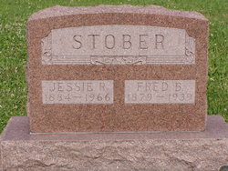
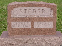
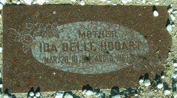
Jessie Rhodema Johnson Stober
| Birth | : | 5 Sep 1884 Davis County, Iowa, USA |
| Death | : | 27 Dec 1966 Bloomfield, Davis County, Iowa, USA |
| Burial | : | Burgher Cemetery, Davis County, USA |
| Coordinate | : | 40.6644669, -92.6010208 |
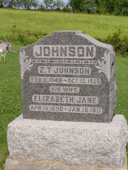
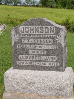
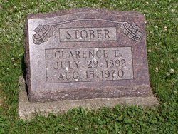
| Description | : | Funeral services for Mrs Clarence Stober, 82, were held at 1:30 p.m. today, Tuesday, December 27, 1966, at the Wagler Funeral Home in Bloomfield with Rev. Gaylon Docious officiating. Burial was in the Burgher Cemetery east of Moulton. Jessie Johnson Stober passed away December 22, in the Davis County Hospital following a lingering illness. Born September 5, 1884, near Monterey, she was the daughter of Z. T. and Jane Brink Johnson. She was a member of the Monterey Christian Church and had lived in the Monterey community jail of her life. She was married to Fred B, Stober... Read More |
frequently asked questions (FAQ):
-
Where is Jessie Rhodema Johnson Stober's memorial?
Jessie Rhodema Johnson Stober's memorial is located at: Burgher Cemetery, Davis County, USA.
-
When did Jessie Rhodema Johnson Stober death?
Jessie Rhodema Johnson Stober death on 27 Dec 1966 in Bloomfield, Davis County, Iowa, USA
-
Where are the coordinates of the Jessie Rhodema Johnson Stober's memorial?
Latitude: 40.6644669
Longitude: -92.6010208
Family Members:
Parent
Spouse
Siblings
Children
Flowers:
Nearby Cemetories:
1. Burgher Cemetery
Davis County, USA
Coordinate: 40.6644669, -92.6010208
2. Burger Cemetery
Davis County, USA
Coordinate: 40.6643982, -92.6007996
3. Horn Cemetery
Davis County, USA
Coordinate: 40.6568985, -92.6252975
4. Evergreen Cemetery
West Grove, Davis County, USA
Coordinate: 40.6916879, -92.6085237
5. Hetzler Cemetery
Davis County, USA
Coordinate: 40.6931000, -92.6241989
6. Johnson Cemetery
Davis County, USA
Coordinate: 40.6296997, -92.5768967
7. Shinn Cemetery
West Grove, Davis County, USA
Coordinate: 40.7041870, -92.6279687
8. Hopkins Cemetery
Davis County, USA
Coordinate: 40.6622009, -92.5333023
9. Kerby Cemetery
Appanoose County, USA
Coordinate: 40.6236000, -92.6425018
10. Bell Cemetery
West Grove, Davis County, USA
Coordinate: 40.7160900, -92.6026750
11. Bethel Cemetery
Davis County, USA
Coordinate: 40.6968994, -92.5436020
12. Washington Cemetery
Davis County, USA
Coordinate: 40.6164017, -92.5432968
13. Morgan Cemetery
Wyacondah, Davis County, USA
Coordinate: 40.6569072, -92.5151380
14. Sunset View Cemetery
Moulton, Appanoose County, USA
Coordinate: 40.7042007, -92.6753006
15. Hardin Cemetery
Moulton, Appanoose County, USA
Coordinate: 40.7036018, -92.6769028
16. Newton Cemetery
Davis County, USA
Coordinate: 40.6166923, -92.5335216
17. Mount Moriah Cemetery
West Grove, Davis County, USA
Coordinate: 40.6981000, -92.5186000
18. John Cemetery
Davis County, USA
Coordinate: 40.7346992, -92.6164017
19. West Grove Cemetery
West Grove, Davis County, USA
Coordinate: 40.7289009, -92.5567017
20. Oakland Cemetery
Moulton, Appanoose County, USA
Coordinate: 40.6822014, -92.6968994
21. Kelly Cemetery
Wyacondah, Davis County, USA
Coordinate: 40.6383330, -92.5069440
22. Coatsville Cemetery
Coatsville, Schuyler County, USA
Coordinate: 40.5872000, -92.6156000
23. Orleans Cemetery
Moulton, Appanoose County, USA
Coordinate: 40.7250000, -92.6665000
24. Fenton Cemetery
Davis County, USA
Coordinate: 40.6405983, -92.5017014

